Infrastructure in Alora
NOTE: This page is under construction.
Highways
Alora Expressway System
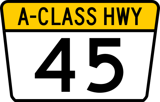
The most advanced system is the Alora Expressway System which consists of a fully access-controlled grade-separated freeway system, most of which is toll-free. The Alora Expressway System is divided into three classifications of highways. The prefix "A-" or "C-" before the route number identify sections of the Alora Expressway System that have not been updated to full limited access freeway status. Routes are marked with one of three different Expressway markers according to the class of highway. Class-A and Class-C Route markers have a trapezoidal "flower-pot" design and Class-E marker is a downward pointing trapezoidal pentagon as shown in the table below. It is possible for some sections of a particular route to be designated with more than one route classification depending on their level of development. The Expressway system has high design standards to ensure the roadways are safe for travel at high speeds. The table below details the required standards.
| Alora Expressway System | ||||||||
| Classification | Expressway Minimum Standards | Route Marker (Typical) | ||||||
| Design Speed | Median/Barrier | Grade Separation | Access Control | Carriageways | Hard Shoulder Width | Vertical Clearance | ||
| Class-E Expressway | 80 mph
(130 Kph) |
Minimum Median Width: 50' (15.24m) or Barrier required | Fully Grade Separated | Full Controlled Access
(via interchanges only) |
|
Left 4' (1.2m)
Right 10' (3.0m) |
16' (4.9 m) | 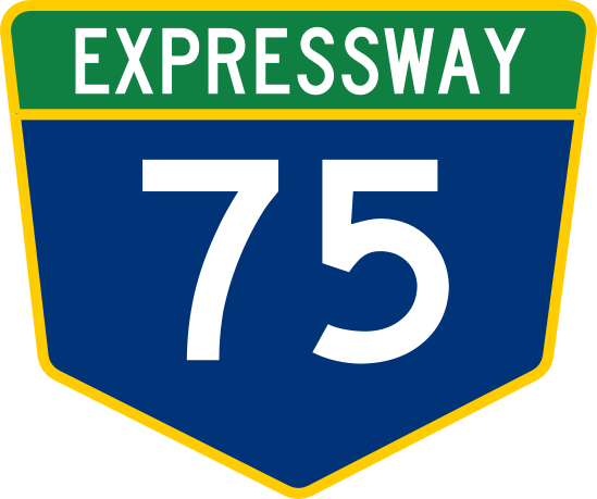
|
| Class-A
Trunk Highway |
At-Grade Intersections allowed.
Signalization required at major junctions. Railways must be grade separated |
Limited Access
(no driveways) |
| |||||
| Class-C
Trunk Highway |
Not Applicable | Limited |
|
10' (3.0m) | 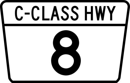
| |||
Numbering System and Corridor Groups
Highways are numbered in correlation to their respective primary corridor. E-1 is grouped with the E-10 and E-11 corridors and other primary feeder routes, such as E-11 and E-15, branch off of these main groups. Three digit Auxiliary Routes serve as spur routes into cities or loop routes looping around cities. These are numbered with the parent number being the first 2 numbers of the 3 digit route number. There are no plans to introduce 4-digit route numbers. Additionally suffixed routes are not allowed in the expressway numbering plan.
Examples:
- E-901 connects to E-90 and would be a service route or loop route that is connected to a expressway numbered as part of the E-9/E-90/E-99 Corridor Group.
- E-371 connects to E-37 and would be a service route or loop route that is connected to a expressway numbered as part of the E-3/E-30 Corridor Group.
- E-100 connects to E-1 and would be a service route or loop route that is connected to a expressway numbered as part of the E-1/E-10/E-11 Corridor Group.
- E-220 connects to E-22 and would be a service route or loop route that is connected to a expressway numbered as part of the E-2/E-20 Corridor Group.
Corridor Groups:
- E-1/E-10/E-11 Corridor - Main corridor - Alora's Mainstreet - Northwest to Southeast (Including Mediterranean Coast Corridor)
- E-2/E-20 Corridor - Mopaso-Athalan Corridor
- E-3/E-30 Corridor - Margonas-Montaro Corridor
- E-4/E-40 Corridor - Adomaka - Vela Canta Corridor
- E-5/E-50 Corridor - Nalmos City - Takorado Corridor
- E-6/E-60 Corridor - Perdio - Kennelida Corridor
- E-7/E-70 Corridor - Arratas - Porto Maganya Corridor
- E-8/E-80 Corridor - Northern Border Corridor
- E-9/E-90/E-99 Corridor - South Coast Corridor
National Highway System

|

|

|
| Primary NHS marker | Alternate NHS marker | State Highway (Generic) |
Alora also has a National Highway System for highways that are not part of the Alora Expressway System. Routes are marked along their route with a standard hexagonal NHS route marker as shown in the table to the right.
NHS Numbering System National highways are numbered differently from the expressway system with the numbering convention having odd numbered roads traveling east to west and even numbered routes traveling north to south to avoid confusion with the expressway system. 1 and 2 digit route numbers indicate parent primary routes and 3 digit route numbers indicate child primary routes that branch from or supplement the NHS numbering system. Suffixed routes are allowed in the National Highway System. suffix routes are legislatively defined as follows.
Suffixes include:
- A = "A" alternate route that follows a similar path/trajectory and meets at both ends. (these are typically not used for spur routes.)
- B = Business or "B" alternate, designates a business route or secondary alternate route into a city that meets on both ends. (can also be a spur route)
- C = City route or "C" alternate is a tertiary alternate route that leads around or through a urban area that meets on both ends. (can also be a spur route)
- N = Northern Alternate Routing (for use with routes traveling east or west).
- E = Eastern Alternate Routing (for use with routes traveling north or south).
- W = Western Alternate Routing (for use with routes traveling north or south).
- S = southern Alternate Routing (for use with routes traveling east or west).
Note that the directional alternate suffixes are used for split route designations where the main route splits into two or three parallel routes. Spur routes that do not loop back to the parent highway (connect only at one end) must be signed with a "SPUR" placard over the route marker.
State Highways
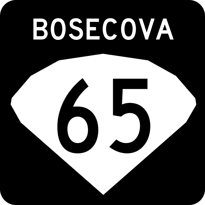
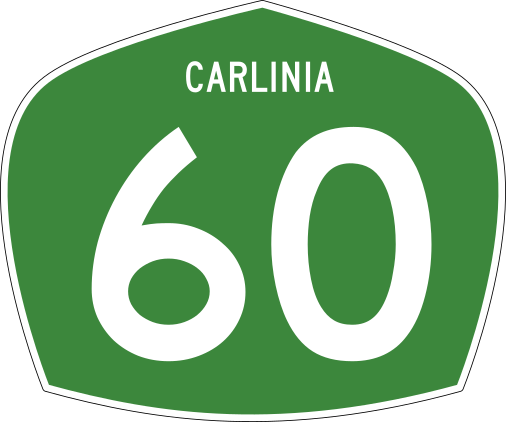
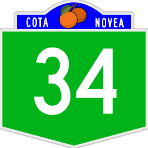
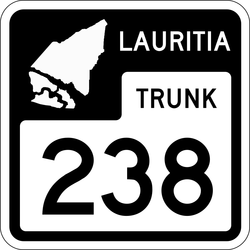
Each state is responsible for building out and maintaining its own system of highways. Some of which are eligible for federal funding if they meet certain requirements. This enables states to receive funding to help with the cost of maintainance and buildout of their highway networks at a 50% matching cost with the federal government. Each state has their own designated route marker or they can use the "generic" state route marker provided by the Alora Department of Transportation as shown in the table above. Below is a table showing the route markers for each state.
| Adenia | Alaria | Arratas | Avalon | Bosecova | Carlinia | Cota Novea | Difonado |
|

|

|

|
|
|
|

|
| Escaskia | Havania | Jalacosa | Kelawa | Lauritia | Medrano | Mopaso | Nolexo |

|

|
|

|
|
|

|

|
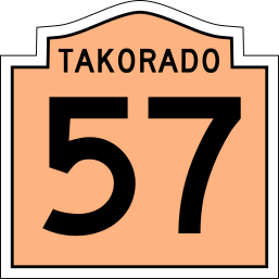
| Pehalasippi | Quenexia | Takorado | Teguteca | Tenata | Vela Canta | West Takora | State Highway (Generic) |

|

|
|
Example of Teguteca state Highway Route marker | 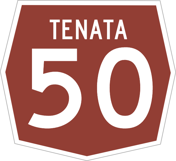
|

|

|
|
National Highway System
Alora also maintains a system of special routes such as forest routes, park routes and back-country roads. State Highways are identified by their own unique state route markers. A generic state marker exists for states that do not utilize their own custom route marker. States are responsible for the construction, maintenance and upkeep of the national and state highways located within their borders. The central government has jurisdiction over the assignment, numbering and routing of national highways. The central government also subsidizes construction of new and existing highways at 90% leaving the state to pay the 10% share. The Alora government does a 50/50 cost split on the construction and upgrade of state highways.
Rail
Alora has a growing network of railways across the nation used for freight and passenger operations throughout the country. Several railroad operators share the national track network providing freight services across the country. In Alora track mileage and land is owned by the government and is managed by the National Railroad Administration (NRA). Freight operators are then assigned an area of responsibility over a particular area and are responsible for maintenance, upkeep and development of their assigned part of the network. Each rail operator then receives grants from the federal government to subsidize the cost of operations since the network is owned by the government.
Major railroad companies operating in Alora:
Passenger Rail
Passenger rail connects many of the major cities and towns across Alora. This network is still under development in more rural areas making Alora a car-centric country.
Mass Transit
Larger cities such as Mopaso City, Takorado, Staughley and Santa Carlina have metro systems that provide rapid transit. These cities also have extensive bus networks as well with many routes running frequently during peak periods. In these larger cities it is easier to get around without a vehicle. However, with mass transit being expensive only the larger population centers have developed networks. Other major cities and larger towns rely on locally operated bus systems in order to provide public transportation. Longer Distance Bus operators also exist in Alora however most of these are private companies that may receive some governemnt subsidies but are not government run.
Alora High Speed Rail (AloraHSR)
Currently there are 2 high speed rail operators in Alora. Alora HSR is a public private partnership railway with service connecting Takorado, Tomale, Mopaso City, Santa Carlina, Staughley, Santa Maria and Kenrich (Gobrassanya). GoHSR also operates within the country operating on trackage rights through the states of Alaria and Tenata to connect between Queensburg through Gallaton and Phailoon City to Carratta.
Seaports & Maritime Transport
Alora maintains ports in many cities along the coast. The highest volume of port operations in Alora are done in Staughley due to its strategic location along the Asperic Ocean and the fact that it is a protected harbor that it protected by barrier islands to the south. Additional port cities along the Asperic Coast include: Nalmos City, Adomaka, Nolexo City, Pellahatchee, Nicoa and Licoa.
Significant marine port operations also occur in the Gulf of Alora in Santa Carlina, Mantan, Malinton, Tomale and Mopaso City due to their strategic location along the Gulf of Alora. Alora also operates one inland port at Gallaton in the Grand Lakes Region which is reached via the Arcois Ship Canal which traverses through Gobrassanya to the gulf of Alora Alora also has ports in the Mediterranean Sea with Escuderos and Puerto Domenica as major port cities in western Takora.