OpenGeofiction:Antarephia
This page is dedicated to admin plans concerning the development and organisation of Antarephia. It sets general directions and may help potential territory owner to choose the territory that fits their mapping project. The maps displayed on this page being for organisation purposes, limits for cultural and climate sectors are not to be understood as strict "borders" but rather the midpoint of the buffer zone when one zone blur into the next one.
Geography
|
Antarephia is a slender continent nearing 10 million km2 (or 3.8 sq mi) of which about 8.8 million km2 are located on the mainland and surrounding islands, and approximately 1.1 million km2 form the large Hardan Archipelago to the South of the continent. In its largest extend (South East - North West), Antarephia stretches on 9,000 km (~5,600 mi). If it were in real-world North hemisphere, Antarephia would stretch from roughly the latitude of Nouakchott, Mauritania all the way up to Kiruna, Sweden (or check the map to the right with Antarephia actual position superimposed on Earth). Keep this in mind for how it may affect the climate, the culture, the general functioning of a given territory and their impact on the mapping you plan. Note on Central Antarephia geographyBetween 2018 and 2021, areas of Central Antarephia underwent some remodelling. Part of this process focused on providing the region with a more coherent cross-border geography (e.g. mountain ranges, rivers, lakes), redesigning territories and rebuilt the coastline at a high-level perspective. It also provided with elements necessary for southern regions of the continent - Southern Mainland and the Hardan Archipelago - to have some sort of milder set of climates (in most coastal regions) and enable backstories for larger ancient and modern cultures to develop and flourish at these high latitudes. The mountains along the border between AN142i and AN148, and its immediate northern and southern extensions, were designed as a low mountain range with a few peaks nearing 1,500m/4,921ft (e.g. arbitrary common summit for AN142i and AN148. This and the absence of highland south of this mountain range (called Mid-Antarephian Gap as temporary term), enable the oceanic air masses from the Hesperic Ocean to cross the continent eastward and follow the Hardan coasts in a South East direction.This tempers the climate of northern regions of the Archipelago, especially the coastal ones. Potential owners of territories located in this region are invited to consider the topographic elements provided in this section when drafting their request. The grant of territories to actual owners will be, to some extent, based on the agreement that they will be mapped according these high-level geographic elements. |
Loading map... |


Bioregions


Maps on the right were designed with some elements in mind such as: natural features already in place, inputs from local owners (as of Nov 2021) and notions of Geography (e.g. own knowledge, Wikipedia, "tutorials" by Artifexian, global "weather" follow-up websites: Windy or Nullschool.). Local variations and details are up to territory owners as long as those are consistent.
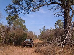
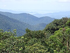
1- Tropical Antarephia
Tropical Antarephia is the name given to the zone located in the Northeast of the continent. It displays a two-season pattern with seasonal rains mostly likely during its hot summer - when the air is saturated with humidity - that follow a dry and sunny "winter". Depending on the location and altitude, savanna (different types) or tropical forests (most likely where humidity is higher: East/North East coast on heights close to the sea) may be present. For simplification, the map on the right displays climates as being AW/AS (Tropical savanna climate) but neighbouring subtropical climate variations (Cfa,Cwa...) may also apply.
2- Arid Antarephia
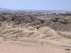
Arid Antarephia is located on the North West of the continent (roughly same latitudes as Namib or Atacama Deserts). Deserts can be sand, gravel or rock desert depending on the mappers' imagination. Depending on the altitude, the desert hot or cold (both have hot summers but cold deserts have cold winters). Due to the latitude, the cold deserts will not be as cold as the Gobi Desert but may resemble other plateaus deserts such as those in the US South East highlands. Very little vegetation is encountered in this region that is likely to feature no perennial stream, river or body of freshwater.
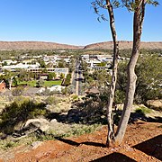
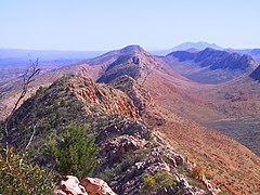
3- Semi-arid Antarephia
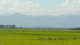
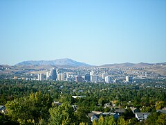
Semi-arid Antarephia is located east of Arid Antarephia. As for the deserts, the climate varies according to the altitude and latitude, regions along the Trans-Antarephian Mountain Range, in the south, are likely to have milder summers, colder winters and nights than regions more North and/or lower. All this leads to a variation of vegetations: steppe, montane grassland, shrublands or even some Arizona-Mountains-forest-like woods where favourable.
4- Subtropical Antarephia
Subtropical Antarephia is located south of Tropical Antarephia and displays a climate similar to the one of the US South East or around the Rio de la Plata in South America (or Sydney, Australia). Winters are mostly mild and Summers are generally hot with potential hurricanes from the Northeast in the late season. Humidity is high year-round leading to large mixed forests (they may have been partially replaced by fields) and wide rivers.
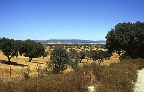
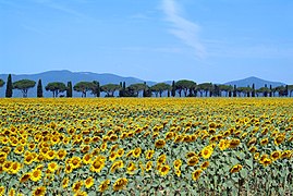
5- Mediterranean Antarephia
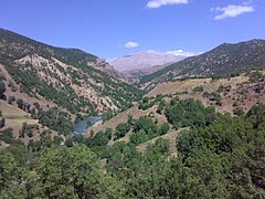
Mediterranean Antarephia is located south of Arid and Semi-Arid Antarephia, and displays mild winters and, depending on the latitude and proximity from the ocean and prevailing winds, warm or hot summers. Rains fall mainly in winter and become rare or absent in summer the closer one goes to the deserts. This influences vegetation: Mediterranean pine/oak-like forest, shrubland. Highlands may display oceanic climate, especially in the southernmost regions, as they block humidity from the Hesperic Ocean. Be mindfully of the width of your rivers or size of your lakes when mapping them.
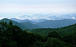
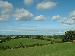
6- Temperate Antarephia
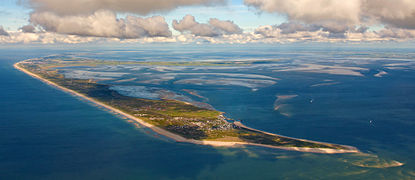
Temperate Antarephia starts roughly around the 45°S parallel and displays variations of the oceanic climates: mild summers and cool winters. Regions to the West are likely to be "milder" year-round with a lot of rain, especially in winter. Further South, the temperature range narrows and lowers with more rain. The Mid-Antarephian Gap allows oceanic winds to cross and temper the climate of northern regions of the Harda Archipelago. Vegetation would be naturally represented by large deciduous forests with conifers being located mainly at higher altitude or further South.
7- Austral Antarephia
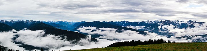
Austral Antarephia is some kind of inverted Scandinavia, the landmass does not allow true comparison with North America or Northeast Asia. Coming from Temperate Antarephia, warm summers reach lower maximum temperatures than further North and winters are cold with snow far from being uncommon. Regions further south, further from the sea and/or not facing the prevailing oceanic winds from the Northwest have cold to freezing-cold winters with cool and rather short summers. The northernmost regions have large mixed forests giving way to the taiga further south, which in turn is replaced by the tundra and glaciers (from 800-1000m or lower - ~3,000ft on the slopes facing South). The same series (mixed forests, conifers, taiga, tundra, glaciers) is triggered by height further north.
NB: The Southern Islands are a community-owned and managed in a form of collaboration. Given their latitude and isolation, they are likely to be covered with glaciers, glacial debris and little tundra (e.g. lichens) along the northernmost coasts.
Landscape gallery
The aim of this gallery is to give potential territory owners an idea of how a given region may look like.
- Tropical Antarephia

Tropical Savanna in wet season
Tropical Savanna in dry season

Highland forest

Highland forest further East
Highland forest further East
Coastal piedmont

Coastal Resort

Island

Islands

Cove

Inlet


- Arid Antarephia

Western Coast if sandy

Dunes

Rocky/Sandy landscape
Rocky formations
potential settlement in highland (~500m/1,800ft)

Desert massifs
Desert massifs

Shrubland in regions with more precipitations

Mountain range bordering zone 3 or 5


.JPG)


- Semi-arid Antarephia

Plain in hotter regions
Mountain regions

Mountain regions

Northeastern regions

Plateau in colder regions

Southern regions with colder/wetter weather
Potential settlement in colder regions


- Subtropical Antarephia

Northeastern coast

Northeastern plain

Inland plain

Mixed forest
Low mountain range

.jpg)


- Mediterranean Antarephia

Northwestern coast

Northwestern mountain regions

Western mountain regions

Northwestern shrublands
Northwestern or central inland plain
Central regions

North or Central hinterland

Central hinterland

Central or southern piedmont

Southern coastal region where flat

Southern coastal region where mountainous


.jpg)


- Temperate Antarephia
Eastern coast with barrier islands

Eastern coast with islands or bay
Hills in the eastern regions
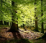
Eastern beech forest

Northern Hardan volcanoes
Western mountains

Western forest

Western Coast

Western Coast if mountainous


- Austral Antarephia

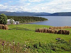
Hardan fields

Northern Hardan Landscape

Coastal forest
Mid-southern forest

Hardan coastal landscape

Northwestern coast if mountainous

Northwestern volcanoes

Southwestern coastal landscape

Hardan Taiga

Southern coast

Southern inland

South Hardan volcanoes


Flora & fauna gallery
Below are photos of animals & plants mentioned on the old Wiki pages. Domesticated animals are not mentioned if they do not seem to occur in the wild. Please note that a forum entry exists on the topic.
- Tropical Antarephia


- Arid Antarephia

Chañar

Queñoa

Yareta

Añañuca

Yarará de Altura

Puna tinamou

Chinchilla

Vizcacha
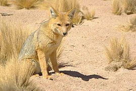
Fox
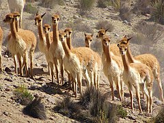
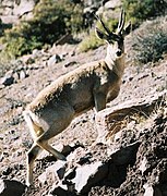
Vicuña

Guanaco

.jpg)
.jpg)


.jpg)


- Semi-arid Antarephia
- Subtropical Antarephia
- Mediterranean Antarephia

Caven Tree

Pine tree

Laurel

Birch

Fir

Fuschia
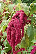
Amaranth

Black-necked swan

Coscoroba

Tern

Falcon/hawk
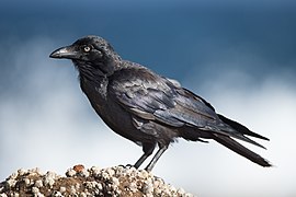
Raven

Lark
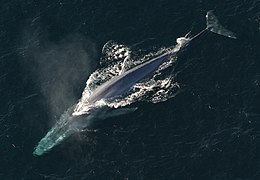
Whale

Mouse
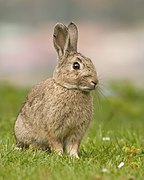
Rabbit
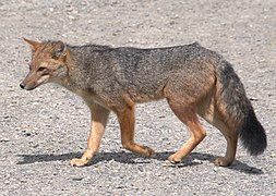
Fox
Wolf


.JPG)
.jpg)


.jpg)
- Temperate Antarephia

Keule
Birch

Ash tree

Mint

Knotweed

Orca
Deer
Rabbit
Fox

Goat

Bat
Black-necked swan
Coscoroba
Falcon/hawk
Raven
Tern

Great Albatross

Magpie

Owl

Sparrow
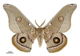
Moth

_Wales_160730_(Tony_Holkham).jpg)


- Austral Antarephia

Southern giant petrel


.jpg)


Culture

Cultural groups
Antarephia is mainly made up of indigenous cultures, usually with their own conlang(s) or substrate(s), with limited Ulethan influence in some coastal regions, owners would define. As shown on the map on the right, a territory could be a cluster within a larger group or hosts many ethnicities, or a majority and various minorities of its own or present in neighbouring territories. As of November 2021, lots of regions have not been mapped extensively or territory recently owned. The description of these sectors is consequently left rather vague at this stage.
Desert cultures
Most probably nomadic in the past. Present situation is up to the territory owners. Existence of too many large urban areas is unlikely given the heat and limited water resources.
Lycene cultures
Indigenous substrate (either Holmic-based, owner's own or Real World less spoken languages) for toponyms or even cultural elements, with a more or less heavy Ulethan colonial history mirroring that of the northern shores of the Strait of Lyc. Please have a look at your northern neighbours' developments when submitting a territory request plan.
Holmic cultures
Either their own group(s), isolates or integrated - either completely or partially - within the Holmic cultural-linguistic block (e.g. Ohesia, San Markos, Ohemia) with their many shades of Ulethan-Holmic blend.
Archipelagic cultures
Some islands have an Holmic-based culture other have their own isolate language/culture or mix both. Ulethan influence, if it exists, should be more tenuous than on the continent. Bear in mind that these are rather small islands some 500km/300mi off the mainland at their closest.
Western cultures
Either their own group(s), isolates or a transition area between Taukans and the desert/high plateaus cultures (the dosage is up to the owners). These include the Qamaric cultures (e.g; Leresso).
High plateaus cultures
Most probably semi-nomadic in the past. Present situation is up to the owners. Favourable locations may host reasonably large urban areas and agriculture.
Steppe/endorheic basins cultures
Most probably semi-nomadic in the past. Present situation is up to the owners. Favourable locations may host reasonably large urban areas and agriculture (E/SE). Culturally, outer regions may be influenced by their neighbours.
Taukan cultures
Taukans are a set of peoples that originate from the upper Şibār River valley in northern Paxtar. From 3000 BCE they migrated in separate waves to various locations in Central Antarephia (eg. Ullanyé, Guai). While they have developed in different ways, they still shares common historical (e.g. modern country originating from trading city-states), cultural (e.g. fundamental beliefs, celebrations, given names) or linguistic (e.g. grammar and vocabulary features). Owners may choose to have their territory either Taukan, Taukan-influenced, related to neighbouring groups or isolate.
Central smaller states cultures
Either their own group(s), isolates, Taukan-influenced or if it further develops, groups from the Southwestern cultures.
Southwestern cultures
Either their own group(s), isolates or related to other neighbouring Antarephian ethnic groups: Taukans, Hardan or from the central smaller states.
Hardan cultures
Harda Archipelago is some kind of austral "Caucasus": a conglomeration of ethnic groups, related or not with their subgroups (e.g; GT Darrsian) overlapping with isolate groups (eg. Kalisanjo, Suya Ahn). Mappers may also choose groups from other Antarephian regions as long as it makes sense. While their economies are usually based on mining, gas, forestry and fisheries - explaining the sometimes "high" population of such high latitudes - these countries' fate may differ: some have developed into rich countries, other have been less fortunate and affected by civil wars, possibly in the context of the "World War". Pockets of colonial remains exist, mainly along the eastern coast, e.g. Kofuku northern coast and capital city, Tárrases).
Southern Islands
The Southern Islands are a community-owned and managed in a form of collaboration. They do not hold permanent population.
Mapping Style
Antarephia having, in most cases, a long established History before coming into contact with the Ulethans, it is likely that it translates somehow into the mapping style(s), with most settlements having at their core a historic neighbourhood/city-centre of some form. Its exact rendition is up to the territory owners who may find inspiration in their neighbours' mapping. Settlements that would have been designed more recently, e.g. 20th century planned cities, settlements in extreme climatic conditions - hot or cold - that would have required "modern" technology to truly expand, are not expected to strictly follow the aforementioned pattern.