File:Eelvation - Hamidiyye-01.jpg

Size of this preview: 800 × 566 pixels. Other resolutions: 2,560 × 1,810 pixels | 3,508 × 2,480 pixels.
Original file (3,508 × 2,480 pixels, file size: 1.65 MB, MIME type: image/jpeg)
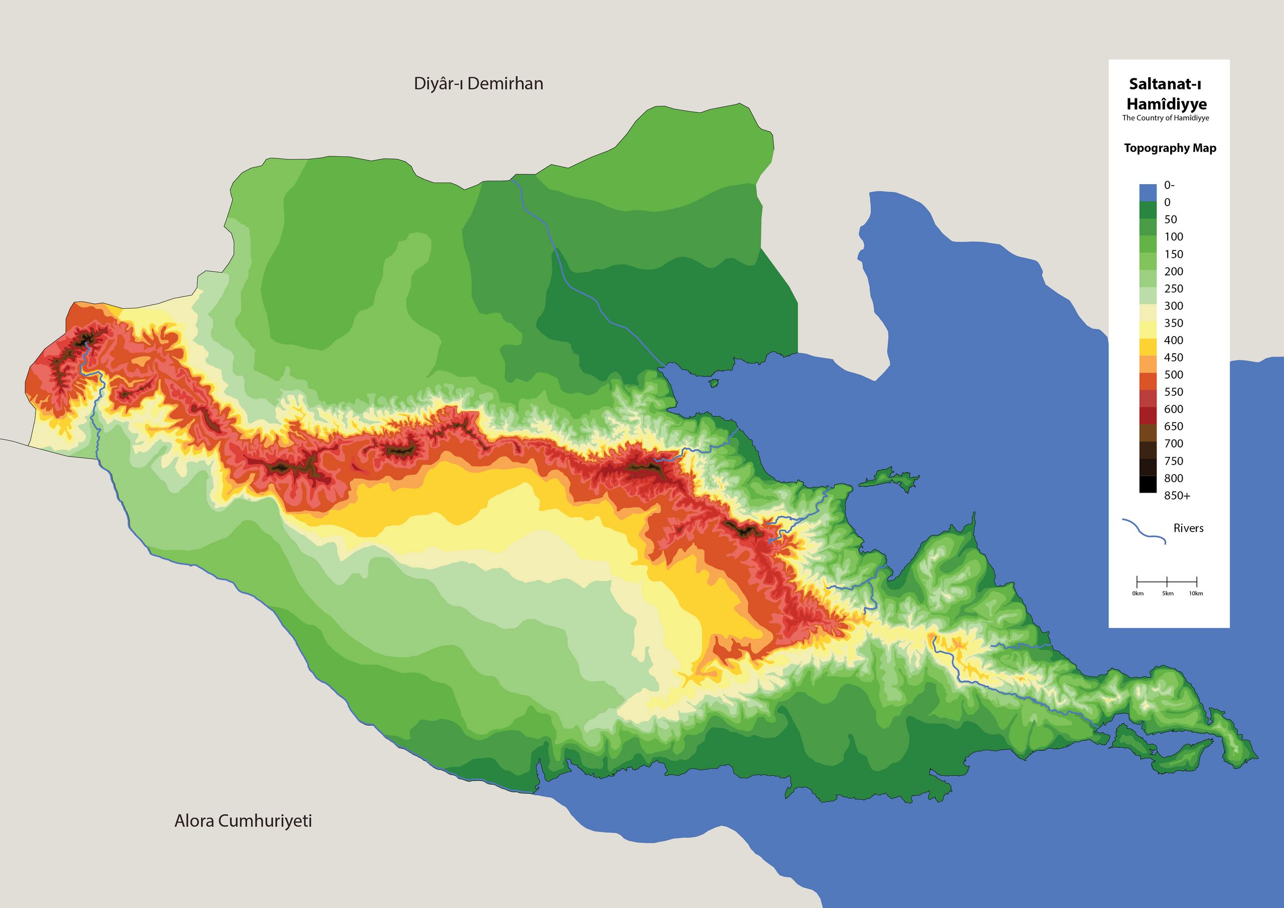
Elevation of Hamidiye - 4 August 2025
| This map is a derivative of the OpenGeofiction base map, which is licensed under the Creative Commons Attribution-NonCommercial-ShareAlike License and is released under the same license. |
File history
Click on a date/time to view the file as it appeared at that time.
| Date/Time | Thumbnail | Dimensions | User | Comment | |
|---|---|---|---|---|---|
| current | 18:53, 8 August 2025 | | 3,508 × 2,480 (1.65 MB) | Aad (talk | contribs) | |
| 18:52, 8 August 2025 |  | 842 × 595 (243 KB) | Aad (talk | contribs) | ||
| 15:08, 4 August 2025 |  | 842 × 595 (244 KB) | Aad (talk | contribs) |
You cannot overwrite this file.
File usage
The following page uses this file: