

Forum:Territory application/AN142b - addition to Joriskjo (AN142g)
- Please fill in the information below to make a territory request.
 | Territory ID and proposed name |
|---|---|
| The Territory ID (from OpenGeofiction:Territories, e.g. AR123a) and proposed name of the country |
AN142b∈⊾ƨ - addition to Joriskjo (upsizing AN142g∈⊾ƨ)
 | Physical geography |
|---|---|
| An overview of climate, topography and landscape of the country. With the exception of Beginner territories, you should always create a sketch map to illustrate & explain your plans. You can add a link to this (hosted on imgBB, Postimages or similar, but not imgur.com) |
General Notes
- Existing conditions (D1.0): https://i.postimg.cc/9z5k2Q42/D1-0-Existing-Conditions.png
- Annotations (D1.1): https://i.postimg.cc/MX2Lwpcz/D1-1-Broad-Annotations.png
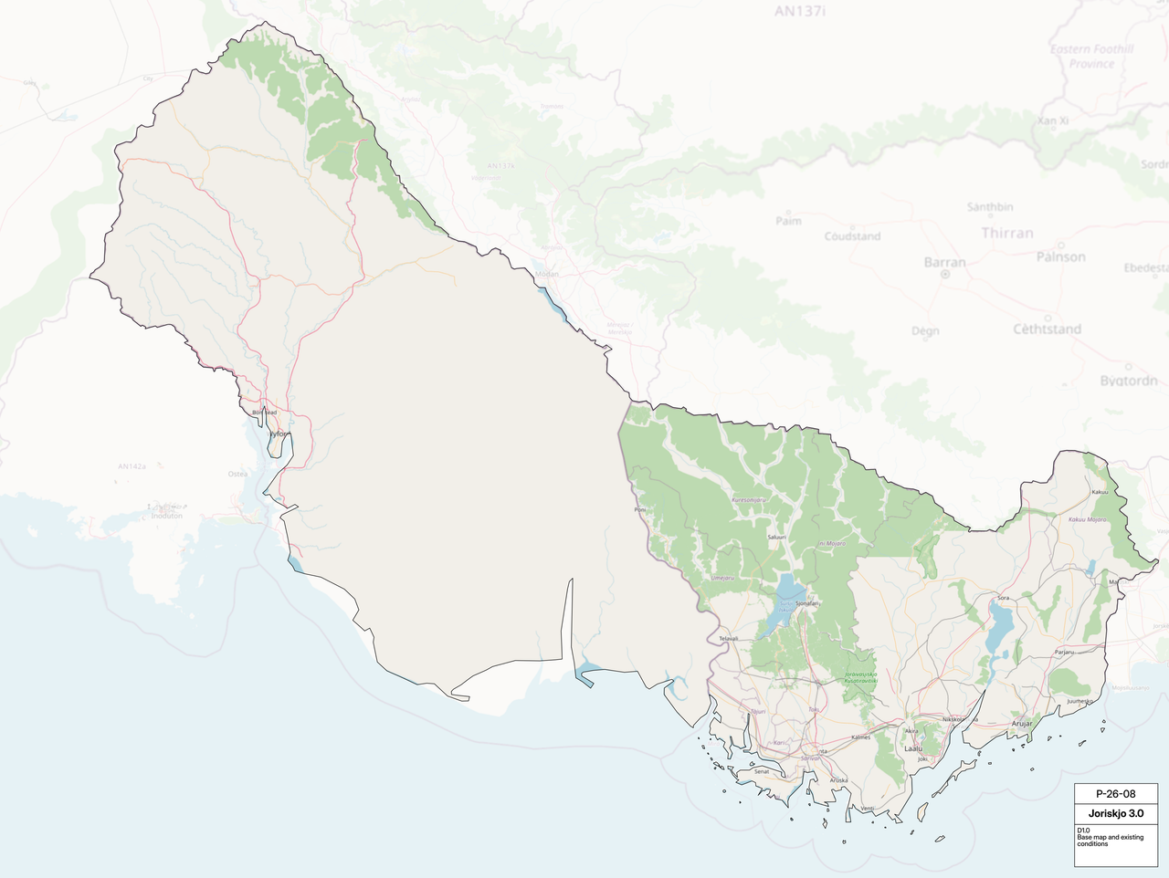
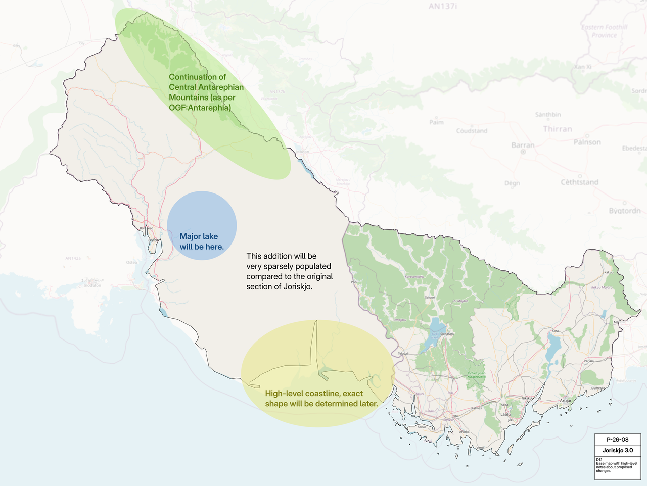
This addition will broadly follow the admin plans for Temperate Antarephia (Bioregion 6), in OpenGeofiction:Antarephia. The climate, topography, and landscape of AN142b will all be consistent with continental plans.
Climate
- Köppen climate class plan (D5.2): https://i.postimg.cc/dQktJNkP/D5-2-Climate-Types.png
- Precipitation, wind, and wave patterns for current Joriskjo (P-25-04 D5.1): https://i.postimg.cc/3r4J3f4Y/P-25-04-D5-1-Precipitation.png
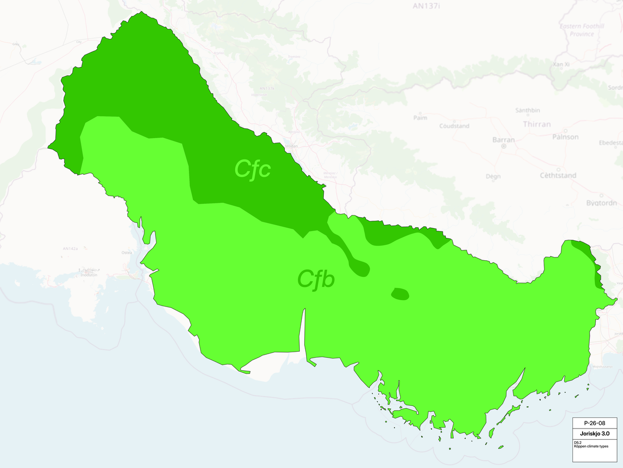
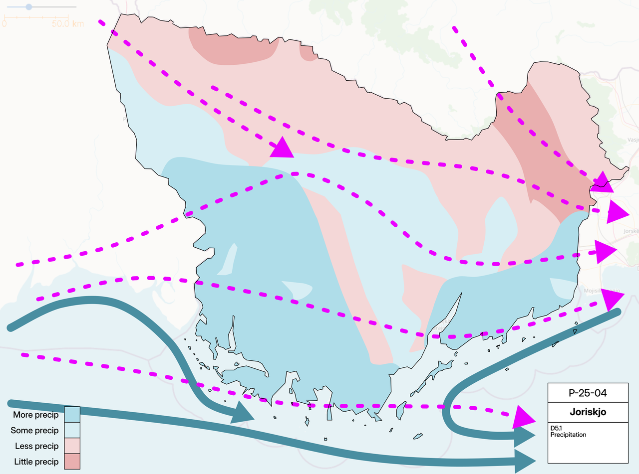
The climate for AN142b would be primarily oceanic (Cfb), with certain mountainous areas having a colder climate (approx. Cfc).
Topography
- Thematic elevation areas (D2.2): https://i.postimg.cc/w38rzjtY/D2-2-Thematic-Elevation-Areas.png
- General elevation plan (D4.0): https://i.postimg.cc/9XRFcg4K/D4-0-Elevation-250m.png
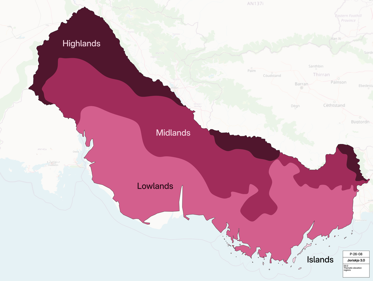
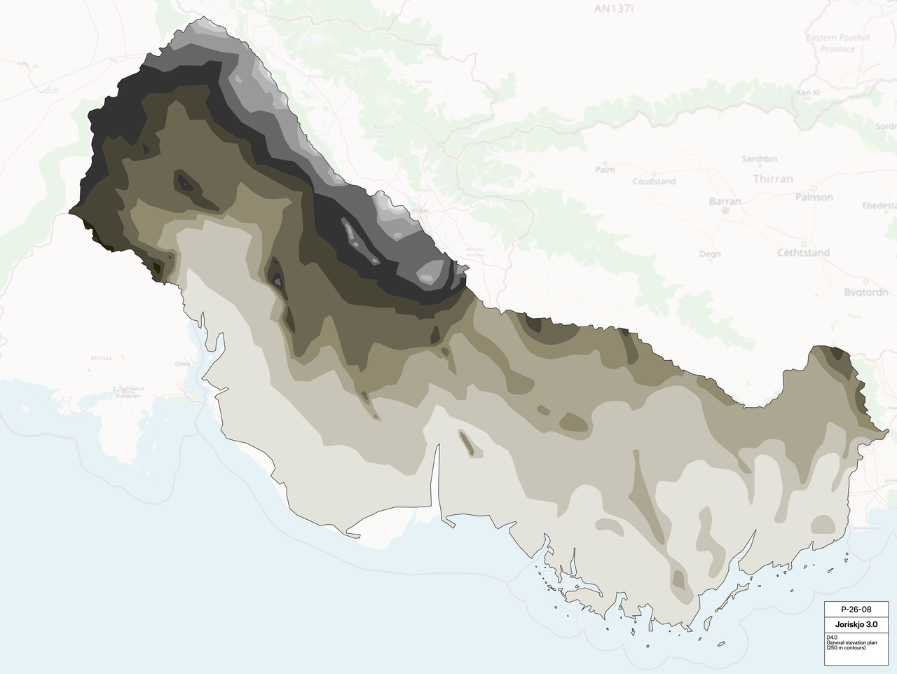
I'm not really good at making topo maps, so I have also provided a more thematic (highland/midland/lowland) plan showing general vibes.
Landscape
- Major geographic features plan (D2.1): https://i.postimg.cc/NLqntjyw/D2-1-Major-Geographic-Features.png
- Major watershed plan (D2.3): https://i.postimg.cc/G9wfRmBB/D2-3-Major-Watersheds.png
- Geographic region plan for current Joriskjo (P-25-04 D2.0): https://i.postimg.cc/Y2GqtD4y/P-25-04-D2-0-Geographic-regions.png
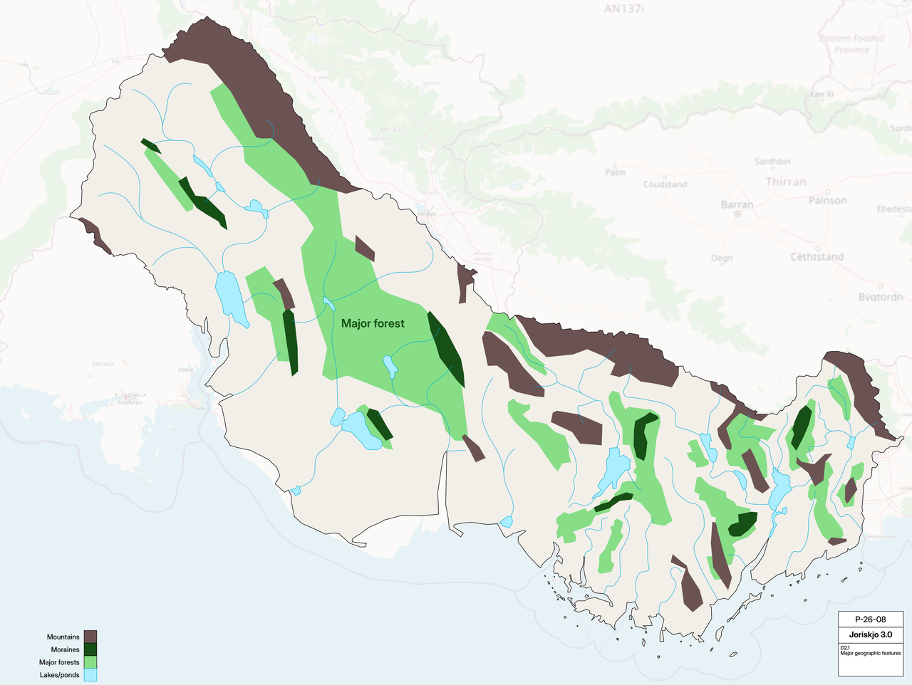
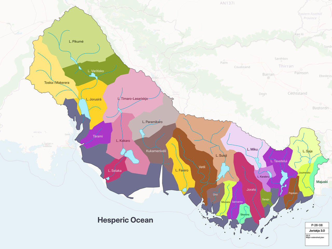
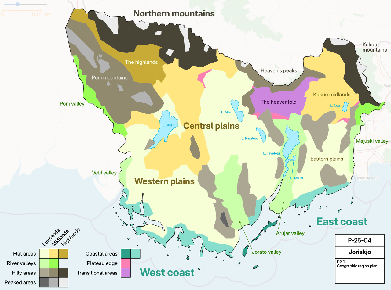
The landscape of AN142b is an extension of what exists in current Joriskjo (AN142g). AN142b would be flatter for the most part, but step up toward the north and west as it approaches the mountain range in central Antarephia. The geographic region plan provides an overview of the plan for current Joriskjo, for reference.
The Lowlands and Midlands of AN142b would be dominated by temperate grasslands and low-lying shrublands, with larger tracts of deciduous and mixed forests around rivers, lakes, and on the rainy side of mountains and hills. Examples would be coastal plains found across New Zealand and Western Europe.
Highland areas would see more heath and other shrub/shorter woody vegetation instead of grasslands, with mixed temperate forests giving way to more coniferous species at higher elevations. Examples include the Southern Alps in New Zealand and the Pacific Northwest (not a lot of snow is expected, and the tree line may be higher up than in these examples).
 | Human geography |
|---|---|
| A brief description of the territory demographics, economic development, land occupation, infrastructure and mapping style |
Demographics
- Administrative divisions (D3.0): https://i.postimg.cc/14hdS3gp/D3-0-Political-Map.png
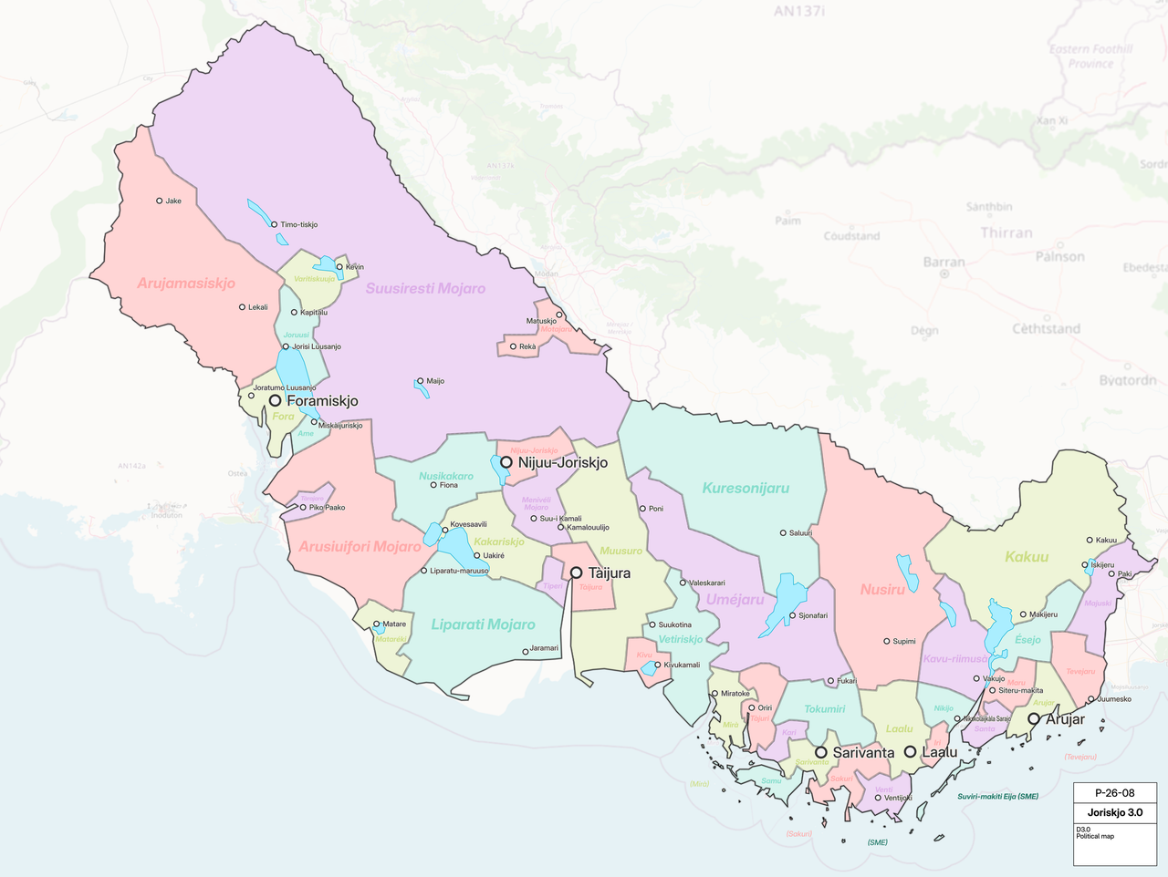
AN142b would be very sparsely populated, compared to the rest of Joriskjo. The total population of new Joriskjo (AN142g + AN142b) would be ~10-15 million, with most people concentrated in current Joriskjo. Administrative divisions reflect this population distribution, and much of the western and interior lands would be mostly uninhabited.
Economy & Distribution
Joriskjo is classified as a developed country, with a nominal GDP per capita of USD ~$45 000, and an HDI of 0.910. This quality of life is highly uneven, with northern areas having much poorer access to infrastructure, services, and amenities.
Land Occupation
Much of AN412b would be natural/open space areas, with lots of protected areas and national parks. The southern and coastal areas will be primarily rural and natural, with large tracts of farmland following highway, railway, and waterway connections between surrounding towns.
Infrastructure
- National highway atlas: https://i.postimg.cc/vDFKyZ17/D3-1-Highway-Atlas.png
- Major railway plan: https://i.postimg.cc/fknPsR3Y/D3-2-Railways.png
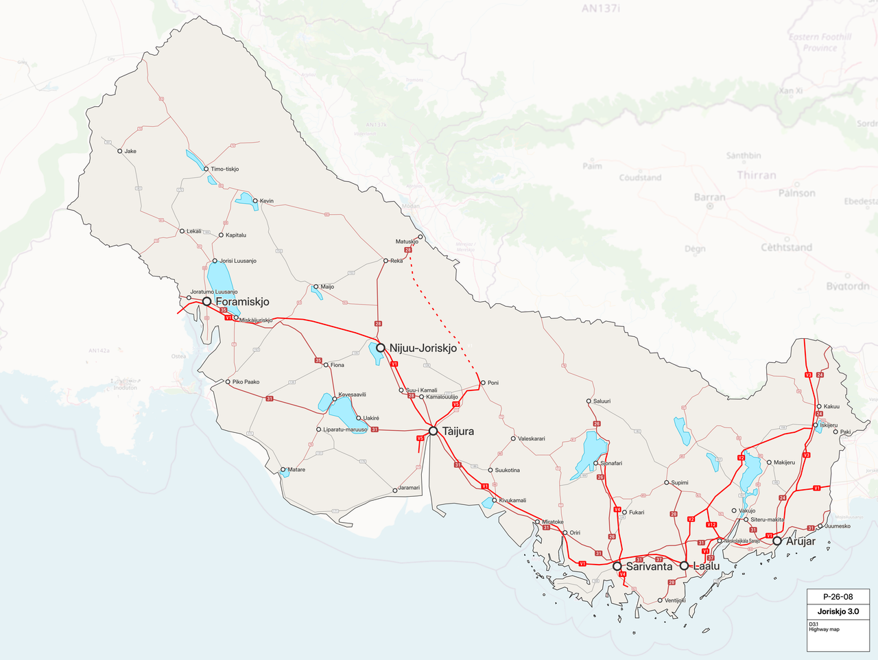
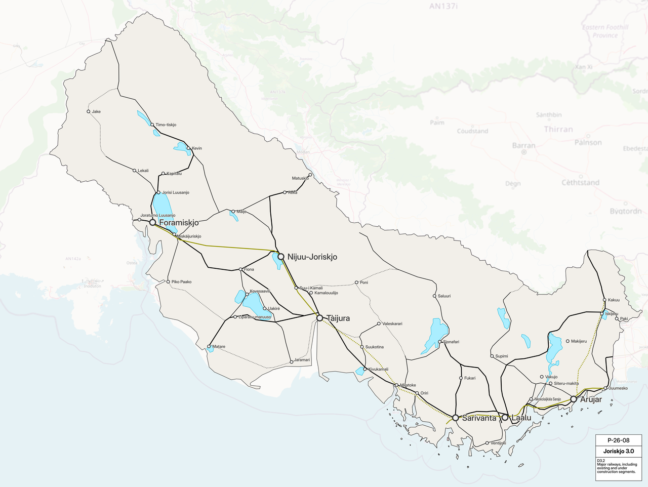
Existing highway and railway infrastructure is mostly in the southeast, with a small corridor linking the three big cities in AN142b (Tàijura, Nijuu-Joriskjo, and Foramiskjo).
 | History & culture |
|---|---|
| A brief description of the intended culture and language |
Language
AN142b would use Joriskjo's conlang Sjepar, with regional variations in toponymy. More information on Sjepar is available on Conworkshop.
Culture
Beyond the standard Northern/Central European examples that Joriskjo uses, I am looking to include nomadic cultures in the northern parts of the country. Large areas of the country's north and west would be held by the state in perpetuity to allow for nomadic peoples in the country to continue their way of life. I have experimented a little bit with this in the north of current Joriskjo.
 | Past mapping |
|---|---|
| To support your request provide links to areas of OGF mapping which showcase your mapping skill. Mapping relevant to the requested theme & geography is especially useful. | |
| The {{coord}}, {{node}}, {{relation}} or {{scalehelper}} templates can optionally be used to link to the OGF map - they result in nicely formatted links. Or you can paste in a URL. |
I can provide more mapping examples as needed.
Urban mapping
- Urban high-detail mapping in Deodeca:
 42.444°S, 139.00513°E
 - City of Ste. Margaux, Deodeca (excluding railways and Caustlie, I did not do those): 41.4788°S, 138.0407°E
- Cabelia, Tarephia: 19.4163°S, 25.0722°E
- Former urban mapping in Joriskjo (moved to Valonne): 48.94685°N, 53.67721°E
- Various parts of Kingstown, Deodeca (collaborative project): 42.4663°S, 139.2496°E
Rural/natural mapping
- Forest cover mapping in Joriskjo: 47.0074°S, 43.7666°E
- Large-scale grassland mapping experiment (more details at higher zooms): 46.2018°S, 44.9646°E
- Forest cover mapping in Deodeca: 42.3465°S, 138.5035°E
- Mountainous landcover (old mapping) in Cabelia: 19.7335°S, 25.7567°E
- Village of Iberville, Deodeca: 42.3537°S, 138.475°E
| Username & date |
|---|---|
| Sign and date the application by typing four tildes (~~~~) without spaces or "nowiki" tags. |
- varnel_maiser (talk / varnel_maiser) 05:36, 28 August 2026 (UTC)
 | Discussion |
|---|---|
| Discussion for clarification & decision |
- All linked images will expire in 2 months. I can always re-upload them as needed. If the postimage links don't work, you can find all the plans in this folder: https://drive.google.com/drive/folders/1oEWGke_0-U1iBhqwlExskeDgoMZCN1fh?usp=sharing
- varnel_maiser (talk / varnel_maiser) 05:36, 28 August 2026 (UTC)
Hello varnel, as a fellow mapper in the region it's nice to see an effort to expand the mapped areas in Antarephia. I do quite like the detail you have included in your proposal, though I do have two points I would raise:
Firstly, whether the existing mapping in Joriskjo will be considered sufficiently "complete" by the Admins to justify expanding the territory.
Secondly, I am interested in how you intend to justify the drastic difference in population density across the territory, given the climate would generally be quite similar in most of the planes and there doesn't seem to be much geological justification for why it would be much harder for those areas to support similar populations. I do like that you have put some emphasis on nomadic cultures but in this respect I am curious as to what you would consider the reasoning behind why there would be a sharp transition between nomadic and sedentary cultures within roughly the same coastal plain and hill region.
I look forward to hearing your thoughts on these points. Qhfreddy (talk) 21:42, 29 August 2026 (UTC)
- Hi! Thanks for your points, I appreciate the feedback and have responded below 😌
- Regarding the first point, I am not concerned about my ability to manage a larger territory. You can download the area around Lake Miku in AN142g or take a look at the country through Spyglass to see how I have divided parts of the current Joriskjo (AN142g) into a ~20 km grid of workzones to break up large mapping tasks. Areas requiring more detail could be further divided and later refined. It's similar to how HOT Tasking Manager divides tasks 🤔, and I would use it in AN142b too.
- For the second, I should clarify that major cities are still proposed in AN142b despite the overall lesser density. A solely physical geographic reason is not needed to explain this difference, especially where lore-based reasons are perfectly suitable. For example, Joriskjo's industrialization was focused on the largest and most accessible existing cities, leading to an uneven development of major infrastructure and amenities. An ensuing wave of rural-urban migration follows, cementing this relationship.
- Thanks for your thoughts, by the way! Always happy to chat 🍵 - varnel_maiser (talk / varnel_maiser) 04:31, 30 August 2026 (UTC)
Hi varnel_maiser,
There's not much to add to this well-structured application. Looking at Major Watersheds, my only comment/request would be to reconnect Vetil River∈⊾ƨ or make the upper course emptying somewhere else and remove the lower course from the relation. I'm merging those territories (keeping the existing AN142g relation but with ref AN142b to keep consistency after recent remodeling). The extension is yours, Happy mapping!
--Aiki (talk) 07:12, 4 September 2026 (UTC) Acting administrator for AN/TA
 |
Territory application approved |
|---|---|
| --Aiki (talk) 07:12, 4 September 2026 (UTC) Acting administrator for AN/TA | |
| As you develop your territory, be sure to keep it realistic. Here are some resources you may find useful for starting out: Help:Portal, Help:Making realistic countries, Help:Making realistic cities and OpenGeofiction:Site policies |