 | File:Wisecota 20.png Wisecota Primary Route 20 Shield
{{Cc-by-nc}}
(864 × 1,080 (81 KB)) - 19:54, 23 May 2022 |
 | File:Khaiwoon coa.png ...rt.org/detail/25316/rosette%203, https://openclipart.org/detail/22698/junk%20%28ship%29
{{Cc-by-sa}}
(800 × 723 (353 KB)) - 19:15, 25 March 2022 |
 | File:QX Route Marker.png Quenexia State Route Marker Example (QX-20)
{{Cc-by-nc}}
(207 × 271 (20 KB)) - 03:55, 30 August 2023 |
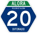
 | File:Alora Hwy 20.png National highway route marker example (Alora NH-20)
{{Cc-by-nc}}
(569 × 506 (57 KB)) - 00:41, 13 March 2022 |
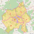
 | File:Xiongjing Districts.png ...%3B%0A(node(area.bndarea)%5B"admin_level"%3D"6"%5D(%7B%7Bbbox%7D%7D)%3B%0A%20%20way(area.bndarea)%5B"admin_level"%3D"6"%5D(%7B%7Bbbox%7D%7D)%3B%0A%20rela
{{Cc-ogf-map}}
(691 × 691 (551 KB)) - 04:18, 3 December 2023 |
: Thanks! [[User:Anonymous21|Anonymous21]] ([[User talk:Anonymous21|talk]]) 20:44, 3 October 2022 (UTC)
...help! - [[User:Anonymous21|Anonymous21]] ([[User talk:Anonymous21|talk]]) 20:39, 5 October 2022 (UTC)
9 KB (1,439 words) - 22:08, 19 June 2023
Population of this country is cc. 14 million. The coastal area's population density goes as high as 150 pp./
[[User:SleepyAks|SleepyAks]] ([[User talk:SleepyAks|talk]]) 20:28, 16 February 2024 (UTC)
5 KB (745 words) - 17:25, 18 February 2024
Does everybody agree? --Mstr (talk) 12:20, 2 January 2016 (CET)
Leaflet | © OpenGeofiction contributors (CC-BY-NC-SA)
17 KB (2,889 words) - 01:14, 28 February 2022
...will adhere to a semi-arid or continental climate, in accordance to Sector 20 (Central Ulethan Steppe).
|Cc
6 KB (1,040 words) - 14:51, 4 January 2023
! style="width:20%" | Name of Raceway
| [http://opengeofiction.net/#map=16/20.8214/86.6944 map]
18 KB (1,981 words) - 03:10, 24 October 2021
...tes are even numbered, ranging from 2 in the south to 18 in the north, and 20 in the south to 98 in the north; north/south routes are odd numbered, rangi
* Option 4: Two-tier system. Numbers 1-19 for more important routes, 20-99 for less important routes. For branch-off routes (spurs) add an addition
98 KB (14,505 words) - 17:27, 23 February 2024
...interested. My country has many gohangukian areas, for example [[Sarangdo, CC]] is currently the most detailed map. Where would it fit well? --[[User:Ard
Like it Isleño, good work! [[User:Wangi|wangi]] ([[User talk:Wangi|talk]]) 01:20, 3 October 2014 (CEST)
131 KB (21,716 words) - 14:55, 23 November 2023
| 20|31|63
|20 %
50 KB (7,568 words) - 10:52, 12 March 2024
...a, Spain (29812262913).jpg|400px|thumb|Beach near Mataman in Fóskiman-iki, 20 km west of Ántibes]]
| 20|31|63
159 KB (21,836 words) - 12:55, 7 May 2024
| rowspan="2" |Cc
|cc
32 KB (4,762 words) - 03:51, 11 April 2024
| script = Aa Ãã Bb Cc Dd Ee Éé Èè Ëë Ff Gg Hh Ii Jj Kk Ll Mm Nn Ññ Oo Ôô Õõ Pp Qq Rr
|20
30 KB (4,258 words) - 09:23, 9 May 2024


