Forum:Territory application/BG21 - Micriama and Infrastructure in Alora: Difference between pages
(very short application for Micriama) |
|||
| Line 1: | Line 1: | ||
NOTE: This page is under construction. | |||
==Highways== | |||
===Alora Expressway System=== | |||
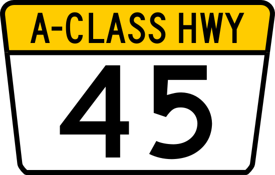
The most advanced system is the ''Alora Expressway System'' which consists of a fully access-controlled grade-separated freeway system, most of which is toll-free. The Alora Expressway System is divided into three classifications of highways. The prefix "A-" or "C-" before the route number identify sections of the ''Alora Expressway System'' that have not been updated to full limited access freeway status. Routes are marked with one of three different Expressway markers according to the class of highway. Class-A and Class-C Route markers have a trapezoidal "flower-pot" design and the Class-E marker is a downward pointing trapezoidal pentagon as shown in the table below. It is possible for some sections of a particular route to be designated with more than one route classification depending on their level of development. The Expressway system has high design standards to ensure the roadways are safe for travel at high speeds. The table below details the required standards. | |||
: | {| class="wikitable" style="border-spacing: 2px; border: 1px solid darkgray;" | ||
|+ '''Alora Expressway System Minimum Design Standards''' | |||
|- style="text-align: center" border="0" | |||
|'''Classification''' | |||
|'''Design Speed''' | |||
|'''Median/Barrier''' | |||
|'''Grade Separation & Access Control''' | |||
|'''Carriageways''' | |||
|'''Hard Shoulder Width''' | |||
|'''Vertical Clearance''' | |||
|- | |||
|style="text-align: center" border="0"|'''''Class-E'' Expressway''' | |||
| rowspan="3" style="text-align: center" border="0"|80 mph | |||
(130 Kph) | |||
| rowspan="2" | | |||
*Minimum Open Median Width: 100' (15.2m) | |||
*Median Crossover protection required under 100' | |||
*Steel Barrier required under 50' | |||
*Concrete Median Barrier required under 24' | |||
| | |||
* Fully Grade Separated | |||
* Full Controlled Access (via interchanges or ramps only) | |||
| rowspan="2" | | |||
*Dual Carriageway (Separated ways of travel) | |||
*Minimum 2 lanes each way | |||
*Lane Width: 12' (3.65m) | |||
| rowspan="2" style="text-align: center" border="0"|Left 4' (1.2m) | |||
Right 10' (3.0m) | |||
| rowspan="3" style="text-align: center" border="0"|16' (4.9 m) | |||
|style="text-align: center" border="0"|[[File:Alora E-75.png|120px|Example of Feeder Primary Route marker|link=Special:FilePath/Alora_E-75.png]] | |||
|- | |||
|style="text-align: center" border="0"|'''''Class-A''''' | |||
'''Trunk Highway''' | |||
| rowspan="2" | | |||
* At-Grade Intersections allowed. | |||
* Signalization or interchanges required at major junctions. | |||
* Railways must be grade separated | |||
* Limited Access via ramps or at intersections only (no driveways) | |||
|style="text-align: center" border="0"|[[File:Alora A-45.png|120px|Example of Class A Trunk Highway Route marker|link=Special:FilePath/Alora_A-45.png]] | |||
|- | |||
|style="text-align: center" border="0"|'''''Class-C''''' | |||
'''Trunk Highway''' | |||
|style="text-align: center" border="0"|Not Applicable | |||
| | |||
*Single Carriageway (1 lane each way) | |||
*[[wikipedia:Super_two|"Super 2"]], or [[wikipedia:2+1_road|"2+1 Road"]] configurations also allowed | |||
*Lane Width: 12' (3.65m) | |||
|style="text-align: center" border="0"|10' (3.0m) | |||
|style="text-align: center" border="0"|[[File:Alora C-8.png|120px|Example of Class C Trunk Highway Route marker|link=Special:FilePath/Alora_C-8.png]] | |||
|} | |||
'''Numbering System and Corridor Groups''' | |||
Highways are numbered in correlation to their respective primary corridor. E-1 is grouped with the E-10 and E-11 corridors and other primary feeder routes, such as E-11 and E-15, branch off of these main groups. Three digit ''Auxiliary Routes'' serve as spur routes into cities or loop routes looping around cities. These are numbered with the parent number being the first 2 numbers of the 3 digit route number. There are no plans to introduce 4-digit route numbers. Additionally suffixed routes are not allowed in the expressway numbering plan. | |||
Examples: | |||
*E-901 connects to E-90 and would be a service route or loop route that is connected to a expressway numbered as part of the E-9/E-90/E-99 Corridor Group. | |||
*E-371 connects to E-37 and would be a service route or loop route that is connected to a expressway numbered as part of the E-3/E-30 Corridor Group. | |||
*E-100 connects to E-1 and would be a service route or loop route that is connected to a expressway numbered as part of the E-1/E-10/E-11 Corridor Group. | |||
*E-220 connects to E-22 and would be a service route or loop route that is connected to a expressway numbered as part of the E-2/E-20 Corridor Group. | |||
Corridor Groups: | |||
*E-1/E-10/E-11 Corridor - Main corridor - Alora's Mainstreet - Northwest to Southeast (Including Mediterranean Coast Corridor) | |||
*E-2/E-20 Corridor - Mopaso-Athalan Corridor | |||
*E-3/E-30 Corridor - Margonas-Montaro Corridor | |||
*E-4/E-40 Corridor - Adomaka - Vela Canta Corridor | |||
*E-5/E-50 Corridor - Nalmos City - Takorado Corridor | |||
*E-6/E-60 Corridor - Perdio - Kennelida Corridor | |||
*E-7/E-70 Corridor - Arratas - Porto Maganya Corridor | |||
*E-8/E-80 Corridor - Northern Border Corridor | |||
*E-9/E-90/E-99 Corridor - South Coast Corridor | |||
===National Highway System=== | |||
{| class="wikitable floatright" style="border-spacing: 2px; border: 1px solid darkgray;" | |||
|- style="text-align: center" border="0" | |||
|[[File:Alora Hwy 20.png|120px|Example of Alora route marker|link=Special:FilePath/Alora_Hwy_20.png]] | |||
|[[File:Alora Hwy 1A.png|120px|Example of Alora route marker|link=Special:FilePath/Alora_Hwy_1A.png]] | |||
|- style="text-align: center" | |||
|Primary NHS marker||Alternate NHS marker | |||
|} | |||
Alora also has a '''National Highway System''' for highways that are not part of the ''Alora Expressway System''. Routes are marked along their route with a standard hexagonal NHS route marker as shown in the table to the right. | |||
'''NHS Numbering System''' | |||
''National highways'' are numbered differently from the expressway system with the numbering convention having odd numbered roads traveling east to west and even numbered routes traveling north to south to avoid confusion with the expressway system. 1 and 2 digit route numbers indicate parent primary routes and 3 digit route numbers indicate child primary routes that branch from or supplement the NHS numbering system. Suffixed routes are allowed in the National Highway System. suffix routes are legislatively defined as follows. | |||
Suffixes include: | |||
*A = "A" alternate route that follows a similar path/trajectory and meets at both ends. (these are typically not used for spur routes.) | |||
*B = Business or "B" alternate, designates a business route or secondary alternate route into a city that meets on both ends. (can also be a spur route) | |||
*C = City route or "C" alternate is a tertiary alternate route that leads around or through a urban area that meets on both ends. (can also be a spur route) | |||
*N = Northern Alternate Routing (for use with routes traveling east or west). | |||
*E = Eastern Alternate Routing (for use with routes traveling north or south). | |||
*W = Western Alternate Routing (for use with routes traveling north or south). | |||
*S = southern Alternate Routing (for use with routes traveling east or west). | |||
Note that the directional alternate suffixes are used for split route designations where the main route splits into two or three parallel routes. Spur routes that do not loop back to the parent highway (connect only at one end) must be signed with a "SPUR" placard over the route marker. | |||
{ | {| class="wikitable" style="border-spacing: 2px; border: 1px solid darkgray;" | ||
|+ '''NHS Highway Minimum Design Standards''' | |||
|- style="text-align: center" border="0" | |||
| '''Classification''' | |||
|'''Design Speed''' | |||
|'''Median/Barrier''' | |||
|'''Access Control''' | |||
|'''Divided Road''' | |||
|'''Minimum Number of Lanes''' | |||
|'''Lane Width''' | |||
|'''Hard Shoulder Width''' | |||
|'''Vertical Clearance''' | |||
|- style="text-align: center" border="0" | |||
|'''Class-5 Freeway''' | |||
| colspan="9" | Same as "Class-E Expressway" | |||
|- style="text-align: center" border="0" | |||
|'''Class-4 Multilane Divided Highway''' | |||
| rowspan="4" |70 mph (110 Kph) | |||
| Unprotected 24' (15.2m) With Barrier 12' (3.65m) | |||
| rowspan="2" | Reduced/Limited Access (driveways discouraged) | |||
| Yes | |||
| rowspan="2" |2 lanes each way | |||
| rowspan="4" |12' (3.65m) | |||
| Left 4' (1.2m) Right 10' (3.0m) | |||
| rowspan="4"|16' (4.9 m) | |||
|- style="text-align: center" border="0" | |||
|'''Class-3 Multilane Undivided Highway''' | |||
| N/A | |||
| No | |||
| Right 10' (3.0m) | |||
|- style="text-align: center" border="0" | |||
|'''Class-2 [[wikipedia:Super_two|"Super 2"]] Highway''' | |||
| Unprotected 24' (15.2m) With Barrier 12' (3.65m) | |||
| Grade Separated Controlled Access (driveways not allowed) | |||
| Yes | |||
| rowspan="3" |1 lanes each way ([[wikipedia:2+1_road|"2+1 Road"]] also allowed) | |||
| Left 4' (1.2m) Right 10' (3.0m) | |||
|- style="text-align: center" border="0" | |||
|'''Class-1A Major Highway''' | |||
| rowspan="2" | N/A | |||
| Reduced/Limited Access (driveways discouraged) | |||
| rowspan="2" |No | |||
| 6.5' (2.0m) | |||
|- style="text-align: center" border="0" | |||
|'''Class-1 Highway''' | |||
| 55 mph (90 Kph) | |||
| Reduced/Limited Access (driveways allowed) | |||
|11' (3.35m) | |||
|4' (1.2m) | |||
|14' | |||
|} | |||
===State Highways=== | |||
{{ | Each state is responsible for building out and maintaining its own system of highways. Some of which are eligible for federal funding if they meet certain requirements. This enables states to receive funding to help with the cost of maintainance and buildout of their highway networks at a 50% matching cost with the federal government. Each state has their own designated route marker or they can use the "generic" state route marker provided by the Alora Department of Transportation as shown in the table above. Below is a table showing the route markers for each state. | ||
{| class="wikitable" style="border-spacing: 2px; border: 1px solid darkgray; margin-left: auto; margin-right: auto; border: none;" | |||
|+Highway Route Markers by State | |||
|- style="text-align: center" border="0" | |||
|Adenia | |||
|Alaria | |||
|Arratas | |||
|Avalon | |||
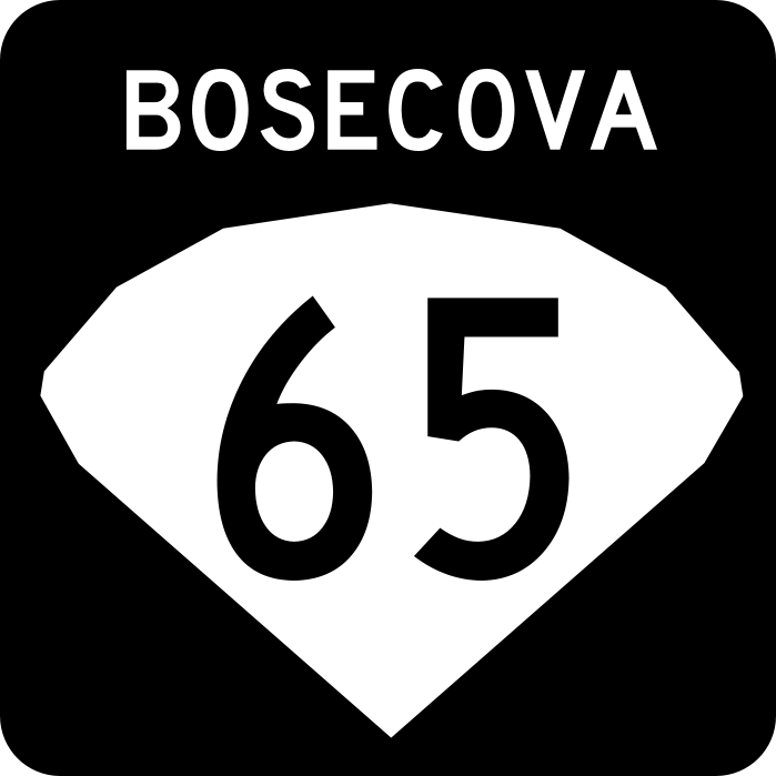
|Bosecova | |||
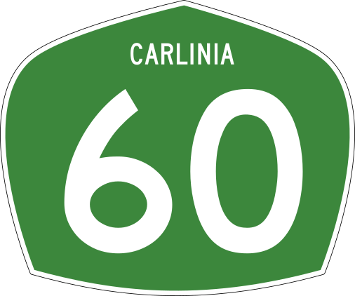
|Carlinia | |||
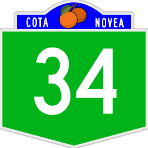
|Cota Novea | |||
|Difonado | |||
|- style="text-align: center" border="0" | |||
|[[File:AD Route Marker.png|120px|Example of Adenia state Highway Route marker|link=Special:FilePath/AD_Route_Marker.png]] | |||
|[[File:AA Route Marker.png|120px|Example of Alaria state Highway Route marker|link=Special:FilePath/AA_Route_Marker.png]] | |||
|[[File:AR Route Marker.png|120px|Example of Arratas state Highway Route marker|link=Special:FilePath/AR_Route_Marker.png]] | |||
|[[File:AV Route Marker.png|120px|Example of Avalon state Highway Route marker|link=Special:FilePath/AV_Route_Marker.png]] | |||
|[[File:BO Route Marker.png|120px|Example of Bosecova state Highway Route marker|link=Special:FilePath/BO_Route_Marker.png]] | |||
|[[File:CL Route Marker.png|120px|Example of Carlinia state Highway Route marker|link=Special:FilePath/CL_Route_Marker.png]] | |||
|[[File:CN Route Marker.png|120px|Example of Cota Novea state Highway Route marker|link=Special:FilePath/CN_Route_Marker.png]] | |||
|[[File:DF Route Marker.png|120px|Example of Difonado state Highway Route marker|link=Special:FilePath/DF_Route_Marker.png]] | |||
|- style="text-align: center" border="0" | |||
|Escaskia | |||
|Havania | |||
|Jalacosa | |||
|Kelawa | |||
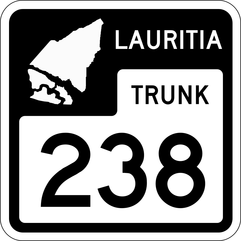
|Lauritia | |||
|Medrano | |||
|Mopaso | |||
|Nolexo | |||
|- style="text-align: center" border="0" | |||
|[[File:ES Route Marker.png|120px|Example of Escaskia state Highway Route marker|link=Special:FilePath/ES_Route_Marker.png]] | |||
|[[File:HV Route Marker.png|120px|Example of Havania state Highway Route marker|link=Special:FilePath/HV_Route_Marker.png]] | |||
|[[File:Alora Generic State.png|120px|Example of generic state Highway Route marker|link=Special:FilePath/Alora_Generic_State.png]] | |||
|[[File:KW Route Marker.png|120px|Example of Kelawa state Highway Route marker|link=Special:FilePath/KW_Route_Marker.png]] | |||
|[[File:LR Route Marker.png|120px|Example of Lauritia state Highway Route marker|link=Special:FilePath/LR_Route_Marker.png]] | |||
|[[File:Alora Generic State.png|120px|Example of generic state Highway Route marker|link=Special:FilePath/Alora_Generic_State.png]] | |||
|[[File:MP Route Marker.png|120px|Example of Mopaso state Highway Route marker|link=Special:FilePath/MP_Route_Marker.png]] | |||
|[[File:NX Route Marker.png|120px|Example of Nolexo state Highway Route marker|link=Special:FilePath/NX_Route_Marker.png]] | |||
|- style="text-align: center" border="0" | |||
|Pehalasippi | |||
|Quenexia | |||
|Takorado | |||
|Teguteca | |||
|Tenata | |||
|Vela Canta | |||
|West Takora | |||
|State Highway (Generic) | |||
|- style="text-align: center" border="0" | |||
|[[File:PS Route Marker.png|120px|Example of Pehalasippi state Highway Route marker|link=Special:FilePath/PS_Route_Marker.png]] | |||
|[[File:QX Route Marker.png|120px|Example of Quenexia state Highway Route marker|link=Special:FilePath/QX_Route_Marker.png]] | |||
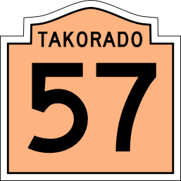
|[[File:TK Route Marker.png|120px|Example of Takorado state Highway Route marker|link=Special:FilePath/TK_Route_Marker.png]] | |||
|[[File:Alora Generic State.png|120px|Example of generic state Highway Route marker|link=Special:FilePath/Alora_Generic_State.png]] | |||
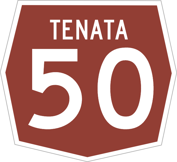
|[[File:TN Route Marker.png|120px|Example of Tenata state Highway Route marker|link=Special:FilePath/TN_Route_Marker.png]] | |||
|[[File:VC Route Marker.png|120px|Example of Vela Canta state Highway Route marker|link=Special:FilePath/VC_Route_Marker.png]] | |||
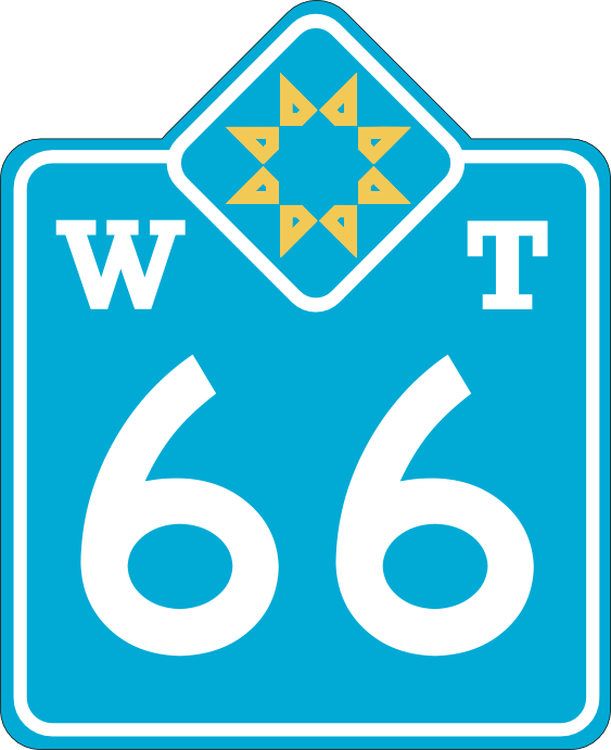
|[[File:WT Route Marker.png|120px|Example of West Takora state Highway Route marker|link=Special:FilePath/WT_Route_Marker.png]] | |||
|[[File:Alora Generic State.png|120px|Example of generic state Highway Route marker|link=Special:FilePath/Alora_Generic_State.png]] | |||
|} | |||
The states of Jalacosa, Medrano and Teguteca all use the Generic State route sheild, and the states of Escaskia, Havania and Kelawa use a modified version of the generic shield. | |||
===National Special Highways=== | |||
{| class="wikitable floatright" style="border-spacing: 2px; border: 1px solid darkgray;" | |||
|- style="text-align: center" border="0" | |||
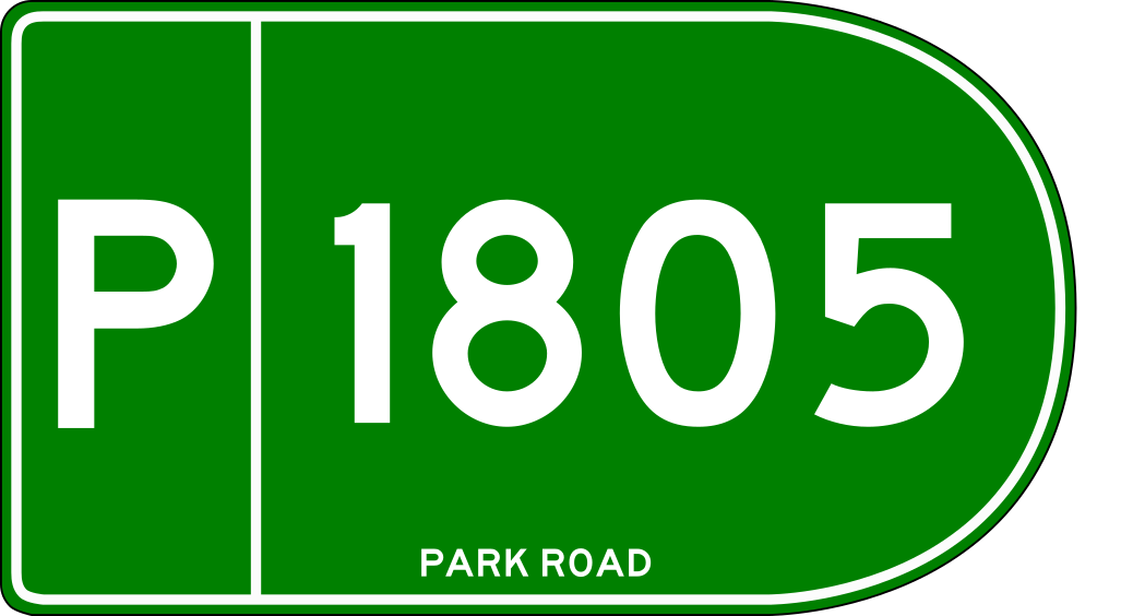
|[[File:Alora P Route.png|120px|Example of Alora Park route marker|link=Special:FilePath/Alora_P_Route.png]] | |||
|[[File:Alora F Route.png|120px|Example of Alora Forest route marker|link=Special:FilePath/Alora_Ft_Route.png]] | |||
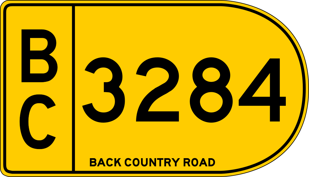
|[[File:Alora BC Route.png|120px|Example of Alora Back Country route marker|link=Special:FilePath/Alora_BC_Route.png]] | |||
|- style="text-align: center" | |||
|Park route marker||Forest route marker||Back country route marker | |||
|} | |||
Alora also maintains a system of special routes such as ''forest routes'', ''park routes'' and ''back-country roads''. These special highways are typically located within national forests, national parks and national land reserves. These roads may be of various condition and it is advised to consult with local authorities and or map resources before using these routes. Some routes are improved paved routes that allow commercial vehicles, while other roads are gravel or have unimproved surfaces that may be treacherous to traverse at times or are only suitable for 4-wheel drive vehicles. | |||
==Rail== | |||
Alora has a growing network of railways across the nation used for freight and passenger operations throughout the country. Several railroad operators share the national track network providing freight services across the country. In Alora track mileage and land is owned by the government and is managed by the National Railroad Administration (NRA). Freight operators are then assigned an area of responsibility over a particular area and are responsible for maintenance, upkeep and development of their assigned part of the network. Each rail operator then receives grants from the federal government to subsidize the cost of operations since the network is owned by the government. | |||
Major railroad companies operating in Alora: | |||
===Passenger Rail=== | |||
Passenger rail connects many of the major cities and towns across Alora. This network is still under development in more rural areas making Alora a car-centric country. | |||
===Mass Transit=== | |||
Larger cities such as Mopaso City, Takorado, Staughley and Santa Carlina have metro systems that provide rapid transit. These cities also have extensive bus networks as well with many routes running frequently during peak periods. In these larger cities it is easier to get around without a vehicle. However, with mass transit being expensive only the larger population centers have developed networks. Other major cities and larger towns rely on locally operated bus systems in order to provide public transportation. Longer Distance Bus operators also exist in Alora however most of these are private companies that may receive some governemnt subsidies but are not government run. | |||
===Alora High Speed Rail (AloraHSR)=== | |||
Currently there are 2 high speed rail operators in Alora. '''Alora HSR''' is a public private partnership railway with service connecting Takorado, Tomale, Mopaso City, Santa Carlina, Staughley, Santa Maria and Kenrich (Gobrassanya). '''GoHSR''' also operates within the country operating on trackage rights through the states of Alaria and Tenata to connect between Queensburg through Gallaton and Phailoon City to Carratta. | |||
==Seaports & Maritime Transport== | |||
Alora maintains ports in many cities along the coast. The highest volume of port operations in Alora are done in Staughley due to its strategic location along the [[Asperic Ocean]] and the fact that it is a protected harbor that it protected by barrier islands to the south. Additional port cities along the Asperic Coast include: Nalmos City, Adomaka, Nolexo City, Pellahatchee, Nicoa and Licoa. | |||
Significant marine port operations also occur in the Gulf of Alora in Santa Carlina, Mantan, Malinton, Tomale and Mopaso City due to their strategic location along the [[Gulf of Alora]]. Alora also operates one inland port at [[Gallaton]] in the [[Grand Lakes Region]] which is reached via the Arcois Ship Canal which traverses through [[Gobrassanya]] to the gulf of Alora Alora also has ports in the [[Mediterranean Sea]] with [[Escuderos]] and [[Puerto Domenica]] as major port cities in western Takora. | |||
==Air Transport== | |||
===Airports=== | |||
Alora has a number of international airports located throughout the country offering passenger and airfreight services world wide at a total of 5 major global hub airports. There are numerous other regional and municipal airports located throughout the country that also provide local and long distance passenger service as well as freight and general aviation services. Numerous small airstrips and private airports also exists having varying levels of flight operations, flight training, municipal, farming and other uses. | |||
{| class="wikitable sortable" border="1" style="margin:0px;width:100%;" | |||
|+ Major Airports in Alora | |||
|- | |||
! | Airport<br />Code | |||
! | Airport Name | |||
! | City | |||
! | Class | |||
! | Gates<br /><small>(total)†</small> | |||
! class="unsortable" | Runway orientation<br />and length | |||
! class="unsortable" | Location | |||
|- | |||
|API | |||
|Apacigua Island International Airport | |||
|Cántalva, JA | |||
|Regional | |||
|52 | |||
|9L/27R (3650m) <br />9R/27L (3650m) | |||
|{{Airport-coord|37.9924|68.4792}} | |||
|- | |||
|ARR | |||
|Hugo Peña Arratas International Airport | |||
|Escuderos, AR | |||
|Global Hub | |||
|46 | |||
|6/24 (3140m) <br />12/30 (3150m) | |||
|{{Airport-coord|34.5230|67.5781}} | |||
|- | |||
|GLI | |||
|Grand Lakes International Airport<small>Jointly owned by both cities.<br />Airport is situated on the border.</small> | |||
|Gallaton, TN<br />& Quesagnais, GL<br /><small>(Gobrassanya)</small> | |||
|Regional | |||
|94 | |||
| 3R/21L (3050m)<br />3C/21C (3050m)<br />3L/21R (3000m) | |||
| {{Airport-coord|20.9919|83.9022}} | |||
|- | |||
|MPX | |||
|Mopaso City International Skyport | |||
|Mopaso City, MP | |||
|Global Hub | |||
|172 | |||
|8L-26R (2930m) <br />8R-26L (3240m) <br />2-20 (3140m) <br />12-30 (3260m) | |||
|{{Airport-coord|24.3710|82.1955}} | |||
|- | |||
|PHZ | |||
|Pellahatchee-Haston International Airport | |||
|Haston, LR | |||
|Regional | |||
|TBD | |||
|TBD (XXXXm) <br />TBD (XXXXm) <br /> | |||
|{{Airport-coord|20.0370|81.1090}} | |||
|- | |||
|SCD | |||
|Santa Carlina Downtown Airport | |||
|Santa Carlina, DF | |||
|Regional | |||
|40 | |||
|10L-28R (2440m) <br />10R-28L (2880m) <br />13-31 (2100m) | |||
|{{Airport-coord|22.2281|81.6111}} | |||
|- | |||
|SCI | |||
|Staughley-Cheltenham International Airport | |||
|Cheltenham, TN | |||
|Global Hub | |||
|107 | |||
|1R-19L (3690m) <br />1C-19C (3400m) <br />1L-19R (3400m) <br />6R-24L (3190m) <br />6L-24R (3120m) | |||
|{{Airport-coord|19.8788|83.1452}} | |||
|- | |||
|SGR | |||
|Saltgrass Regional Airport | |||
|Cheltenham, TN | |||
|Regional | |||
|TBD | |||
|06-24 (XXXXm) <br />14-32 (XXXXm) <br /> | |||
|{{Airport-coord|19.5830|84.9455}} | |||
|- | |||
|SUN | |||
|Sun Coast International Airport | |||
|Tahatan City, PS | |||
|regional | |||
|TBD | |||
|TBD (XXXXm) <br />TBD (XXXXm) <br /> | |||
|{{Airport-coord|19.3572|83.6545}} | |||
|- | |||
|TKO | |||
|Takorado International Airport | |||
|Takorado, TK | |||
|Global Hub | |||
|141 | |||
|11L-29R (3480m) <br />11R-29L (3140m) <br />2L-20R (3280m) <br />2R-20L (3390m) | |||
|{{Airport-coord|32.0652|75.5344}} | |||
|} | |||
===Operators=== | |||
===Air Traffic Control=== | |||
==Energy== | |||
Alora has many sources of energy within the country and has also committed to a long term effort to reduce harmful emissions nationwide to half what they currently are by 2040. Aloran citizens embrace the use of energy conservation and ecologically friendly sources of energy ("green energy"), recycling and sustainability efforts. This effort has been largely pushed by the efforts of the Neo-Green party through the congress and senate via lobbying efforts. High emission power generation stations also must adhere to tough restrictions regarding emissions and have been equipped with emission control systems that significantly reduce the harmful effects of the emissions. The Aloran government has also passed a resolution phasing out coal fired power plants completely by the year 2035. Due to significant water resources Hydro-electric power is widely used in Alora and is the predominent source of sustainable electricity provided in the country. Alora also uses other forms of sustainable energy including solar, wind, and tidal generation. | |||
===Electricity=== | |||
Alora provides its electric power as A/C (alternating current) at 60Hz. Most residential and small commercial establishments use single phase power at 240Hz. Industrial power can range from 240v all the way up to 960v three phase power based on the needs of the company. Alora has a strong electric power infrastructure in place with many generation stations located across the country with a strong electrical distribution backbone with built in redundancies. Power outages while common during extreme weather, are rare otherwise due to built in redundancies and also due to the power networks in cities being largely underground. | |||
Main sources of electric power in Alora: | |||
*Green Energy | |||
**Hydroelectric | |||
**Solar | |||
**Wind | |||
**Geothermal | |||
**Tidal | |||
*Nuclear (see below) | |||
*Hydrocarbons (see below) | |||
**Coal (being phased out by 2035) | |||
**Oil | |||
**Natural Gas | |||
===Hydrocarbons=== | |||
The use of Hyrdocarbons is still a main energy resource for Alora. Most hydrocarbon use in the country is in the form of petroleum products which are refined into a multitude of products as well as the use of Coal and Natural Gas. | |||
====Use as Fuel==== | |||
Most energy consumption of hydrocarbons in Alora is done in the form of fuels such as diesel, gasoline (petrol), fuel-oils, propane, coal and methane gas. Most hydrocarbons used in alora are in the form of refined petroleum products but coal is also converted into methane gas and gasoline to help with the supply. (banned in Alora the last oil-fired plant closed in 1997) | |||
====Use in Products==== | |||
Hydrocarbons can also be used for a variety of other products such as plastics, waxes, petroleum jelly and even food additives. | |||
====Use in Food and Food Production==== | |||
Environmental efforts in Alora have been working towards eliminating the use of dirty fuels completely by 2040, namely the use of coal. As the country has been reducing coal use the number of exports of coal to other countries has increased. the legislature has been considering placing a moratorium on future mining of coal resources but that has faced opposition of the coal industry who look to profit from the lucrative exportation of coal around the world. | |||
===Nuclear=== | |||
Alora has used nuclear power in many forms since its initial use in 1956. Over the years the use of nuclear fuels has come into some criticism due to the risk of nuclear accidents and exposures of people to nuclear radiation. Growing concern over the disposal of nuclear waste produces also created criticism causing the ''Alora National Nuclear Commission (ANNC)'' along with the ''Aloran Technology and Research Institute (ATARI)'' to begin studies on how to reduce the impact of nuclear energy and mitigate the risks involved. These studies resulted in a safer alternatives that would continue the ability to use nuclear energy due to its benefits as an energy source. Through the use of what it calls ''Green Nuclear'' Alora is looking toward the use of clean nuclear power sources to provide economically reliable power in a way that reduces nuclear waste produced and also finds ways to repurpose spent nuclear fuel so that it no longer poses an environmental risk after its initial use. | |||
====Green Nuclear==== | |||
Green Nuclear energy provides a safer way to use nuclear energy. The ANNC and ATARI worked alongside the nuclear energy industry to develop 'encapulated fuel pellets''. These new fuels greatly reduce the exposure risks of nuclear energy, are also safe to handle with normal precautions and do not require special storage once fuel is spent. In addition new nuclear power plants built in Alora are facilities that are constructed in a way that makes them "meltdown proof" due to the use of these new encapsulated fuels that cannot meltdown thus eliminating the need for special containment facilities. These fuels can also be repurposed after they are spent for other uses, such as secondary energy generation and heat generation. The advent of Green Nuclear was a compromise met between the nuclear industry and the government which had sought to ban nuclear energy altogether due to the waste created along with the risk of radiation pollution. Currently Alora only has 4 nuclear power plants. 2 in the Takora region (San Carlos, TK and Tahlio, WT), 1 in the Escaskia region east of Athalan and 1 in the Alora region near Phipps Beach on Nolexo Island. All of these facilities use the new encapsulated fuel technology. Additionally, the ANNC and ATARI are working on solutions to deal with the existing nuclear waste that was generated prior to the use of the new encapsulated fuels. | |||
===Green Energy=== | |||
{| class="wikitable floatright" style="border-spacing: 2px; border: 1px solid darkgray;" | |||
|+Green Energy Sources | |||
!Type | |||
!% of Renewable Energy | |||
!% of Total Energy | |||
|- | |||
|Hydroelectric | |||
|80% | |||
|37% | |||
|- | |||
|Wind | |||
|9% | |||
|4% | |||
|- | |||
|Solar | |||
|7% | |||
|3% | |||
|- | |||
|Geothermal | |||
|3% | |||
|1% | |||
|- | |||
|Tidal | |||
|1% | |||
|<1% | |||
|- | |||
|Hydrogen | |||
|<1% | |||
|<1% | |||
|} | |||
Alora has been working toward the use of more sustainable or renewable sources of energy that have a lesser impact upon the environment and climate. Current initiatives include reducing reliance on hydrocarbons as a source of energy by subsidizing electric energy and the use of hybrid and electric powered vehicles. The main use of green energy is for electric generation, however steam production from geothermal also has industrial uses beyond electric power. | |||
'''Hydroelectric''' | |||
Currently the largest renewable energy source in Alora is ''hydroelectric' power due to the many rivers and high rainfall in many parts of the country. | |||
'''Wind, Solar and Geothermal Energy''' | |||
The use of Wind and solar power are developing technologies that have been deployed throughout Alora. Solar energy does well in arid and semi arid regions of the country such as in the Region of Takora and parts of Escaskia. Geothermal energy is also more prevalent in the Takora region where there is more hot springs and geo-thermal activity. Wind energy on the other hand has been employed throughout Alora leading it to the the largest provider of electric power after hydroelectric. There are future plans to expand the use of wind power, including at sea. | |||
'''Tidal and Other Renewables''' | |||
Tidal generation is the newest form of energy creation in the country. Currently Alora only has one tidal generation station located in ''Talchikatan Pass'' at the mouth of the ''Etame Sound'' located between ''Nalcotes Point'' in Cota Novea and ''Daka Point'' on Nolexo Island. The use of Hydrogen gas as a renewable source of energy has not caught on in Alora and is currently limited to some minor industrial uses only. | |||
==Telecommunications== | |||
==Water & Sanitation== | |||
[[Category:Alora]] | |||
Revision as of 16:40, 8 September 2023
NOTE: This page is under construction.
Highways
Alora Expressway System
The most advanced system is the Alora Expressway System which consists of a fully access-controlled grade-separated freeway system, most of which is toll-free. The Alora Expressway System is divided into three classifications of highways. The prefix "A-" or "C-" before the route number identify sections of the Alora Expressway System that have not been updated to full limited access freeway status. Routes are marked with one of three different Expressway markers according to the class of highway. Class-A and Class-C Route markers have a trapezoidal "flower-pot" design and the Class-E marker is a downward pointing trapezoidal pentagon as shown in the table below. It is possible for some sections of a particular route to be designated with more than one route classification depending on their level of development. The Expressway system has high design standards to ensure the roadways are safe for travel at high speeds. The table below details the required standards.
| Classification | Design Speed | Median/Barrier | Grade Separation & Access Control | Carriageways | Hard Shoulder Width | Vertical Clearance | |
| Class-E Expressway | 80 mph
(130 Kph) |
|
|
|
Left 4' (1.2m)
Right 10' (3.0m) |
16' (4.9 m) | 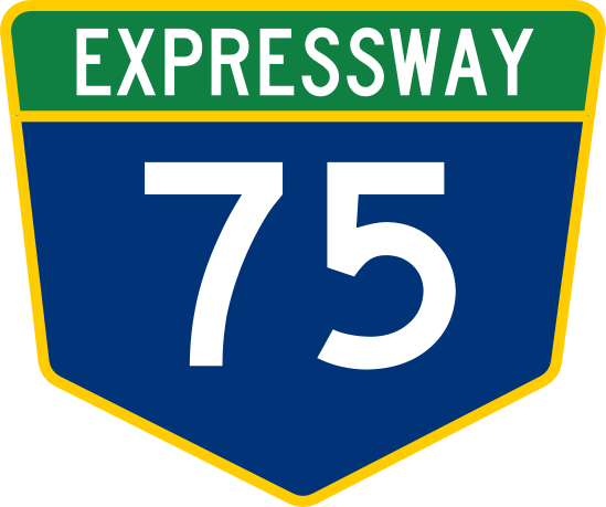
|
| Class-A
Trunk Highway |
|
| |||||
| Class-C
Trunk Highway |
Not Applicable |
|
10' (3.0m) | 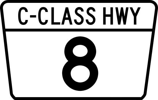
|
Numbering System and Corridor Groups
Highways are numbered in correlation to their respective primary corridor. E-1 is grouped with the E-10 and E-11 corridors and other primary feeder routes, such as E-11 and E-15, branch off of these main groups. Three digit Auxiliary Routes serve as spur routes into cities or loop routes looping around cities. These are numbered with the parent number being the first 2 numbers of the 3 digit route number. There are no plans to introduce 4-digit route numbers. Additionally suffixed routes are not allowed in the expressway numbering plan.
Examples:
- E-901 connects to E-90 and would be a service route or loop route that is connected to a expressway numbered as part of the E-9/E-90/E-99 Corridor Group.
- E-371 connects to E-37 and would be a service route or loop route that is connected to a expressway numbered as part of the E-3/E-30 Corridor Group.
- E-100 connects to E-1 and would be a service route or loop route that is connected to a expressway numbered as part of the E-1/E-10/E-11 Corridor Group.
- E-220 connects to E-22 and would be a service route or loop route that is connected to a expressway numbered as part of the E-2/E-20 Corridor Group.
Corridor Groups:
- E-1/E-10/E-11 Corridor - Main corridor - Alora's Mainstreet - Northwest to Southeast (Including Mediterranean Coast Corridor)
- E-2/E-20 Corridor - Mopaso-Athalan Corridor
- E-3/E-30 Corridor - Margonas-Montaro Corridor
- E-4/E-40 Corridor - Adomaka - Vela Canta Corridor
- E-5/E-50 Corridor - Nalmos City - Takorado Corridor
- E-6/E-60 Corridor - Perdio - Kennelida Corridor
- E-7/E-70 Corridor - Arratas - Porto Maganya Corridor
- E-8/E-80 Corridor - Northern Border Corridor
- E-9/E-90/E-99 Corridor - South Coast Corridor
National Highway System

|

|
| Primary NHS marker | Alternate NHS marker |
Alora also has a National Highway System for highways that are not part of the Alora Expressway System. Routes are marked along their route with a standard hexagonal NHS route marker as shown in the table to the right.
NHS Numbering System National highways are numbered differently from the expressway system with the numbering convention having odd numbered roads traveling east to west and even numbered routes traveling north to south to avoid confusion with the expressway system. 1 and 2 digit route numbers indicate parent primary routes and 3 digit route numbers indicate child primary routes that branch from or supplement the NHS numbering system. Suffixed routes are allowed in the National Highway System. suffix routes are legislatively defined as follows.
Suffixes include:
- A = "A" alternate route that follows a similar path/trajectory and meets at both ends. (these are typically not used for spur routes.)
- B = Business or "B" alternate, designates a business route or secondary alternate route into a city that meets on both ends. (can also be a spur route)
- C = City route or "C" alternate is a tertiary alternate route that leads around or through a urban area that meets on both ends. (can also be a spur route)
- N = Northern Alternate Routing (for use with routes traveling east or west).
- E = Eastern Alternate Routing (for use with routes traveling north or south).
- W = Western Alternate Routing (for use with routes traveling north or south).
- S = southern Alternate Routing (for use with routes traveling east or west).
Note that the directional alternate suffixes are used for split route designations where the main route splits into two or three parallel routes. Spur routes that do not loop back to the parent highway (connect only at one end) must be signed with a "SPUR" placard over the route marker.
| Classification | Design Speed | Median/Barrier | Access Control | Divided Road | Minimum Number of Lanes | Lane Width | Hard Shoulder Width | Vertical Clearance | |
| Class-5 Freeway | Same as "Class-E Expressway" | ||||||||
| Class-4 Multilane Divided Highway | 70 mph (110 Kph) | Unprotected 24' (15.2m) With Barrier 12' (3.65m) | Reduced/Limited Access (driveways discouraged) | Yes | 2 lanes each way | 12' (3.65m) | Left 4' (1.2m) Right 10' (3.0m) | 16' (4.9 m) | |
| Class-3 Multilane Undivided Highway | N/A | No | Right 10' (3.0m) | ||||||
| Class-2 "Super 2" Highway | Unprotected 24' (15.2m) With Barrier 12' (3.65m) | Grade Separated Controlled Access (driveways not allowed) | Yes | 1 lanes each way ("2+1 Road" also allowed) | Left 4' (1.2m) Right 10' (3.0m) | ||||
| Class-1A Major Highway | N/A | Reduced/Limited Access (driveways discouraged) | No | 6.5' (2.0m) | |||||
| Class-1 Highway | 55 mph (90 Kph) | Reduced/Limited Access (driveways allowed) | 11' (3.35m) | 4' (1.2m) | 14' | ||||
State Highways
Each state is responsible for building out and maintaining its own system of highways. Some of which are eligible for federal funding if they meet certain requirements. This enables states to receive funding to help with the cost of maintainance and buildout of their highway networks at a 50% matching cost with the federal government. Each state has their own designated route marker or they can use the "generic" state route marker provided by the Alora Department of Transportation as shown in the table above. Below is a table showing the route markers for each state.
| Adenia | Alaria | Arratas | Avalon | Bosecova | Carlinia | Cota Novea | Difonado |
|

|

|

|
|
|
|

|
| Escaskia | Havania | Jalacosa | Kelawa | Lauritia | Medrano | Mopaso | Nolexo |

|

|

|

|
|
|

|

|
| Pehalasippi | Quenexia | Takorado | Teguteca | Tenata | Vela Canta | West Takora | State Highway (Generic) |

|

|
|
|
|

|
|
|
The states of Jalacosa, Medrano and Teguteca all use the Generic State route sheild, and the states of Escaskia, Havania and Kelawa use a modified version of the generic shield.
National Special Highways
|

|
|
| Park route marker | Forest route marker | Back country route marker |
Alora also maintains a system of special routes such as forest routes, park routes and back-country roads. These special highways are typically located within national forests, national parks and national land reserves. These roads may be of various condition and it is advised to consult with local authorities and or map resources before using these routes. Some routes are improved paved routes that allow commercial vehicles, while other roads are gravel or have unimproved surfaces that may be treacherous to traverse at times or are only suitable for 4-wheel drive vehicles.
Rail
Alora has a growing network of railways across the nation used for freight and passenger operations throughout the country. Several railroad operators share the national track network providing freight services across the country. In Alora track mileage and land is owned by the government and is managed by the National Railroad Administration (NRA). Freight operators are then assigned an area of responsibility over a particular area and are responsible for maintenance, upkeep and development of their assigned part of the network. Each rail operator then receives grants from the federal government to subsidize the cost of operations since the network is owned by the government.
Major railroad companies operating in Alora:
Passenger Rail
Passenger rail connects many of the major cities and towns across Alora. This network is still under development in more rural areas making Alora a car-centric country.
Mass Transit
Larger cities such as Mopaso City, Takorado, Staughley and Santa Carlina have metro systems that provide rapid transit. These cities also have extensive bus networks as well with many routes running frequently during peak periods. In these larger cities it is easier to get around without a vehicle. However, with mass transit being expensive only the larger population centers have developed networks. Other major cities and larger towns rely on locally operated bus systems in order to provide public transportation. Longer Distance Bus operators also exist in Alora however most of these are private companies that may receive some governemnt subsidies but are not government run.
Alora High Speed Rail (AloraHSR)
Currently there are 2 high speed rail operators in Alora. Alora HSR is a public private partnership railway with service connecting Takorado, Tomale, Mopaso City, Santa Carlina, Staughley, Santa Maria and Kenrich (Gobrassanya). GoHSR also operates within the country operating on trackage rights through the states of Alaria and Tenata to connect between Queensburg through Gallaton and Phailoon City to Carratta.
Seaports & Maritime Transport
Alora maintains ports in many cities along the coast. The highest volume of port operations in Alora are done in Staughley due to its strategic location along the Asperic Ocean and the fact that it is a protected harbor that it protected by barrier islands to the south. Additional port cities along the Asperic Coast include: Nalmos City, Adomaka, Nolexo City, Pellahatchee, Nicoa and Licoa.
Significant marine port operations also occur in the Gulf of Alora in Santa Carlina, Mantan, Malinton, Tomale and Mopaso City due to their strategic location along the Gulf of Alora. Alora also operates one inland port at Gallaton in the Grand Lakes Region which is reached via the Arcois Ship Canal which traverses through Gobrassanya to the gulf of Alora Alora also has ports in the Mediterranean Sea with Escuderos and Puerto Domenica as major port cities in western Takora.
Air Transport
Airports
Alora has a number of international airports located throughout the country offering passenger and airfreight services world wide at a total of 5 major global hub airports. There are numerous other regional and municipal airports located throughout the country that also provide local and long distance passenger service as well as freight and general aviation services. Numerous small airstrips and private airports also exists having varying levels of flight operations, flight training, municipal, farming and other uses.
| Airport Code |
Airport Name | City | Class | Gates (total)† |
Runway orientation and length |
Location |
|---|---|---|---|---|---|---|
| API | Apacigua Island International Airport | Cántalva, JA | Regional | 52 | 9L/27R (3650m) 9R/27L (3650m) |
|
| ARR | Hugo Peña Arratas International Airport | Escuderos, AR | Global Hub | 46 | 6/24 (3140m) 12/30 (3150m) |
|
| GLI | Grand Lakes International AirportJointly owned by both cities. Airport is situated on the border. |
Gallaton, TN & Quesagnais, GL (Gobrassanya) |
Regional | 94 | 3R/21L (3050m) 3C/21C (3050m) 3L/21R (3000m) |
|
| MPX | Mopaso City International Skyport | Mopaso City, MP | Global Hub | 172 | 8L-26R (2930m) 8R-26L (3240m) 2-20 (3140m) 12-30 (3260m) |
|
| PHZ | Pellahatchee-Haston International Airport | Haston, LR | Regional | TBD | TBD (XXXXm) TBD (XXXXm) |
|
| SCD | Santa Carlina Downtown Airport | Santa Carlina, DF | Regional | 40 | 10L-28R (2440m) 10R-28L (2880m) 13-31 (2100m) |
|
| SCI | Staughley-Cheltenham International Airport | Cheltenham, TN | Global Hub | 107 | 1R-19L (3690m) 1C-19C (3400m) 1L-19R (3400m) 6R-24L (3190m) 6L-24R (3120m) |
|
| SGR | Saltgrass Regional Airport | Cheltenham, TN | Regional | TBD | 06-24 (XXXXm) 14-32 (XXXXm) |
|
| SUN | Sun Coast International Airport | Tahatan City, PS | regional | TBD | TBD (XXXXm) TBD (XXXXm) |
|
| TKO | Takorado International Airport | Takorado, TK | Global Hub | 141 | 11L-29R (3480m) 11R-29L (3140m) 2L-20R (3280m) 2R-20L (3390m) |
Operators
Air Traffic Control
Energy
Alora has many sources of energy within the country and has also committed to a long term effort to reduce harmful emissions nationwide to half what they currently are by 2040. Aloran citizens embrace the use of energy conservation and ecologically friendly sources of energy ("green energy"), recycling and sustainability efforts. This effort has been largely pushed by the efforts of the Neo-Green party through the congress and senate via lobbying efforts. High emission power generation stations also must adhere to tough restrictions regarding emissions and have been equipped with emission control systems that significantly reduce the harmful effects of the emissions. The Aloran government has also passed a resolution phasing out coal fired power plants completely by the year 2035. Due to significant water resources Hydro-electric power is widely used in Alora and is the predominent source of sustainable electricity provided in the country. Alora also uses other forms of sustainable energy including solar, wind, and tidal generation.
Electricity
Alora provides its electric power as A/C (alternating current) at 60Hz. Most residential and small commercial establishments use single phase power at 240Hz. Industrial power can range from 240v all the way up to 960v three phase power based on the needs of the company. Alora has a strong electric power infrastructure in place with many generation stations located across the country with a strong electrical distribution backbone with built in redundancies. Power outages while common during extreme weather, are rare otherwise due to built in redundancies and also due to the power networks in cities being largely underground.
Main sources of electric power in Alora:
- Green Energy
- Hydroelectric
- Solar
- Wind
- Geothermal
- Tidal
- Nuclear (see below)
- Hydrocarbons (see below)
- Coal (being phased out by 2035)
- Oil
- Natural Gas
Hydrocarbons
The use of Hyrdocarbons is still a main energy resource for Alora. Most hydrocarbon use in the country is in the form of petroleum products which are refined into a multitude of products as well as the use of Coal and Natural Gas.
Use as Fuel
Most energy consumption of hydrocarbons in Alora is done in the form of fuels such as diesel, gasoline (petrol), fuel-oils, propane, coal and methane gas. Most hydrocarbons used in alora are in the form of refined petroleum products but coal is also converted into methane gas and gasoline to help with the supply. (banned in Alora the last oil-fired plant closed in 1997)
Use in Products
Hydrocarbons can also be used for a variety of other products such as plastics, waxes, petroleum jelly and even food additives.
Use in Food and Food Production
Environmental efforts in Alora have been working towards eliminating the use of dirty fuels completely by 2040, namely the use of coal. As the country has been reducing coal use the number of exports of coal to other countries has increased. the legislature has been considering placing a moratorium on future mining of coal resources but that has faced opposition of the coal industry who look to profit from the lucrative exportation of coal around the world.
Nuclear
Alora has used nuclear power in many forms since its initial use in 1956. Over the years the use of nuclear fuels has come into some criticism due to the risk of nuclear accidents and exposures of people to nuclear radiation. Growing concern over the disposal of nuclear waste produces also created criticism causing the Alora National Nuclear Commission (ANNC) along with the Aloran Technology and Research Institute (ATARI) to begin studies on how to reduce the impact of nuclear energy and mitigate the risks involved. These studies resulted in a safer alternatives that would continue the ability to use nuclear energy due to its benefits as an energy source. Through the use of what it calls Green Nuclear Alora is looking toward the use of clean nuclear power sources to provide economically reliable power in a way that reduces nuclear waste produced and also finds ways to repurpose spent nuclear fuel so that it no longer poses an environmental risk after its initial use.
Green Nuclear
Green Nuclear energy provides a safer way to use nuclear energy. The ANNC and ATARI worked alongside the nuclear energy industry to develop 'encapulated fuel pellets. These new fuels greatly reduce the exposure risks of nuclear energy, are also safe to handle with normal precautions and do not require special storage once fuel is spent. In addition new nuclear power plants built in Alora are facilities that are constructed in a way that makes them "meltdown proof" due to the use of these new encapsulated fuels that cannot meltdown thus eliminating the need for special containment facilities. These fuels can also be repurposed after they are spent for other uses, such as secondary energy generation and heat generation. The advent of Green Nuclear was a compromise met between the nuclear industry and the government which had sought to ban nuclear energy altogether due to the waste created along with the risk of radiation pollution. Currently Alora only has 4 nuclear power plants. 2 in the Takora region (San Carlos, TK and Tahlio, WT), 1 in the Escaskia region east of Athalan and 1 in the Alora region near Phipps Beach on Nolexo Island. All of these facilities use the new encapsulated fuel technology. Additionally, the ANNC and ATARI are working on solutions to deal with the existing nuclear waste that was generated prior to the use of the new encapsulated fuels.
Green Energy
| Type | % of Renewable Energy | % of Total Energy |
|---|---|---|
| Hydroelectric | 80% | 37% |
| Wind | 9% | 4% |
| Solar | 7% | 3% |
| Geothermal | 3% | 1% |
| Tidal | 1% | <1% |
| Hydrogen | <1% | <1% |
Alora has been working toward the use of more sustainable or renewable sources of energy that have a lesser impact upon the environment and climate. Current initiatives include reducing reliance on hydrocarbons as a source of energy by subsidizing electric energy and the use of hybrid and electric powered vehicles. The main use of green energy is for electric generation, however steam production from geothermal also has industrial uses beyond electric power.
Hydroelectric Currently the largest renewable energy source in Alora is hydroelectric' power due to the many rivers and high rainfall in many parts of the country.
Wind, Solar and Geothermal Energy The use of Wind and solar power are developing technologies that have been deployed throughout Alora. Solar energy does well in arid and semi arid regions of the country such as in the Region of Takora and parts of Escaskia. Geothermal energy is also more prevalent in the Takora region where there is more hot springs and geo-thermal activity. Wind energy on the other hand has been employed throughout Alora leading it to the the largest provider of electric power after hydroelectric. There are future plans to expand the use of wind power, including at sea.
Tidal and Other Renewables Tidal generation is the newest form of energy creation in the country. Currently Alora only has one tidal generation station located in Talchikatan Pass at the mouth of the Etame Sound located between Nalcotes Point in Cota Novea and Daka Point on Nolexo Island. The use of Hydrogen gas as a renewable source of energy has not caught on in Alora and is currently limited to some minor industrial uses only.