File:1917 Dregolesian Moraines Plebiscite.png: Difference between revisions
(Results of the 1917 Dregolesian Moraines Plebiscite that defined the borders in the area. Category:Dregovine Category:Suria Category:Geklinia-Dregolesia Category:Political maps) |
Rustem Pasha (talk | contribs) m (ogf-map) |
||
| Line 2: | Line 2: | ||
Results of the 1917 Dregolesian Moraines Plebiscite that defined the borders in the area. | Results of the 1917 Dregolesian Moraines Plebiscite that defined the borders in the area. | ||
== Licensing == | |||
{{Cc-ogf-map}} | |||
[[Category:Dregovine]] | [[Category:Dregovine]] | ||
[[Category:Suria]] | [[Category:Suria]] | ||
[[Category:Geklinia-Dregolesia]] | [[Category:Geklinia-Dregolesia]] | ||
[[Category:Political maps]] | [[Category:Political maps]] | ||
[[Category:Historical maps]] | |||
Latest revision as of 10:50, 7 July 2022
Summary
Results of the 1917 Dregolesian Moraines Plebiscite that defined the borders in the area.
Licensing
| This map is a derivative of the OpenGeofiction base map, which is licensed under the Creative Commons Attribution-NonCommercial-ShareAlike License and is released under the same license. |
File history
Click on a date/time to view the file as it appeared at that time.
| Date/Time | Thumbnail | Dimensions | User | Comment | |
|---|---|---|---|---|---|
| current | 14:06, 27 March 2022 | 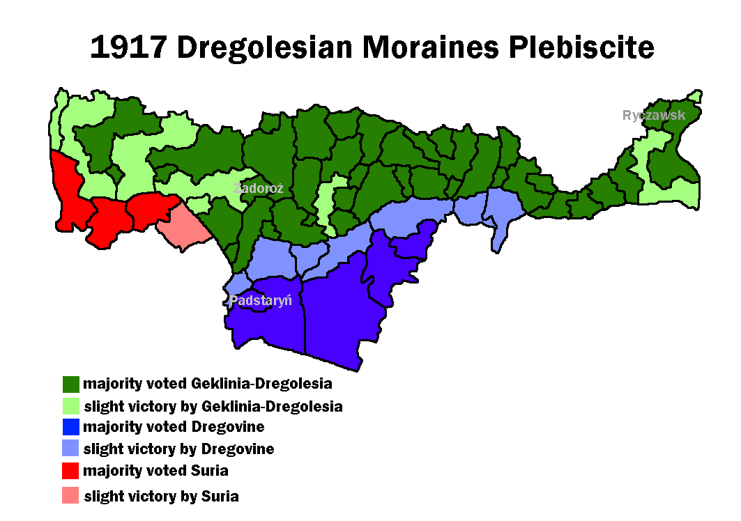 | 1,063 × 748 (64 KB) | Mie (talk | contribs) | Results of the 1917 Dregolesian Moraines Plebiscite that defined the borders in the area. Category:Dregovine Category:Suria Category:Geklinia-Dregolesia Category:Political maps |
You cannot overwrite this file.
File usage
The following 2 pages use this file: