Mergania: Difference between revisions
mNo edit summary |
mNo edit summary |
||
| (36 intermediate revisions by 2 users not shown) | |||
| Line 1: | Line 1: | ||
{{Infocard | {{Infocard | ||
| name = | | name = Merganian Confederation | ||
| flag = Mergania_flag.png | | flag = Mergania_flag.png | ||
| symbol = Mergania_coatofarms.png | | symbol = Mergania_coatofarms.png | ||
| symbol_caption = Mergania's coat of arms | | symbol_caption = Mergania's coat of arms | ||
| native_name = Merganien | | native_name = Konföderation Merganien | ||
| native_language = [[ | | native_language = [[User:Mstr/Sandbox#Mergan language|Mergan]] | ||
| capital = Freistat | | capital = Freistat | ||
| population = 27 250 000 | | population = 27 250 000 | ||
| Line 15: | Line 15: | ||
| zoom = 5 | | zoom = 5 | ||
| relation = 428 | | relation = 428 | ||
| intro = | | intro = '''Mergania''', officially the '''Merganian Confederation''', is a federal sovereign state in [[User:Mstr/Sandbox#Eastern Uletha|East Uletha]] and an active member of the [[User:Mstr/Sandbox#x|Eastern Ulethan Organisation of Independent Allies]] and [[Assembly of Nations]]. | ||
'''Mergania''' is a federal sovereign state in [[Eastern Uletha]] and an active member of the [[Eastern Ulethan Organisation of Independent Allies]] and [[Assembly of Nations]]. In the 21st century, Mergania is a great power and has one of the world's largest economies in the sector of high technology. As a global leader in several industrial and technological sectors, it plays an important role in export and import of goods. Mergania is a highly developed country with a very high standard of living sustained by a skilled and productive society. It upholds a social security and universal health care system, environmental protection and a tuition-free university education. | In the 21st century, Mergania is a great power and has one of the world's largest economies in the sector of high technology. | ||
As a global leader in several industrial and technological sectors, it plays an important role in export and import of goods. | |||
Mergania is a highly developed country with a very high standard of living sustained by a skilled and productive society. | |||
It upholds a social security and universal health care system, environmental protection and a tuition-free university education. | |||
<div class="toclimit-1">__TOC__</div> | |||
}} | }} | ||
==Etymology== | ==Etymology== | ||
The name of Mergania derives from the [[Romantian]] expression "mergari", which means "to trade". The ending "-nia" was established later on and stems from [[Ingerish]]. The name came up after [[Kalmish]] settlements have been established in | The name of Mergania derives from the [[Romantian]] expression "mergari", which means "to trade". The ending "-nia" was established later on and stems from [[Ingerish]]. | ||
The name came up after [[User:Mstr/Sandbox#Kalmish language|Kalmish]] settlements have been established in East Uletha in the 14th century. | |||
==History== | ==History== | ||
| Line 58: | Line 62: | ||
}} | }} | ||
Discoveries shows that ancient humans were present in Mergania at least 350 000 years ago. One of the oldest complete hunting weapon found anywhere in the world was discovered in northern [[Holswig]]. This is the settlement of most Reisjian Tribes. | Discoveries shows that ancient humans were present in Mergania at least 350 000 years ago. | ||
One of the oldest complete hunting weapon found anywhere in the world was discovered in northern [[Holswig]]. | |||
This is the settlement of most Reisjian Tribes. | |||
===Rise and fall of Reisja (802-1047)=== | ===Rise and fall of Reisja (802-1047)=== | ||
The first king established the Reisja Kingdom, with the Royal King Lotharan Geyer ruling the Reisjian Kingdom. He established trade with many nations, being on a trade route from inland Northern [[Uletha]] to [[Orano]] and [[Commonia]]. He also planned cites and villages to be built for the population who were living in poor housing conditions. This, in turn, caused the citizens to pay higher taxes. | The first king established the Reisja Kingdom, with the Royal King Lotharan Geyer ruling the Reisjian Kingdom. | ||
Neumann Geyer then became the second king in 834 AD. The citizens pleaded the king to reduce the high taxes, but to no avail. Evil was on the rise under his rule, as he did not make much effort to keep law and order. He was not popular, and in most history books he was mentioned only very briefly. | He established trade with many nations, being on a trade route from inland Northern [[Uletha]] to [[Orano]] and [[Commonia]]. | ||
He also planned cites and villages to be built for the population who were living in poor housing conditions. | |||
This, in turn, caused the citizens to pay higher taxes. | |||
Neumann Geyer then became the second king in 834 AD. The citizens pleaded the king to reduce the high taxes, but to no avail. | |||
Evil was on the rise under his rule, as he did not make much effort to keep law and order. He was not popular, and in most history books he was mentioned only very briefly. | |||
In 865, King Neumann died, Wagner Neumann, his eldest son took over. He was very fearful that he will be murdered, so he built a wall around his palace, and employed a thousand spies to guard his palace. He even give orders to kill his brothers for some trumped up charges. The people thought he was crazy, and they barged into the palace. He was then pulled off his throne, but luckily he was not murdered. | In 865, King Neumann died, Wagner Neumann, his eldest son took over. | ||
He was very fearful that he will be murdered, so he built a wall around his palace, and employed a thousand spies to guard his palace. | |||
He even give orders to kill his brothers for some trumped up charges. | |||
The people thought he was crazy, and they barged into the palace. He was then pulled off his throne, but luckily he was not murdered. | |||
===Wabish Rule(1047-1434)=== | ===Wabish Rule(1047-1434)=== | ||
In 1047, a revolution against the Reisjan Royal Court happened, and thus they were driven out of the country. King Wabia Schermann took over as the next King of the Wabish Kingdom. | In 1047, a revolution against the Reisjan Royal Court happened, and thus they were driven out of the country. | ||
King Wabia Schermann took over as the next King of the Wabish Kingdom. | |||
===Separation of Mergania (1434-1822)=== | ===Separation of Mergania (1434-1822)=== | ||
| Line 87: | Line 101: | ||
{{Infobox geography | {{Infobox geography | ||
| name = Mergania | | name = Mergania | ||
| continent = | | continent = (East) Uletha | ||
| region = Central Islands | | region = Central Islands | ||
| population = 27 250 000 | | population = 27 250 000 | ||
| Line 102: | Line 116: | ||
| time_zone = WUT+8:00 (EUT) | | time_zone = WUT+8:00 (EUT) | ||
}} | }} | ||
Mergania is the southernmost of a number of countries that form the [[Scythe of Uletha]] in [[Eastern Uletha]], with [[Viljanni]] and [[Eshein]] bordering to the south, [[ | Mergania is the southernmost of a number of countries that form the [[User:Mstr/Sandbox#Scythe of Uletha|Scythe of Uletha]] in [[User:Mstr/Sandbox#Eastern Uletha|East Uletha]], with [[Viljanni]] and [[Eshein]] bordering to the south, [[User:Mstr/Sandbox#x|tbd]], [[User:Mstr/Sandbox#x|tbd]] and [[User:Mstr/Sandbox#x|tbd]] to the east and [[Helvetiany]], and the [[Madean Union]] to the north. | ||
* | It is also bordered by the [[User:Mstr/Sandbox#Darcodian Sea|Darcodian Sea]] and the [[User:Mstr/Sandbox#x|Gulf of Volta]]. It lies mostly between latitudes 43.5° and 48.5° N and longitudes 129° and 133° E. | ||
* | Mergania has five oversea territories on three continents, each named after the largest town: | ||
* | *[[User:Mstr/Sandbox#x|Fiorentia]] in one in the East of [[UL012]] {{Node|45216423}} | ||
*{{ | *[[User:Mstr/Sandbox#x|Johannastat]] in the North of [[Reeland]] {{Node|45697838}} | ||
*[[User:Mstr/Sandbox#x|Ludenitz]] in the East of [[Archanta]] {{Node|135287837}} | |||
*[[User:Mstr/Sandbox#x|Sant Michelle]] in the south of West Uletha {{Node|133203344}} | |||
*[[User:Mstr/Sandbox#x|Uthira Stadt]] in the East of [[Tarephia]] {{Node|129495642}} | |||
Rivers of Mergania are characterized by their relatively short lengths and considerably low gradients due to the narrow and not much mountainous topography of the country. | |||
The xxxx, the xxxxxx and the xxxxx are regarded as the three major rivers of Mergania. | |||
The longest river of Mergania is the xxxxxx, which flows from xxxxx to xxxx. | |||
Typical rivers of Mergania rise from forests and cut out flat V-shaped valleys in their upper reaches, and form alluvial plains in their lower reaches which enable the Merganians to cultivate fields and to set up cities. | |||
Most rivers are dammed to supply both water and electricity. | |||
{{#clear_external_data:}}{{#get_web_data:url=https://overpass.ogf.rent-a-planet.com/api/interpreter?data=(area%5B%22admin_level%22%3D%222%22%5D%5B%22name%22%3D%22Merganien%22%5D%3B)-%3E.a%3B%20relation%5B%22type%22%3D%22waterway%22%5D(area.a)%3Bout%3B | |||
|format=xml | |||
|data= | |||
relation_id=/osm/relation/@id, | |||
name=/osm/relation/tag[@k='name']/@v | |||
|use xpath | |||
}} | |||
{| class="wikitable sortable <!--mw-collapsiblemw-collapsed-->" | |||
! width=500px; | Name | |||
{{#for_external_table:<nowiki/> | |||
{{!}}- | |||
{{!}}[http://opengeofiction.net/relation/{{{relation_id}}} {{{name}}}] | |||
}} | |||
|} | |||
{{#clear_external_data:}} | |||
===Time zones=== | |||
{| class="wikitable" border="0" style="margin:0px;width:560px;" style="float:left; clear:left; | |||
! colspan="7" | Time zones in Mergania (from west to east) | |||
|- | |||
| [[User:Mstr/Sandbox#x|Uthira Stadt]] | |||
| [[User:Mstr/Sandbox#x|Sant Michelle]] | |||
| [[User:Mstr/Sandbox#x|Johannastat]] | |||
| Main land | |||
| [[User:Mstr/Sandbox#x|Fiorentia]] | |||
| [[User:Mstr/Sandbox#x|Ludenitz]] | |||
|- | |||
| [[File:Clock_{{#time: h|now + 2 hours}}-{{#time: i|now + 2 hours}}.svg|60px|link=]] | |||
| [[File:Clock_{{#time: h|now + 3 hours}}-{{#time: i|now + 3 hours}}.svg|60px|link=]] | |||
| [[File:Clock_{{#time: h|now + 7 hours}}-{{#time: i|now + 7 hours}}.svg|60px|link=]] | |||
| [[File:Clock_{{#time: h|now + 8 hours}}-{{#time: i|now + 8 hours}}.svg|60px|link=]] | |||
| [[File:Clock_{{#time: h|now + 9 hours}}-{{#time: i|now + 9 hours}}.svg|60px|link=]] | |||
| [[File:Clock_{{#time: h|now + 11 hours}}-{{#time: i|now + 11 hours}}.svg|60px|link=]] | |||
|- | |||
|} | |||
The Mergan main islands are all located in the time zone WUT+8:00. | |||
All exclaves are located more west or east, which lead to different time zones for WUT+2:00 in [[User:Mstr/Sandbox#x|Uthira Stadt]] to WUT+11:00 in [[User:Mstr/Sandbox#x|Ludenitz]]. | |||
===Exclusive economic zone=== | ===Exclusive economic zone=== | ||
| Line 114: | Line 172: | ||
===Climate=== | ===Climate=== | ||
The island is dominated by an oceanic climate with quite narrow temperature differences between seasons. Thus the temperature varies with the seasons seldom dropping below −10°C or rising above 30°C. The prevailing wind is from the east and bears frequent spells of mild and wet weather from the [[Asperic Ocean]], although the western parts are mostly sheltered from this wind since the majority of the rain falls over the eastern regions the western parts are therefore the driest. Rainfall occurs year-round, with no consistent dry season. The winters often are mild, especially at the western coasts. Summers are warmest in the west of Mergania, being closest to the [[Darcodian Sea]]. Heavy snowfall are seldom in winter due to the lack of high ground. | The island is dominated by an oceanic climate with quite narrow temperature differences between seasons. | ||
Thus the temperature varies with the seasons seldom dropping below −10°C or rising above 30°C. | |||
The prevailing wind is from the east and bears frequent spells of mild and wet weather from the [[Asperic Ocean]], although the western parts are mostly sheltered from this wind since the majority of the rain falls over the eastern regions the western parts are therefore the driest. | |||
Rainfall occurs year-round, with no consistent dry season. The winters often are mild, especially at the western coasts. Summers are warmest in the west of Mergania, being closest to the [[Darcodian Sea]]. | |||
Heavy snowfall are seldom in winter due to the lack of high ground. | |||
{| class="wikitable collapsible" style="width:800px;" | {| class="wikitable collapsible" style="width:800px;" | ||
| Line 209: | Line 271: | ||
| style="background:#8ca0ff; border-left:2px solid #bbb;"| '''117.6''' | | style="background:#8ca0ff; border-left:2px solid #bbb;"| '''117.6''' | ||
|- | |- | ||
| colspan="15" style="background:#dcf0f0; color:navy; text-align:center;"| <small>Source:<ref>[http://i.imgur.com/ | | colspan="15" style="background:#dcf0f0; color:navy; text-align:center;"| <small>Source:<ref>[http://i.imgur.com/gxL6soq.png "Temperatures in Mergania 2011"]. Statistisches Amt der Konföderation. Freistat, 2012. Retrieved 28 February 2013.</ref></small> | ||
|} | |} | ||
| Line 305: | Line 367: | ||
===Law=== | ===Law=== | ||
The civil law system of Mergania is based on [[Ancient Ulethan law]]. The Mergan penal system seeks the protection of the public and the rehabilitation of the criminal. Mergania has a very low murder rate with 0.7 murders per 100000 in 2017. | The civil law system of Mergania is based on [[Ancient Ulethan law]]. | ||
The Mergan penal system seeks the protection of the public and the rehabilitation of the criminal. | |||
Mergania has a very low murder rate with 0.7 murders per 100000 in 2017. | |||
===Foreign relations=== | ===Foreign relations=== | ||
| Line 313: | Line 377: | ||
[[File:Mergan_embassy_Huntington1.png|280px|thumb|right|Mergan embassy in [[Huntington]], [[Federal States]]|link=]] | [[File:Mergan_embassy_Huntington1.png|280px|thumb|right|Mergan embassy in [[Huntington]], [[Federal States]]|link=]] | ||
{{clear}} | |||
{{#multimaps: | service = OGF | center = 15,0 | height = 480px | width = 1040px | zoom = 2 | maxzoom = 19 | |||
| layers = +Standard,TopoMap | |||
| overlays = +Mergan embassies,+Embassies in Mergania,+EUOIA representations | |||
| overlaydef = { | |||
"Mergan embassies": [ {"overpass": "relation (134945); (._;%3E;);"}, {"url": "/index.php/User:Mstr/Stylesheet?action=raw", "select": "tags.diplomatic"} ], | |||
"Embassies in Mergania": [ {"overpass": "relation (181926); (._;%3E;);"}, {"url": "/index.php/User:Mstr/Stylesheet?action=raw", "select": "tags.diplomatic"}], | |||
"EUOIA representations": [ {"overpass": "relation (181929); (._;%3E;);"}, {"url": "/index.php/User:Mstr/Stylesheet?action=raw", "select": "tags.diplomatic"}] | |||
} | |||
}} | |||
{{clear}} | |||
===Administrative divisions=== | ===Administrative divisions=== | ||
| Line 322: | Line 399: | ||
| fourth-level = ''s'', ''g'' | | fourth-level = ''s'', ''g'' | ||
}} | }} | ||
The | The Merganian Confederation comprises nine federal states ([[Mergania#Brugham-Übersee|Brugham-Übersee]], [[Mergania#Frießen|Frießen]], [[Mergania#Habsach|Habsach]], [[Mergania#Holswig|Holswig]], [[Mergania#Mähringen|Mähringen]], [[Mergania#Rüthingen|Rüthingen]], [[Mergania#Schersen|Schersen]], [[Mergania#Stefalen|Stefalen]], [[Mergania#Vocklenbrug|Vocklenbrug]]) and five oversea territories (...). | ||
Each state has its own state constitution and is largely autonomous in regard to its internal organisation. | Each state has its own state constitution and is largely autonomous in regard to its internal organisation. | ||
Because of differences in size and population the subdivisions of these states vary. | Because of differences in size and population the subdivisions of these states vary. | ||
<gallery position="center"> | |||
File:Brugham-Übersee_flag.png|200px||<center>State flag of [[Mergania#Brugham-Übersee|Brugham-Übersee]] | |||
File:Frießen_flag.png|200px||<center>State flag of [[Mergania#Frießen|Frießen]] | |||
File:Habsach_flag.png|200px||<center>State flag of [[Mergania#Habsach|Habsach]] | |||
File:Holswig_flag.png|200px||<center>State flag of [[Mergania#Holswig|Holswig]] | |||
File:Mähringen_flag.png|200px||<center>State flag of [[Mergania#Mähringen|Mähringen]] | |||
File:Rüthingen_flag.png|200px||<center>State flag of [[Mergania#Rüthingen|Rüthingen]] | |||
File:Schersen_flag.png|200px||<center>State flag of [[Mergania#Schersen|Schersen]] | |||
File:Stefalen_flag.png|200px||<center>State flag of [[Mergania#Stefalen|Stefalen]] | |||
File:Vocklenbrug_flag.png|200px||<center>State flag of [[Mergania#Vocklenbrug|Vocklenbrug]] | |||
</gallery> | |||
====Brugham-Übersee==== | |||
'''Brugham-Übersee''' is a state of Mergania located in north-east, north of [[Mergania#Mähringen|Mähringen]] and east of [[Mergania#Rüthingen|Rüthingen]]. | |||
====Frießen==== | |||
'''Frießen''' is a state of Mergania located in center, north of [[Mergania#Vocklenbrug|Vocklenbrug]] and south of [[Mergania#Mähringen|Mähringen]]. | |||
====Habsach==== | |||
'''Habsach''' is a state of Mergania located in the south, south [[Mergania#Stefalen|Stefalen]] and [[Mergania#Vocklenbrug|Vocklenbrug]]. The state is bordering to the south with [[Eshein]]. | |||
====Holswig==== | |||
'''Holswig''' is a state of Mergania located in the north-west, west of [[Mergania#Schersen|Schersen]]. | |||
====Mähringen==== | |||
'''Mähringen''' is a state of Mergania located in the middle, south of [[Mergania#Schersen|Schersen]] and [[Mergania#Rüthingen|Rüthingen]] and north of [[Mergania#Frießen|Frießen]] and [[Mergania#Vocklenbrug|Vocklenbrug]]. | |||
====Rüthingen==== | |||
'''Rüthingen''' is a state of Mergania located in the north east, north of [[Mergania#Mähringen|Mähringen]] and east of [[Mergania#Schersen|Schersen]]. | |||
====Schersen==== | |||
'''Schersen''' is a state of Mergania located in the north, north of [[Mergania#Mähringen|Mähringen]] and between [[Mergania#Rüthingen|Rüthingen]] and [[Mergania#Holswig|Holswig]]. | |||
====Stefalen==== | |||
'''Stefalen''' is a state of Mergania located in the south-east of the main island, north of [[Mergania#Habsach|Habsach]] and east of [[Mergania#Vocklenbrug|Vocklenbrug]]. | |||
====Vocklenbrug==== | |||
'''Vocklenbrug''' is a state of Mergania located in the south-west of the main island, north of [[Mergania#Habsach|Habsach]], west of [[Mergania#Stefalen|Stefalen]] and south of [[Mergania#Mähringen|Mähringen]] and [[Mergania#Frießen|Frießen]]. | |||
===Armed Forces=== | ===Armed Forces=== | ||
The [[Confederate Defence]] is the unified armed forces of Mergania and member of the [[ | The [[Confederate Defence]] is the unified armed forces of Mergania and member of the [[East Ulethan Defense Association|EUDA]]. | ||
===National safety and security=== | ===National safety and security=== | ||
| Line 344: | Line 451: | ||
====Police==== | ====Police==== | ||
coming soon... | coming soon... | ||
===National flag=== | |||
[[File:Mergania_flag.png|180px|thumb|right|The flag of Mergania|link=]]The '''flag of Mergania''' or Mergan flag (Mergan: Merganische Flagge) consists of the two national colors of Mergania (Mergan: Blau-Gold) | |||
{{legend|#FFFF00|gold (RGB: 255,255,0; Web color: #FFFF00)}} | |||
{{legend|#000BC6|blue (RGB: 0,11,198; Web color: #000BC6)}} | |||
arranged in form of a spiral. | |||
Gold symoblizes the grain growing in the huge wheatfields while blue stands for the sea surrounding the Mergan islands. | |||
The spiral shape can also be interpreted as an allusion to waves of the sea. | |||
The flag's center shows three black stag antlers in diagonal direction, each on gold background. | |||
The stag antlers stem from the [[Mergania#Mähringer Dynasty|Mähringer Dynasty]]. | |||
Mergania's flag was first adopted as the national flag in 1832, but details have been modified several times until 1921, when the current flag was created. | |||
==Economy== | ==Economy== | ||
{{Infobox economy | {{Infobox economy | ||
| name = Mergania | | name = Mergania | ||
| economy_type = | | economy_type = Social-market economy | ||
| currency = | | currency = Thaler | ||
| sample = | | sample = | ||
| monetary_authority = Merganische Zentralbank | | monetary_authority = {{Way|26514547|Merganische Zentralbank}} | ||
| gdp_ppp_year = 2020 estimate | | gdp_ppp_year = 2020 estimate | ||
| gdp_ppp_total = $ | | gdp_ppp_total = $1524 billion | ||
| gdp_ppp_per_capita = $ | | gdp_ppp_per_capita = $55433 | ||
| gdp_nominal_year = 0 | | gdp_nominal_year = 0 | ||
| gdp_nominal_total = 0 | | gdp_nominal_total = 0 | ||
| gdp_nominal_per_capita = 0 | | gdp_nominal_per_capita = 0 | ||
| hdi = 0.922 | | hdi = 0.922 | ||
| hdi_change = {{increase}} | | hdi_change = {{increase}} | ||
| Line 365: | Line 481: | ||
| main_exports = Technical equipment, vehicles, chemicals, x, x | | main_exports = Technical equipment, vehicles, chemicals, x, x | ||
| main_imports = Agricultural products, x, x, x | | main_imports = Agricultural products, x, x, x | ||
| sector_bars = {{bar percent| | | sector_bars = {{bar percent|Services|blue|45.2}}{{bar percent|Industry|red|38.6}}{{bar percent|Agriculture|yellow|9.5}}{{bar percent|Other|#000000|6.7}} | ||
| custom_label1 = Exports<br><br>Main export partners | |||
| custom1 = {{increase}} $422 billion (2022)<br><br>[[File:Unknown_Flag.png|28px]] Belphenia<br>{{Federal States}}<br>{{Kojo}}<br>{{Izaland}} | |||
| custom_label2 = Imports<br><br>Main import partners | |||
| custom2 = {{increase}} $401 billion (2022)<br><br>{{Kojo}}<br>{{Federal States}}<br>{{Gobrassanya}}<br>[[File:Unknown_Flag.png|28px]] Latina | |||
}} | }} | ||
Mergania has a social market economy with a highly skilled labour force, a large capital stock, a low level of corruption and a comperatively high level of innovation. It is one of the world's largest exporter and importer of goods and has a large national economy. Therefore Mergania is a leading nation in the [[EUEC]]. The unemployment rate is low and Mergania has one of the highest labour productivity levels in the world. Especially the modern industry of Mergania is regarded as one of the most competitive and innovative. An [[List of companies in Mergania|overview of companies in Mergania]] is provided by the [[Mergania#Ministry of Economic Affairs|Ministry of Economic Affairs]]. | :[[File:Gnome-edit-redo-bw.svg|20px|link=]] ''See also: [[User:Mstr/Sandbox#Economy of Mergania|Economy of Mergania]]'' | ||
Mergania has a social market economy with a highly skilled labour force, a large capital stock, a low level of corruption and a comperatively high level of innovation. | |||
It is one of the world's largest exporter and importer of goods and has a large national economy. | |||
Therefore Mergania is a leading nation in the [[EUEC]]. | |||
The unemployment rate is low and Mergania has one of the highest labour productivity levels in the world. | |||
Especially the modern industry of Mergania is regarded as one of the most competitive and innovative. | |||
An [[List of companies in Mergania|overview of companies in Mergania]] is provided by the [[Mergania#Ministry of Economic Affairs|Ministry of Economic Affairs]]. | |||
Some of the world's largest and well known companies are headquartered in Mergania. 16 Mergan-based companies are included in the [[Mergan Handelsbörsen|MHB]], the Mergan stock market index. Mergania is recognised for its large portion of specialised small and medium enterprises, which are very flexible and innovative. Many of these companies are global market leaders in their segment and are labelled hidden champions. [[Chaussee]] near Freistat developed a thriving, cosmopolitan hub for startup companies and became a leading location for venture capital funded firms in the [[EUEC]]. | Some of the world's largest and well known companies are headquartered in Mergania. | ||
16 Mergan-based companies are included in the [[Mergan Handelsbörsen|MHB]], the Mergan stock market index. | |||
Mergania is recognised for its large portion of specialised small and medium enterprises, which are very flexible and innovative. | |||
Many of these companies are global market leaders in their segment and are labelled hidden champions. | |||
[[Chaussee]] near Freistat developed a thriving, cosmopolitan hub for startup companies and became a leading location for venture capital funded firms in the [[EUEC]]. | |||
===Data=== | ===Data=== | ||
| Line 376: | Line 506: | ||
''See also: [[List of companies in Mergania]]'' | ''See also: [[List of companies in Mergania]]'' | ||
Some of the world's largest stock-market-listed companies are headquartered in Mergania. 16 Mergania-based companies such as [[LeunaOil]], [[Pliar]], {{MER-company|Sabouche}} and [[SAF]] are included in the [[Mergan_Handelsbörsen#MERGHAB16|MERGHAB16]], the most important [[Mergan_Handelsbörsen|Mergan stock market]] index. | Some of the world's largest stock-market-listed companies are headquartered in Mergania. | ||
16 Mergania-based companies such as [[LeunaOil]], [[Pliar]], {{MER-company|Sabouche}} and [[SAF]] are included in the [[Mergan_Handelsbörsen#MERGHAB16|MERGHAB16]], the most important [[Mergan_Handelsbörsen|Mergan stock market]] index. | |||
Mergania is also recognised for its large portion of specialised small and medium enterprises. Around 850 of these companies are global market leaders in their segment and are labelled hidden champions. Examples for those relatively small but highly successful companies are {{MER-company|TMW}} and {{MER-company|Magnus}}. Freistat developed a thriving, cosmopolitan hub for startup companies and became a leading location for venture capital funded firms in [[ | Mergania is also recognised for its large portion of specialised small and medium enterprises. | ||
Around 850 of these companies are global market leaders in their segment and are labelled hidden champions. | |||
Examples for those relatively small but highly successful companies are {{MER-company|TMW}} and {{MER-company|Magnus}}. | |||
Freistat developed a thriving, cosmopolitan hub for startup companies and became a leading location for venture capital funded firms in [[East Uletha]]. | |||
===Sectors=== | ===Sectors=== | ||
| Line 385: | Line 519: | ||
====Services==== | ====Services==== | ||
===Technology=== | ===Technology=== | ||
===Currency=== | |||
'''Thaler''' (₸) is the official currency of Mergania. One Thaler is divided into 1000 Millar. | |||
==Infrastructure== | ==Infrastructure== | ||
| Line 397: | Line 534: | ||
| internet_code = [[Mergania#Telecommunication and computing|.mer]] | | internet_code = [[Mergania#Telecommunication and computing|.mer]] | ||
}} | }} | ||
:[[File:Gnome-edit-redo-bw.svg|20px|link=]] ''See also: [[User:Mstr/Sandbox#Infrastructure in Mergania|Infrastructure in Mergania]]'' | |||
===Transportation=== | ===Transportation=== | ||
| Line 402: | Line 540: | ||
====Road traffic==== | ====Road traffic==== | ||
Mergania has a dense network of roads | Mergania has a dense network of roads which is extensively used. | ||
The Staatsautobahn ([[Ingerish]]: Confederate Motorway) is the Mergan confederate highway system. | |||
Where no local speed limit is posted, the advisory limit is 120 km/h. | |||
Only federally built controlled-access highways meeting certain construction standards including at least two lanes per direction are called Staatsautobahn. | |||
They have their own, green-coloured signs and numbers smaller than 20 in the numbering system. | |||
All Staatsautobahnen are named by using the capital letter "A" (for the first category), followed by a blank and a number (for example "A 1"). | |||
The main Autobahnen have single digit numbers, shorter sections have numbers between 11 and 19. | |||
The Staatsautobahnen are considered the safest category of Mergan roads: in 2007, while carrying 22% of all motorized road traffic, they only accounted for 7% of Mergania's traffic fatalities. | |||
Mergan Staatsautobahnen are toll-free for light vehicles. | |||
A blanket mandatory toll on trucks and buses was introduced in the 1980s. | |||
*<span class="plainlinks" style="white-space:nowrap; background:#228B22; padding:2px 1px; margin: 0 1px 0 0; border-radius:3px;">[https://opengeofiction.net/relation/399678 <span style="white-space:nowrap; text-decoration:none; letter-spacing:1px; color:#ffffff; background:#228B22; padding:0 2px 0 2px; border:#ffffff solid 1px; border-radius:3px;">'''A 1''']</span></span> [[Mergania#?|Norderhaven]] - [[Mergania#Freistat|Freistat]] - [[Mergania#?|Leutringen]] - [[Mergania#?|Werschin]] - [[Mergania#?|Suidbrug]] - [[Mergania#Gausbrug|Gausbrug]] - [[Mergania#?|tbd]] - [[Mergania#?|Mergan border]] - [[Eshein]] (I-1) | |||
* | *<span style="white-space:nowrap; background:#228B22; padding:2px 1px; margin: 0 1px 0 0; border-radius:3px;"><span style="white-space:nowrap; text-decoration:none; letter-spacing:1px; color:#ffffff; background:#228B22; padding:0 2px 0 2px; border:#ffffff solid 1px; border-radius:3px;">'''A 2'''</span></span> [[Mergania#Brugham|Brugham]] - [[Mergania#Freistat|Freistat]] - [[Mergania#?|Bütingen]] - [[Mergania#?|Maizen]] - [[Mergania#?|Frisdewalg]] - [[Mergania#?|Wasepalk]] | ||
* | *<span style="white-space:nowrap; background:#228B22; padding:2px 1px; margin: 0 1px 0 0; border-radius:3px;"><span style="white-space:nowrap; text-decoration:none; letter-spacing:1px; color:#ffffff; background:#228B22; padding:0 2px 0 2px; border:#ffffff solid 1px; border-radius:3px;">'''A 3'''</span></span> [[Mergania#Freistat|Freistat]] - [[Mergania#?|Wiesbrungach]] - [[Mergania#?|Liek]] - [[Mergania#?|Dornerstedt]] - [[Mergania#?|Büleck]] | ||
*<span style="white-space:nowrap; background:#228B22; padding:2px 1px; margin: 0 1px 0 0; border-radius:3px;"><span style="white-space:nowrap; text-decoration:none; letter-spacing:1px; color:#ffffff; background:#228B22; padding:0 2px 0 2px; border:#ffffff solid 1px; border-radius:3px;">'''A 4'''</span></span> [[Mergania#Brugham|Brugham]] - [[Mergania#?|Norderhaven]] - [[Mergania#?|Liek]] | |||
* | *<span style="white-space:nowrap; background:#228B22; padding:2px 1px; margin: 0 1px 0 0; border-radius:3px;"><span style="white-space:nowrap; text-decoration:none; letter-spacing:1px; color:#ffffff; background:#228B22; padding:0 2px 0 2px; border:#ffffff solid 1px; border-radius:3px;">'''A 5'''</span></span> [[Mergania#?|tbd]] - [[Mergania#?|Werschin]] - [[Mergania#?|tbd]] - [[Mergania#?|Wasepalk]] | ||
*<span style="white-space:nowrap; background:#228B22; padding:2px 1px; margin: 0 1px 0 0; border-radius:3px;"><span style="white-space:nowrap; text-decoration:none; letter-spacing:1px; color:#ffffff; background:#228B22; padding:0 2px 0 2px; border:#ffffff solid 1px; border-radius:3px;">'''A 11'''</span></span> [[Mergania#?|tbd]] - [[Mergania#?|Mergan border]] - [[Viljanni]] | |||
*<span style="white-space:nowrap; background:#228B22; padding:2px 1px; margin: 0 1px 0 0; border-radius:3px;"><span style="white-space:nowrap; text-decoration:none; letter-spacing:1px; color:#ffffff; background:#228B22; padding:0 2px 0 2px; border:#ffffff solid 1px; border-radius:3px;">'''A 12'''</span></span> [[Mergania#Gausbrug|Gausbrug]] - [[Mergania#?|Mergan border]] - [[Viljanni]] | |||
*<span style="white-space:nowrap; background:#228B22; padding:2px 1px; margin: 0 1px 0 0; border-radius:3px;"><span style="white-space:nowrap; text-decoration:none; letter-spacing:1px; color:#ffffff; background:#228B22; padding:0 2px 0 2px; border:#ffffff solid 1px; border-radius:3px;">'''A 13'''</span></span> [[Mergania#?|Suidbrug]] - [[Mergania#?|tbd]] | |||
* | |||
* | |||
The national roads in Mergania are called '''Staatsstraße''' ([[Ingerish]]: Confederate Highway). | |||
*{{MER- | Their numbers are between 21 and 99 and are usually well known to local road users, as they appear (written in black digits on a yellow rectangle with black border) on direction traffic signs and in street maps. | ||
Staatsstraßen are often referred to as "B" (for the second category) followed by its number, for example "B21". | |||
While the first digit stands for the region, more important routes have a lower second digit. | |||
*<span style="white-space:nowrap; background:#ffb900; padding:2px 1px; margin: 0 1px 0 0; border-radius:3px;"><span style="white-space:nowrap; text-decoration:none; letter-spacing:1px; color:#000000; background:#ffb900; padding:0 2px 0 2px; border:#000000 solid 1px; border-radius:3px;">'''B21'''</span></span> | |||
*<span style="white-space:nowrap; background:#ffb900; padding:2px 1px; margin: 0 1px 0 0; border-radius:3px;"><span style="white-space:nowrap; text-decoration:none; letter-spacing:1px; color:#000000; background:#ffb900; padding:0 2px 0 2px; border:#000000 solid 1px; border-radius:3px;">'''B22'''</span></span> | |||
*<span style="white-space:nowrap; background:#ffb900; padding:2px 1px; margin: 0 1px 0 0; border-radius:3px;"><span style="white-space:nowrap; text-decoration:none; letter-spacing:1px; color:#000000; background:#ffb900; padding:0 2px 0 2px; border:#000000 solid 1px; border-radius:3px;">'''B31'''</span></span> | |||
*<span style="white-space:nowrap; background:#ffb900; padding:2px 1px; margin: 0 1px 0 0; border-radius:3px;"><span style="white-space:nowrap; text-decoration:none; letter-spacing:1px; color:#000000; background:#ffb900; padding:0 2px 0 2px; border:#000000 solid 1px; border-radius:3px;">'''B32'''</span></span> | |||
*<span style="white-space:nowrap; background:#ffb900; padding:2px 1px; margin: 0 1px 0 0; border-radius:3px;"><span style="white-space:nowrap; text-decoration:none; letter-spacing:1px; color:#000000; background:#ffb900; padding:0 2px 0 2px; border:#000000 solid 1px; border-radius:3px;">'''B42'''</span></span> | |||
*<span style="white-space:nowrap; background:#ffb900; padding:2px 1px; margin: 0 1px 0 0; border-radius:3px;"><span style="white-space:nowrap; text-decoration:none; letter-spacing:1px; color:#000000; background:#ffb900; padding:0 2px 0 2px; border:#000000 solid 1px; border-radius:3px;">'''B43'''</span></span> | |||
*<span style="white-space:nowrap; background:#ffb900; padding:2px 1px; margin: 0 1px 0 0; border-radius:3px;"><span style="white-space:nowrap; text-decoration:none; letter-spacing:1px; color:#000000; background:#ffb900; padding:0 2px 0 2px; border:#000000 solid 1px; border-radius:3px;">'''B52'''</span></span> | |||
*<span style="white-space:nowrap; background:#ffb900; padding:2px 1px; margin: 0 1px 0 0; border-radius:3px;"><span style="white-space:nowrap; text-decoration:none; letter-spacing:1px; color:#000000; background:#ffb900; padding:0 2px 0 2px; border:#000000 solid 1px; border-radius:3px;">'''B53'''</span></span> | |||
*<span style="white-space:nowrap; background:#ffb900; padding:2px 1px; margin: 0 1px 0 0; border-radius:3px;"><span style="white-space:nowrap; text-decoration:none; letter-spacing:1px; color:#000000; background:#ffb900; padding:0 2px 0 2px; border:#000000 solid 1px; border-radius:3px;">'''B61'''</span></span> | |||
*<span style="white-space:nowrap; background:#ffb900; padding:2px 1px; margin: 0 1px 0 0; border-radius:3px;"><span style="white-space:nowrap; text-decoration:none; letter-spacing:1px; color:#000000; background:#ffb900; padding:0 2px 0 2px; border:#000000 solid 1px; border-radius:3px;">'''B93'''</span></span> {{MER-locality|Mergan border}} - {{MER-locality|Sant Elena}} - {{MER-locality|Mergan border}} | |||
Other main public roads are maintained by the States, called '''Landesstraße''' ([[Ingerish]]: Country Highway). | |||
The numbers of these roads are prefixed with "C" (for the third category), but are usually not seen on direction signs or written in maps. | |||
They appear on the kilometre posts on the roadside. Numbers are larger than 110, where the first digit stands for the state. | |||
*<span style="white-space:nowrap; background:#eeeeee; padding:2px 1px; margin: 0 1px 0 0; border-radius:3px;"><span style="white-space:nowrap; text-decoration:none; letter-spacing:1px; color:#000000; background:#eeeeee; padding:0 2px 0 2px; border:#000000 solid 1px; border-radius:3px;">'''111'''</span></span> | |||
*<span style="white-space:nowrap; background:#eeeeee; padding:2px 1px; margin: 0 1px 0 0; border-radius:3px;"><span style="white-space:nowrap; text-decoration:none; letter-spacing:1px; color:#000000; background:#eeeeee; padding:0 2px 0 2px; border:#000000 solid 1px; border-radius:3px;">'''112'''</span></span> | |||
Minor roads and streets are built and maintained by the municipalities. | |||
These roads have the number prefix "D" (for the fourth street category). | |||
====Railroad traffic==== | ====Railroad traffic==== | ||
| Line 445: | Line 597: | ||
====Aviation==== | ====Aviation==== | ||
*important airports have HMM* code, all others use HM** code | |||
[[ | {{#clear_external_data:}}{{#get_web_data:url=https://overpass.ogf.rent-a-planet.com/api/interpreter?data=(area%5B%22admin_level%22%3D2%5D%5B%22name%22%3D%22Merganien%22%5D%3B)-%3E.bndarea%3B%0A(way(area.bndarea)%5B%22aeroway%22%3D%22aerodrome%22%5D%5B%22is_in%3Acontinent%22%5D%5B%22is_in%3Acountry%22%5D%5B%22is_in%3Acity%22%5D%5B%22name%22%5D%5B%22aero%3Atype%22%5D%5B%22aero%3Agates%22%5D%5B%22aero%3Arunways%22%5D%3B)%3Bout%20center%20meta%3B | ||
|format=xml | |||
|data= | |||
way_id=/osm/way/@id, | |||
lat=/osm/way/center/@lat, | |||
lon=/osm/way/center/@lon, | |||
name=/osm/way/tag[@k='name']/@v, | |||
continent=/osm/way/tag[@k='is_in:continent']/@v, | |||
city=/osm/way/tag[@k='is_in:city']/@v, | |||
iata=/osm/way/tag[@k='iata']/@v, | |||
icao=/osm/way/tag[@k='icao']/@v, | |||
code=/osm/way/tag[@k='aero:code']/@v, | |||
gates=/osm/way/tag[@k='aero:gates']/@v, | |||
runways=/osm/way/tag[@k='aero:runways']/@v, | |||
type=/osm/way/tag[@k='aero:type']/@v | |||
|use xpath | |||
}} | |||
{| class="wikitable sortable" | |||
|+ List of airports <!--<span class="plainlink">([https://wiki.opengeofiction.net/index.php/{{FULLPAGENAMEE}}?action=purge&titles={{FULLPAGENAMEE}} '''<span style=color:#04B404>refresh</span>'''])</span>--> {{Purge}} | |||
|- | |||
! width=250px; | Airport name | |||
! width=130px; | Primary city | |||
! width=30px; | Code | |||
! width=30px; | WAAT | |||
! width=30px; | ANACA | |||
! width=100px; | Continent | |||
! width=70px; | Type | |||
! width=50px; | Gates | |||
! width=120px; | Runways | |||
{{#for_external_table:<nowiki/> | |||
{{!}}- | |||
{{!}}[[File:Airplane silhouette.svg|20px|link=]] <span class="plainlinks">[https://opengeofiction.net/way/{{{way_id}}} {{{name}}}]</span> | |||
{{!}}[[{{{country}}}#{{{city}}}|{{{city}}}]] | |||
{{!}}<code>{{{code}}}</code> | |||
{{!}}<code>{{{iata}}}</code> | |||
{{!}}<code>{{{icao}}}</code> | |||
{{!}}[[{{{continent}}}]] | |||
{{!}}{{{type}}} | |||
{{!}}{{{gates}}} | |||
{{!}}{{{runways}}} | |||
}} | |||
|}{{#clear_external_data:}} | |||
<!--{{{var|default}}}--> | |||
{ | <!--{{#clear_external_data:}}{{#get_web_data:url=https://overpass.ogf.rent-a-planet.com/api/interpreter?data=(area%5B%22admin_level%22=2%5D%5B%22name%22=%22Merganien%22%5D;)-%3E.bndarea;%0A(node(area.bndarea)%5B%22aeroway%22%3D%22aerodrome%22%5D%5B%22name%22%5D%5B%22iata%22%5D%5B%22icao%22%5D;way(area.bndarea)%5B%22aeroway%22%3D%22aerodrome%22%5D%5B%22name%22%5D%5B%22iata%22%5D%5B%22icao%22%5D;relation(area.bndarea)%5B%22aeroway%22%3D%22aerodrome%22%5D%5B%22name%22%5D%5B%22iata%22%5D%5B%22icao%22%5D%3B)%3Bout%3B | ||
| | |format=xml | ||
|data= | |||
obj_id=/osm/way/@id, | |||
name=/osm/way/tag[@k='name']/@v, | |||
iata=/osm/way/tag[@k='iata']/@v, | |||
icao=/osm/way/tag[@k='icao']/@v, | |||
rw1=/osm/way/tag[@k='aero:runway1']/@v, | |||
rw2=/osm/way/tag[@k='aero:runway2']/@v, | |||
rw3=/osm/way/tag[@k='aero:runway3']/@v, | |||
rw4=/osm/way/tag[@k='aero:runway4']/@v, | |||
rw5=/osm/way/tag[@k='aero:runway5']/@v | |||
|use xpath | |||
}} | |||
{| class="wikitable sortable" | |||
! width="400px" | Name | |||
! width="100px" | iata | |||
! width="100px" | icao | |||
! colspan="5" width="200px" | runways | |||
{{#for_external_table:<nowiki/> | |||
{{!}}- | |||
{{!}}[http://opengeofiction.net/way/{{{obj_id}}} {{{name}}}] | |||
{{!}}{{{iata}}} | |||
{{!}}{{{icao}}} | |||
{{!}}{{{rw1}}} | |||
{{!}}{{{rw2}}} | |||
{{!}}{{{rw3}}} | |||
{{!}}{{{rw4}}} | |||
{{!}}{{{rw5}}} | |||
}} | |||
| | |||
| | |||
| | |||
| | |||
| | |||
| | |||
|} | |} | ||
{{#clear_external_data:}}--> | |||
====Shipping and inland water transport==== | ====Shipping and inland water transport==== | ||
| Line 531: | Line 694: | ||
===Telecommunication and computing=== | ===Telecommunication and computing=== | ||
Mergania has its own top-level domain | Mergania has its own top-level domain [[Mergania#?|.mer]]. | ||
==Demographics== | ==Demographics== | ||
| Line 537: | Line 700: | ||
| name = Mergania | | name = Mergania | ||
| demonym = Mergan | | demonym = Mergan | ||
| official_languages = [[ | | official_languages = [[User:Mstr/Sandbox##Mergan language|Mergan]] | ||
| minority_languages = Eshen | | minority_languages = Eshen | ||
| ethnicity_plain = x | | ethnicity_plain = x | ||
| Line 550: | Line 713: | ||
| custom2 = x | | custom2 = x | ||
}} | }} | ||
With a population of 28.8 million (2020), Mergania is a densely populated country in East Uletha. | |||
Due to its situation on islands the population density is with 398 inhabitants per square kilometre (tbd per square mile) quite high. | |||
The fertility rate of 2.10 children born per woman (2019 estimates) is almost equal to the replacement rate. | |||
The average age is 43.2 years. | |||
After the [[Federal States]], Mergania is one of the most popular immigration destinations in the world. | |||
The majority of migrants live in Merganias cities. | |||
Mergania has a number of large cities, most of them located close to the coast. | |||
There are tbd officially recognised metropolitan regions. | |||
The country's largest city is Freistat, which is also the largest urban area. | |||
===Religion=== | ===Religion=== | ||
[[ | [[Mergania#?|Christicism]] is the largest religion in Mergania, claiming 64.3% [[Mergania#?|Reformatic]] and 13.4% [[Mergania#?|Ortholic traditions]]. | ||
All other religions accounted for 22.3%<ref>[http://i.imgur.com/gxL6soq.png "Religionsausübung in Merganien"]. Statistisches Amt der Konföderation. Freistat, 2013. Retrieved 1 August 2014.</ref>. | |||
Geographically, [[Mergania#?|Reformatism]] is spread all over the country, whereas [[Mergania#?|Ortholicism]] is concentrated in the south, especially in [[Mergania#Habsach|Habsach]]. | |||
Main churches in Mergania are: | Main churches in Mergania<ref>Glockenbacher, H; [http://i.imgur.com/gxL6soq.png "Kirchen und ihre Arbeit in Merganien"]. Journal of International Religions 33(1), 122-135, 2013.</ref> are: | ||
*the Reformatic Church in Mergania, | *the [[Mergania#?|Reformatic Church in Mergania]], | ||
*the Mergan Ortholic Church, | *the [[Mergania#?|Mergan Ortholic Church]], | ||
*the Freedenom Church. | *the [[Mergania#?|Freedenom Church]]. | ||
A unique features of [[ | A unique features of [[Mergania#?|Christicism in Mergania]] is the fairly advanced reconciliation of both parts of the chirch, so called [[Mergania#?|Oicumenism]]. | ||
One of the main steps was the foundation of the [[Mergania#?|Monestary of Tetzel]] in the southwest of [[Mergania#Vocklenbrug|Vocklenbrug]], which is notable for being composed of more than one hundred brothers from [[Mergania#?|Reformatic]] and [[Mergania#?|Ortholic]] traditions. | |||
The community emphasizes the reconciliation of all denominations. | |||
This movement is internationally known, attracting over 70 000 young pilgrims annually<ref>Wegerhoff, K.B.; Steiner, S; Maier, P; [http://i.imgur.com/gxL6soq.png "Tetzel und seine Geschichte"]. Zeitschrift für Glaubensfragen 13(2),34-55, 2001.</ref>. | |||
{{clear}} | |||
===Languages=== | ===Languages=== | ||
[[Mergania#Mergan | [[Mergania#Mergan language|Mergan]] is the only official and predominant spoken language in Mergania. | ||
Typically, Mergan citizens are multilingual, 74% claim to be able to communicate in at least one foreign language, usually [[Ingerish]]<ref>[http://i.imgur.com/gxL6soq.png "Languages in Mergania"]. Statistisches Amt der Konföderation. Freistat, 2018. Retrieved 3 January 2019.</ref>. | |||
Further native minority languages in Mergania are [[Eshen]], [[tbd]], as well as [[tbd]]. | |||
The most used immigrant languages are [[Ispelian]], [[tbd]], and [[Kårska]]. | |||
<div class="mw-collapsible <!--mw-collapsed"-->><!-- AAAAAAAAAAAAAAAAAAAAAAAAAAAAAAAAAAAAAAAAAA start collapsible section AAAAAAAAAAAAAAAAAAAAAAAAAAAAAAAAAAAAAAAAAA --> | |||
====Mergan language==== | |||
<div class="mw-collapsible-content"> | |||
{{Infobox lang | |||
| name = Mergan | |||
| nativename = Merganisch | |||
| pronunciation = /mergan/ | |||
| states = {{Mergania}}<br> | |||
| region = (native region) | |||
| ethnicity = (native ethnic group associated) | |||
| speakers = 60 million | |||
| s-date = 2015 | |||
| nation = {{Mergania}}<br>{{Alved}}<br>{{Helvetiania}} | |||
| minority = {{Eshein}}<br>{{Reeland}}<br>{{Viljanni}} | |||
| agency = (regulating body) | |||
| standard-forms = | |||
| script = [[Romantian|Romantian script]] ([[Kalmish#Kalmish alphabet|Kalmish alphabet]]) | |||
| sign = | |||
| fam1 = [[Uletarephian]] | |||
| fam2 = [[Gaermanic]] | |||
| fam3 = [[Uletarephian/Gaermanic languages#West Gaermanic languages|West Gaermanic]] | |||
| ancestor1 = (ancestor languages, can be used through ancestor5) | |||
| dialects = | |||
| event1 = (custom historical event) | |||
| date1 = (date for custom historical event) | |||
| event2 = (custom historical event) | |||
| date2 = (date for custom historical event) | |||
| event3 = (custom historical event) | |||
| date3 = (date for custom historical event) | |||
}} | |||
'''Mergan''' (Mergan: Merganisch, in [[Kalm]] sometimes called Ostkalmisch) is the [[Mergania#?|East Ulethan]] variety of [[Kalmish]], mainly written and spoken in and around Mergania. | |||
It is official language in [[Älved]] and [[Helvetiania]], but also spoken by minorities in many countries in East Uletha like [[Reeland]] and [[Eshein]]. | |||
''This is a short overview how Kalmish came to East Uletha:'' | |||
* at the beginning of the 12th century merchants of the [[Mergania#?|Sellern dynasty]] used the [[Mergania#?|Great Pretanic Trade Route]] to reach the east | |||
* they brought the [[Kalmish]] language and culture to the east of the [[Uletha|Ulethan]] continent and spread it to several regions | |||
* several large migration waves in the 12th and 13th century brought a large amount of emigrants to the east, many of them settled around the [[Mergania#?|Kaspen Sea]] and [[Mergania#?|Darcodian Sea]] and strengthen Kalmish influence and culture there | |||
* while the sparely populated islands in the east of the Darcodian Sea provided good prospects for the settlers, Kalmish immigrants in many other regions have been expulsed, they moved further eastwards and finally arrived at the Mergan islands as well | |||
* during the centuries, culture and language developed differently in the East (Mergan) and West (Kalmish), however not independently and only with slight differences due to strong trade relations | |||
* the spread of the written Kalmish language in the 17th and 18th century led to a gradually adjustment of the spoken Mergan language, so Mergan became again (and nowadays [[Mergania#Mergan language|Standard Mergan]] is) similar to [[Kalmish#Modern language|Modern Kalmish]] | |||
Typical Mergan words (contrary to Kalmish): | |||
*Brug - Festung | |||
*Belt - Meerenge | |||
* ... | |||
* ... | |||
* ... | |||
*Suid - Süd | |||
*Veste - Festung | |||
There are many Mergan dialects predominantly spoken in the different regions of Mergania. | |||
Well known is Plaat, which is a Mergan dialect spoken in northeast Mergania and in the coastal regions of [[Helvetiania]]. | |||
Even for native Mergan speakers it is hard to understand Plaat and some other Mergan dialects. | |||
</div></div>{{clear}}<!-- VVVVVVVVVVVVVVVVVVVVVVVVVVVVVVVVVVVVVVVVVV finish collapsible section VVVVVVVVVVVVVVVVVVVVVVVVVVVVVVVVVVVVVVVVVV --> | |||
====Toponyms==== | |||
Placenames in the Mergan language area can be classified by the language from which they originate, and by era. | |||
Some of them are equal to Kalmish toponyms, others are very different and unique. | |||
*[https://turbo.ogf.rent-a-planet.com/?Q=(area%5B%22admin_level%22%3D2%5D%5B%22name%22%3D%22Merganien%22%5D%3B)-%3E.bndarea%3B%0Anode(area.bndarea)%5B%22place%22%5D%5B%22name%22~%22ach%22%5D(%7B%7Bbbox%7D%7D)%3Bout%20body%3B%3E%3Bout%20skel%20qt%3B&C=0.70311;-58.00781;1&R -ach] means small river | |||
*[https://turbo.ogf.rent-a-planet.com/?Q=(area%5B%22admin_level%22%3D2%5D%5B%22name%22%3D%22Merganien%22%5D%3B)-%3E.bndarea%3B%0Anode(area.bndarea)%5B%22place%22%5D%5B%22name%22~%22ban%22%5D(%7B%7Bbbox%7D%7D)%3Bout%20body%3B%3E%3Bout%20skel%20qt%3B&C=0.70311;-58.00781;1&R -ban] means hill/mountain | |||
*[https://turbo.ogf.rent-a-planet.com/?Q=(area%5B%22admin_level%22%3D2%5D%5B%22name%22%3D%22Merganien%22%5D%3B)-%3E.bndarea%3B%0Anode(area.bndarea)%5B%22place%22%5D%5B%22name%22~%22benk%22%5D(%7B%7Bbbox%7D%7D)%3Bout%20body%3B%3E%3Bout%20skel%20qt%3B&C=0.70311;-58.00781;1&R -benk] means bend | |||
*[https://turbo.ogf.rent-a-planet.com/?Q=(area%5B%22admin_level%22%3D2%5D%5B%22name%22%3D%22Merganien%22%5D%3B)-%3E.bndarea%3B%0Anode(area.bndarea)%5B%22place%22%5D%5B%22name%22~%22breg%22%5D(%7B%7Bbbox%7D%7D)%3Bout%20body%3B%3E%3Bout%20skel%20qt%3B&C=0.70311;-58.00781;1&R -breg] meas bridge | |||
*[https://turbo.ogf.rent-a-planet.com/?Q=(area%5B%22admin_level%22%3D2%5D%5B%22name%22%3D%22Merganien%22%5D%3B)-%3E.bndarea%3B%0Anode(area.bndarea)%5B%22place%22%5D%5B%22name%22~%22brug%22%5D(%7B%7Bbbox%7D%7D)%3Bout%20body%3B%3E%3Bout%20skel%20qt%3B&C=0.70311;-58.00781;1&R -brug] means fortress | |||
*[https://turbo.ogf.rent-a-planet.com/?Q=(area%5B%22admin_level%22%3D2%5D%5B%22name%22%3D%22Merganien%22%5D%3B)-%3E.bndarea%3B%0Anode(area.bndarea)%5B%22place%22%5D%5B%22name%22~%22brungach%22%5D(%7B%7Bbbox%7D%7D)%3Bout%20body%3B%3E%3Bout%20skel%20qt%3B&C=0.70311;-58.00781;1&R -brungach] means fortress at a river | |||
*[https://turbo.ogf.rent-a-planet.com/?Q=(area%5B%22admin_level%22%3D2%5D%5B%22name%22%3D%22Merganien%22%5D%3B)-%3E.bndarea%3B%0Anode(area.bndarea)%5B%22place%22%5D%5B%22name%22~%22stat%22%5D(%7B%7Bbbox%7D%7D)%3Bout%20body%3B%3E%3Bout%20skel%20qt%3B&C=0.70311;-58.00781;1&R -stat] means town | |||
===Education=== | ===Education=== | ||
Responsibility for educational supervision in Mergania is primarily organised within the individual confederate states, which follow the rules made by the [[Mergania#Ministry of Education and Research|Ministry of Education and Research]]. Kindergarten education is provided for all children between three and six years old, after which school attendance is compulsory for at least nine years. Primary education lasts for five years. Secondary education includes three traditional types of schools focused on different academic levels: the Oberschule enrols the most gifted children and prepares students for university studies; the Mittelschule for intermediate students lasts five years and the Gemeinschule prepares pupils for vocational education. | Responsibility for educational supervision in Mergania is primarily organised within the individual confederate states, which follow the rules made by the [[Mergania#Ministry of Education and Research|Ministry of Education and Research]]. | ||
Kindergarten education is provided for all children between three and six years old, after which school attendance is compulsory for at least nine years. Primary education lasts for five years. | |||
Secondary education includes three traditional types of schools focused on different academic levels: the Oberschule enrols the most gifted children and prepares students for university studies; the Mittelschule for intermediate students lasts five years and the Gemeinschule prepares pupils for vocational education. | |||
The standard system of apprenticeship called dual education does not lead to an academic degree. Instead, it allows students in vocational training to learn in a company as well as in a state-run vocational school. This model is highly regarded and reproduced all around the world. | The standard system of apprenticeship called dual education does not lead to an academic degree. | ||
Instead, it allows students in vocational training to learn in a company as well as in a state-run vocational school. This model is highly regarded and reproduced all around the world. | |||
All [[ | All [[Mergania#Universities|Mergan universities]] are public institutions, and students have traditionally studied without fee payment. | ||
The general requirement for university is the Cog, a qualification normally based on continuous assessment during the last few years at school and final examinations, there are no exceptions. | |||
Academic education is open to international students and is increasingly common. | |||
In the academic ranking especially the [[Mergania#?|Technical University of Bronn]] has a prominent position. | |||
<div class="mw-collapsible mw-collapsed"><!-- AAAAAAAAAAAAAAAAAAAAAAAAAAAAAAAAAAAAAAAAAA start collapsible section AAAAAAAAAAAAAAAAAAAAAAAAAAAAAAAAAAAAAAAAAA --> | |||
====School system==== | |||
<div class="mw-collapsible-content"> | |||
{| class="wikitable" border="1" style="margin:0px;" style="width:550px;" | {| class="wikitable" border="1" style="margin:0px;" style="width:550px;" | ||
|- | |- | ||
| Line 621: | Line 879: | ||
|- | |- | ||
|} | |} | ||
</div></div>{{clear}}<!-- VVVVVVVVVVVVVVVVVVVVVVVVVVVVVVVVVVVVVVVVVV finish collapsible section VVVVVVVVVVVVVVVVVVVVVVVVVVVVVVVVVVVVVVVVVV --> | |||
<div class="mw-collapsible mw-collapsed"><!-- AAAAAAAAAAAAAAAAAAAAAAAAAAAAAAAAAAAAAAAAAA start collapsible section AAAAAAAAAAAAAAAAAAAAAAAAAAAAAAAAAAAAAAAAAA --> | |||
====Universities==== | ====Universities==== | ||
The [[Technical University of Bronn | <div class="mw-collapsible-content"> | ||
Further institutions are the [[Tecscleron University]] in [[Freistat]], [[O'Hanna University]] in [[Johannastat]], [[Technical University Gausbrug]], [[Amadeus University Gausbrug]], [[University Werschin]], [[University Wiesbrungach]], | The [[Mergania#?|Technical University of Bronn (TUB) is the largest education institution in Mergania and one of the most prestigious research institutions worldwide. | ||
[[Brugham School of Trade and Business]], [[Mergodin University|Mergodin School of Economics and Engineering]], [[Fridericiana University|Fridericiana University Fiorentia]], [[Holswig University Büleck]], [[Northern University]] in Thoga and the [[University Suidbrug]]. | Further institutions are the [[Mergania#?|Tecscleron University]] in [[Freistat]], [[Mergania#?|O'Hanna University]] in [[Mergania#?|Johannastat]], [[Mergania#?|Technical University Gausbrug]], [[Mergania#?|Amadeus University Gausbrug]], [[Mergania#?|University Werschin]], [[Mergania#?|University Wiesbrungach]], [[Mergania#?|Brugham School of Trade and Business]], [[Mergania#?|Mergodin University|Mergodin School of Economics and Engineering]], [[Mergania#?|Fridericiana University|Fridericiana University Fiorentia]], [[Mergania#?|Holswig University Büleck]], [[Mergania#?|Northern University]] in Thoga and the [[Mergania#?|University Suidbrug]]. | ||
</div></div>{{clear}}<!-- VVVVVVVVVVVVVVVVVVVVVVVVVVVVVVVVVVVVVVVVVV finish collapsible section VVVVVVVVVVVVVVVVVVVVVVVVVVVVVVVVVVVVVVVVVV --> | |||
===Health=== | ===Health=== | ||
Mergania's system of hospices, called spitals, dates from medieval times, and today, Mergania has one of the world's oldest universal health care system, dating from the 1920s. Since then, reforms and provisions have ensured a balanced health care system. Currently the population is covered by a health insurance plan without any need for a private health insurance contract. | Mergania's system of hospices, called spitals, dates from medieval times, and today, Mergania has one of the world's oldest universal health care system, dating from the 1920s. | ||
Since then, reforms and provisions have ensured a balanced health care system. | |||
Currently the population is covered by a health insurance plan without any need for a private health insurance contract. | |||
==Culture== | ==Culture== | ||
Culture in Mergania has been mainly influenced by philosophers (Desidereus, Briegel, Eschenbacher), writers (tbd, tbd, tbd) and scientists (tbd, tbd, tbd). | |||
The country is well known foir its seafaring traditions. | |||
===Music=== | |||
[[File:Five Guys band.png|250px|thumb|left|The Mergan a capella band [[Mergania/Info#Musicians|Five Guys]]|link=]] | |||
Mergan classical music includes works by some of the world's most well-known composers like [[Mergania#?|Leonhard Buck]], [[Mergania#?|Karl Strass]] and [[Mergania#?|Johann Sing]]. | |||
Others like [[Mergania#?|tbd]], [[Mergania#?|tbd]] and [[Mergania#?|tbd]] are important composers of the 20th and early 21st centuries. | |||
In the past 50 years, Mergan music includes the movements of pop, heavy metal/rock, punk, pop rock, indie, folk music, and hip hop. | |||
Mergan DJs and artists of the techno and house music scene gained global influence, with [[Mergania#?|tbd]] pioneering in this genre. | |||
With the [[Mergania#?|Five Guys]] (Fünf Kerle), Mergan a capella music have become well known in the whole world. | |||
=== | ===Film and television=== | ||
tbd ... | |||
tbd ... | |||
The Mergan public, state-owned broadcaster [[Mergania#?|Mergan Vision]]] provides radio and television broadcasts in 25 languages across the globe. | |||
Its purpose is to inform people in all countries mainly about news and politics in Mergania. | |||
Mergan Vision's work is regulated by the [[Mergania#?|Mergan Broadcast Act]] to ensure that content is independent of government influence. | |||
===Sports=== | ===Sports=== | ||
Almost 8 million people in Mergania are registered in one of the 55000 sports clubs in the country. | |||
About two-thirds of the population between 14 and 70 participate in sports weekly. | |||
Field hockey is the most popular team sport in Mergania for men and women, closely followed by football. | |||
Also handball and volleyball are popular team sports. | |||
Cycling, tennis, gymnastics and golf are the most widely engaged in individual sports. | |||
In addition, Mergania is one of the leading motor sports countries in the world. | |||
Constructors like [[Mergania#?|tbd]] and [[Mergania#?|tbd]] are prominent manufacturers in motor sport. | |||
Organisation of sports began at the end of the 19th century and the beginning of the 20th century. | |||
Federations for sports were established, rules were unified and sports clubs came into existence. | |||
A [[Mergania#?|Mergan National Geolympic Committee]] was established in 1918. | |||
Historically, Mergan athletes have also been successful contenders in the Geolympiad. | |||
====Field hockey==== | ====Field hockey==== | ||
====Football==== | ====Football==== | ||
Football is the second most popular sport in Mergania, with many registered players and most clubs among all sports in Mergania. | |||
====Other Sports==== | ====Other Sports==== | ||
| Line 654: | Line 939: | ||
*Handball | *Handball | ||
*Tennis | *Tennis | ||
*Motorsport ... | *Motorsport ... [[Mergania#?|Ostring]] | ||
comin soon... | comin soon... | ||
===International contributions=== | ===International contributions=== | ||
Due to its cultural heritage and economic power, Mergania hosted a number of recognizable international events, such as the [[Mergania#?|Expomondial 2012]], [[Mergania#?|tbd]] and [[Mergania#?|tbd]]. | |||
==Further reading== | ==Further reading== | ||
==References== | ==References== | ||
| Line 739: | Line 957: | ||
* [https://ognnews.wordpress.com/tag/mergania/ News stories from Mergania at OGN World News Center] | * [https://ognnews.wordpress.com/tag/mergania/ News stories from Mergania at OGN World News Center] | ||
* [http://opengeofiction.net/#map=7/46.104/130.062 Mergania at OpenGeoFiction] | * [http://opengeofiction.net/#map=7/46.104/130.062 Mergania at OpenGeoFiction] | ||
==Galleries== | |||
Images to be incorporate into the article (some of them have to be modified). | |||
===History=== | |||
<gallery> | |||
File:Auguste_Victoria_mine_shafts,_Marl.jpg|Abandoned mine shaft in Stefalen|link=Mergania#History | |||
</gallery> | |||
===Geography=== | |||
<gallery> | |||
</gallery> | |||
===Politics=== | |||
<gallery> | |||
File:Hungary-02184_-_Hungarian_Parliament_Building_(32232122520).jpg|Mergan parliament building in Freistat|link=Mergania#Politics | |||
File:Hungarian Parliament Building at night, Hungary-2605 (7814848786).jpg|Mergan parliament building at night|link=Mergania#Politics | |||
File:Hungarian Parliament Building - Council Hall (27368050660).jpg|Parliament hall|link=Mergania#Politics | |||
File:German_Embassy,_Prague,_back_side_with_garden-6587.jpg|Mergan embassy in Ravalin|link=Mergania#Politics | |||
File:German-embassy-prague.jpg|Mergan embassy in Ravalin|link=Mergania#Politics | |||
File:2013-08-05_Villa_Camphausen,_Mainzer_Straße_233,_Bonn_IMG_4967.jpg|Mergan embassy in Canan-Yar in Al-Kaza|link=Mergania#Politics | |||
File:Be Indian Embassy 01.jpg|Mergan embassy in Huntington, Federal States|link=Mergania#Politics | |||
File:Chinesische_Botschaft_Berlin_(2010).jpg|Embassy of Kojo in Freistat|link=Mergania#Politics | |||
</gallery> | |||
===Military=== | |||
<gallery> | |||
<!--|Advanced Air Defense System (AADS)|link=Mergania#Politics--> | |||
File:J38_592_Fregatte_F_224_Sachsen-Anhalt.jpg|20px|link=fsdffs|Mergan Naval Forces frigate class F200|link=Mergania#Politics | |||
File:U_Boot_212_HDW_1.jpg|Mergan Naval Forces submarine class U300 built at Hohwerdt-Werke shipyard|link=Mergania#Politics | |||
File:Scire_%28S_527%29.jpg|Mergan Naval Forces submarine class U300|link=Mergania#Politics | |||
</gallery> | |||
===Economy=== | |||
<gallery> | |||
File:Bourse_Bxl_01.JPG|Building of the Mergan Handelsbörse, the Mergan stock exchange|link=Mergania#Economy | |||
</gallery> | |||
===Economy - primary sector=== | |||
<gallery> | |||
File:Oil_platform_Gail_in_the_Santa_Barbara_Channel,_California_2.jpg|Oil platform in the Darcodian Sea|link=Mergania#Economy | |||
File:Oil_platform_(Brazil)_1.jpg|Oil platform in the Darcodian Sea|link=Mergania#Economy | |||
File:Braunkohlebagger und Absetzer.jpg|Open coal pit in north Mergania|link=Mergania#Economy | |||
</gallery> | |||
===Economy - secondary sector=== | |||
<gallery> | |||
File:BASF Nsw.jpg|'''SAF''' chemical plant in Mergania|link=Mergania#Economy | |||
File:BASF Schwarzheide GmbH Werksansicht 01.jpg|'''SAF''' chemical plant abroad|link=Mergania#Economy | |||
File:Manufacturing_Line.jpg|'''Pharmovid''' pharmaceutical production|link=Mergania#Economy | |||
File:A321_final_assembly_%289351765668%29.jpg|Civil plane production at the Mergan '''Aerotheon''' plant|link=Mergania#Economy | |||
File:Boeing_Co._Officials_Show_Secretary_Kerry_737_Assembly_Line_Following_Trade_Speech_at_Plant_in_Washington_%2817685396230%29.jpg|Experts monitor plane production at the '''Watanabe Aerospace''' plant in Mergania|link=Mergania#Economy | |||
File:Volkswagen_Nutzf_Fassade.jpg|Traditional '''Wagenunion''' plant|link=Mergania#Economy | |||
File:Luftbild vom Ford Betriebsgebäude in der Nähe vom Fühlinger See in Köln, Deutschland (48331419627).jpg|Modern '''Wagenunion''' plant|link=Mergania#Economy | |||
File:Bauma_2007_Loader_Liebherr_1.jpg|Wheel loader produced by '''Liebscher''', one of the world's leading heavy equipment manufacturers|link=Mergania#Economy | |||
File:Technik-Museum_Kassel_Modell_Ma%C3%9Fstab_1_20_des_Transrapid_07_Vision_%28Modellstudie%29.jpg|'''Halsken Superconducting Magnetic Levitation''' train (HSML)|link=Mergania#Economy | |||
File:Neoplan_N4021.jpg|'''Planeo''' articulated bus|link=Mergania#Economy | |||
File:Neoplan_N116_Cityliner.jpg|'''Planeo''' coach|link=Mergania#Economy | |||
File:Neoplan_bus_at_Sheremetyevo_International_Airport_pic1.JPG|'''Planeo''' airport bus|link=Mergania#Economy | |||
File:Großbaustelle in Riem (München).JPG|Construction site of the Mergan company '''Bautag'''|link=Mergania#Economy | |||
File:U_Boot_212_HDW_1.jpg|Submarine class U300 built at '''Hohwerdt-Werke''' shipyard|link=Mergania#Economy | |||
</gallery> | |||
===Economy - tertiary sector=== | |||
<gallery> | |||
File:Evergreen_ship.jpg|Container ship of '''Mergaveer Corporation''', one of the largest global freight shipping company|link=Mergania#Economy | |||
File:Container ship Ever Living on the river Elbe Destination Hamburg.jpg|'''Mergaveer Corporation''' container ship "King George" of the MERG-E-class (about 4250 PPE)|link=Mergania#Economy | |||
File:Speicherstadt Kaffeerösterei 587.jpg|Traditional '''Gobeletplain''' coffee roasters|link=Mergania#Economy | |||
</gallery> | |||
===Science and technology=== | |||
<gallery> | |||
File:Chanute-Herring_1896_hang_glider.jpg|First flight attempts of '''Georg Lilienthal''' with a biplane hang glider in 1890|link=Mergania#Economy | |||
File:American_X-ray_journal_(1897)_(14570437447).jpg|X-ray apparatus build by the Mergan physicist '''Carl Ernst Röntgen''' in 1893|link=Mergania#Economy | |||
File:Kaplan_turbine_with_adjustable_blades_%28Uglich_dam%29.jpg|Kaplan turbine, developed and patented by the Mergan engineer '''Hannsjörg Kaplan''' in 1907|link=Mergania#Economy | |||
File:Wankel Rotary Engine from Mazda RX-7.jpg|Wankel engine designed by the Mergan engineer '''Conrad Wankel''' in 1931|link=Mergania#Economy | |||
File:Petten_Forschungsreaktor.jpg|Nuclear research facility|link=Mergania#Economy | |||
</gallery> | |||
===Infrastructure=== | |||
<gallery> | |||
File:Containerhafen_Waltershofer_Hafen_-_panoramio.jpg|The container harbor in Brugham is the largest one in Mergania and one of the largest in East Uletha|link=Mergania#Infrastructure | |||
File:Shanghai_maglev_train.jpg|Halsken Superconducting Magnetic Levitation train (HSML) in operation|link=Mergania#Infrastructure | |||
File:Maglev_june2005.jpg|HSML in operation|link=Mergania#Infrastructure | |||
File:Transrapid_Maglev.JPG|HSML in operation|link=Mergania#Infrastructure | |||
</gallery> | |||
===Demographics=== | |||
<gallery> | |||
File:Frauenkirche_Dresden_%28bei_Nacht%29.jpg|Christian main cathedral in Freistat|link=Mergania#Demographics | |||
</gallery> | |||
===Culture=== | |||
<gallery> | |||
File:Hockey-Damen-TSVM-SGEF.jpg|Hockey is one of the most popular sports in Mergania|link=Mergania#Culture | |||
</gallery> | |||
[[Category:Mergania]] | [[Category:Mergania]] | ||
[[Category:Countries in East Uletha]] | |||
Latest revision as of 15:43, 23 January 2024

|
Merganian Confederation  Konföderation Merganien (Mergan) Capital: Freistat
Population: 27 250 000 (2013) Motto: Freedom, Justice and Fraternalism |
Loading map... |
Mergania, officially the Merganian Confederation, is a federal sovereign state in East Uletha and an active member of the Eastern Ulethan Organisation of Independent Allies and Assembly of Nations. In the 21st century, Mergania is a great power and has one of the world's largest economies in the sector of high technology. As a global leader in several industrial and technological sectors, it plays an important role in export and import of goods. Mergania is a highly developed country with a very high standard of living sustained by a skilled and productive society. It upholds a social security and universal health care system, environmental protection and a tuition-free university education.
Etymology
The name of Mergania derives from the Romantian expression "mergari", which means "to trade". The ending "-nia" was established later on and stems from Ingerish. The name came up after Kalmish settlements have been established in East Uletha in the 14th century.
History
| History of Mergania | |
|---|---|
| x | 18xx |
| • x | 18xx |
| • x | 18xx |
| • x | 18xx |
| • x | 18xx |
| x | 18xx-18xx |
| • x | 18xx |
| • x | 18xx |
| • x | 18xx |
| • x | 18xx |
| Modernity | 18xx |
| • x | 18xx-18xx |
| • x | 18xx |
| • x | 18xx |
| • x | 18xx |
Discoveries shows that ancient humans were present in Mergania at least 350 000 years ago.
One of the oldest complete hunting weapon found anywhere in the world was discovered in northern Holswig.
This is the settlement of most Reisjian Tribes.
Rise and fall of Reisja (802-1047)
The first king established the Reisja Kingdom, with the Royal King Lotharan Geyer ruling the Reisjian Kingdom. He established trade with many nations, being on a trade route from inland Northern Uletha to Orano and Commonia. He also planned cites and villages to be built for the population who were living in poor housing conditions. This, in turn, caused the citizens to pay higher taxes. Neumann Geyer then became the second king in 834 AD. The citizens pleaded the king to reduce the high taxes, but to no avail. Evil was on the rise under his rule, as he did not make much effort to keep law and order. He was not popular, and in most history books he was mentioned only very briefly.
In 865, King Neumann died, Wagner Neumann, his eldest son took over. He was very fearful that he will be murdered, so he built a wall around his palace, and employed a thousand spies to guard his palace. He even give orders to kill his brothers for some trumped up charges. The people thought he was crazy, and they barged into the palace. He was then pulled off his throne, but luckily he was not murdered.
Wabish Rule(1047-1434)
In 1047, a revolution against the Reisjan Royal Court happened, and thus they were driven out of the country. King Wabia Schermann took over as the next King of the Wabish Kingdom.
Separation of Mergania (1434-1822)
North Mergania
South Mergania
Reunifiction
Industralisation of Mergania and support to other countries
Mergania rapidly developed after it open its doors in 1834.
New frontiers
Confederate States
Geography
 | |
|---|---|
| Geography of Mergania | |
| Continent | (East) Uletha |
| Region | Central Islands |
| Population | 27 250 000 (2013) |
| Area | |
| • Total | 122 758 km2 0 sq mi |
| • Water (%) | 62.7% |
| Population density | 0 km2 0 sq mi |
| Major Islands | x, x, x, x |
| Major rivers | x, x, x, x |
| Time zone | WUT+8:00 (EUT) |
Mergania is the southernmost of a number of countries that form the Scythe of Uletha in East Uletha, with Viljanni and Eshein bordering to the south, tbd, tbd and tbd to the east and Helvetiany, and the Madean Union to the north. It is also bordered by the Darcodian Sea and the Gulf of Volta. It lies mostly between latitudes 43.5° and 48.5° N and longitudes 129° and 133° E. Mergania has five oversea territories on three continents, each named after the largest town:
- Fiorentia in one in the East of UL012 45216423
- Johannastat in the North of Reeland 45697838
- Ludenitz in the East of Archanta 135287837
- Sant Michelle in the south of West Uletha 133203344
- Uthira Stadt in the East of Tarephia 129495642
Rivers of Mergania are characterized by their relatively short lengths and considerably low gradients due to the narrow and not much mountainous topography of the country. The xxxx, the xxxxxx and the xxxxx are regarded as the three major rivers of Mergania. The longest river of Mergania is the xxxxxx, which flows from xxxxx to xxxx. Typical rivers of Mergania rise from forests and cut out flat V-shaped valleys in their upper reaches, and form alluvial plains in their lower reaches which enable the Merganians to cultivate fields and to set up cities. Most rivers are dammed to supply both water and electricity.
| Name
|
|---|
| Farau Relation |
| Fluss 1 |
| Fluss 2 |
| Bach 1 |
Time zones
| Time zones in Mergania (from west to east) | ||||||
|---|---|---|---|---|---|---|
| Uthira Stadt | Sant Michelle | Johannastat | Main land | Fiorentia | Ludenitz | |

|

|

|

|

|

| |
The Mergan main islands are all located in the time zone WUT+8:00. All exclaves are located more west or east, which lead to different time zones for WUT+2:00 in Uthira Stadt to WUT+11:00 in Ludenitz.
Exclusive economic zone
The exclusive economic zone of Mergania (Template:MER-coordinates) is the 200 nautical miles sea zone (measured from the coast line) prescribed by the 19?? AN Convention on the Law of the Sea over which each state has special rights regarding the exploration and use of marine resources, including energy production from water and wind.
Climate
The island is dominated by an oceanic climate with quite narrow temperature differences between seasons. Thus the temperature varies with the seasons seldom dropping below −10°C or rising above 30°C. The prevailing wind is from the east and bears frequent spells of mild and wet weather from the Asperic Ocean, although the western parts are mostly sheltered from this wind since the majority of the rain falls over the eastern regions the western parts are therefore the driest. Rainfall occurs year-round, with no consistent dry season. The winters often are mild, especially at the western coasts. Summers are warmest in the west of Mergania, being closest to the Darcodian Sea. Heavy snowfall are seldom in winter due to the lack of high ground.
| Mergania Weather Averages | ||||||||||||||
|---|---|---|---|---|---|---|---|---|---|---|---|---|---|---|
| Month | Jan | Feb | Mar | Apr | May | Jun | Jul | Aug | Sep | Oct | Nov | Dec | Year | |
| Average maximum temperature °C |
7.5 | 9.1 | 10.1 | 13.4 | 17.8 | 20.1 | 24.8 | 22.6 | 19.5 | 15.6 | 10.2 | 8.1 | 14.9 | |
| Average minimum temperature °C |
2.5 | 2.4 | 3.7 | 4.2 | 7.5 | 11.8 | 13.8 | 13.7 | 11.6 | 8.2 | 4.1 | 2.3 | 7.2 | |
| Sunshine hours |
74.2 | 79.3 | 122.1 | 178.5 | 199.3 | 195.7 | 212.1 | 203.5 | 155.2 | 122.5 | 78.2 | 69.2 | 1689.8 | |
| Rainfall mm |
62.2 | 55.4 | 61.4 | 59.9 | 57.3 | 55.0 | 57.1 | 56.2 | 61.7 | 71.2 | 78.9 | 72,3 | 748.6 | |
| Rainfall ≥ 1 mm days |
9.4 | 9.2 | 10.1 | 10.2 | 9.4 | 9.3 | 9.1 | 8.6 | 8.9 | 10.0 | 12.1 | 11.3 | 117.6 | |
| Source:[1] | ||||||||||||||
Urbanization
Freistat
Brugham
Gausbrug
Politics
Parliament
Government
| Government of Mergania | |
|---|---|
| Federal parliamentary republic | |
| Capital | Freistat |
| Head of state | |
| • President | Joachim Selm |
| • President of the Confederate Chamber | Helena Gotauer |
| • Chancellor | Gabriel Dietauer |
| Legislature | 2020-2025 |
| • Upper house | Confederate Chamber (Konföderiertenkammer) |
 | |
| • Lower house | Confederate Convention (Konföderiertenversammlung) |
 | |
| Judiciary | x |
| x | x |
| x | x |
Major political parties | |
GB NKP SUM FLP LSB | |
| AN, EUOIA | |
- Green Alliance (Grünes Bündnis, GB)
- National Conservatives (National Konservative Partei, NKP)
- Social Union Merganiens (Soziale Union, SUM)
- Free Liberal Party (Freiheitlich Liberale Partei, FLP)
- Left Socialist Alliance (Links Sozialistisches Bündnis, LSB)
Administration
- Ministry of Building, Infrastructure and Energy
- Ministry of Defence
The Ministry of Defence is a confederate agency with main responsibility for the Confederate Defence and located in Freistat.
- Ministry of Economic Affairs
map coming soon... National Center of Innovation
- Ministry Economic Cooperation and Development
coming soon...
- Ministry of Education and Research
coming soon...
- Ministry for the Environment and Nature Conservation
map coming soon...
- Ministry for Family Affairs, Senior Citizens, Women and Youth
coming soon...
- Ministry of Finance
coming soon...
- Ministry of Food and Agriculture
coming soon...
- Ministry of Foreign Affairs
coming soon...
- Ministry of Health
coming soon...
- Ministry of the Interior
coming soon... Confederate Statistical Office Mergania
- Ministry of Justice and Consumer Protection
coming soon...
- Ministry of Labour and Social Affairs
map coming soon...
Law
The civil law system of Mergania is based on Ancient Ulethan law. The Mergan penal system seeks the protection of the public and the rehabilitation of the criminal. Mergania has a very low murder rate with 0.7 murders per 100000 in 2017.
Foreign relations
Mergania has many diplomatic missions abroad and maintains relations with even more countries, for details see Foreign relations of Mergania.
Loading map...
Administrative divisions
 | |
|---|---|
| Administrative divisions of Mergania | |
| First-level | 8 Federal states 1 Free city-state 5 External territories |
| Second-level | f and f |
| Third-level | s, g |
| Fourth-level | s, g |
The Merganian Confederation comprises nine federal states (Brugham-Übersee, Frießen, Habsach, Holswig, Mähringen, Rüthingen, Schersen, Stefalen, Vocklenbrug) and five oversea territories (...). Each state has its own state constitution and is largely autonomous in regard to its internal organisation. Because of differences in size and population the subdivisions of these states vary.
State flag of Brugham-Übersee 
State flag of Frießen 
State flag of Habsach 
State flag of Holswig 
State flag of Mähringen 
State flag of Rüthingen 
State flag of Schersen 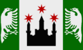
State flag of Stefalen 
State flag of Vocklenbrug


Brugham-Übersee
Brugham-Übersee is a state of Mergania located in north-east, north of Mähringen and east of Rüthingen.
Frießen
Frießen is a state of Mergania located in center, north of Vocklenbrug and south of Mähringen.
Habsach
Habsach is a state of Mergania located in the south, south Stefalen and Vocklenbrug. The state is bordering to the south with Eshein.
Holswig
Holswig is a state of Mergania located in the north-west, west of Schersen.
Mähringen
Mähringen is a state of Mergania located in the middle, south of Schersen and Rüthingen and north of Frießen and Vocklenbrug.
Rüthingen
Rüthingen is a state of Mergania located in the north east, north of Mähringen and east of Schersen.
Schersen
Schersen is a state of Mergania located in the north, north of Mähringen and between Rüthingen and Holswig.
Stefalen
Stefalen is a state of Mergania located in the south-east of the main island, north of Habsach and east of Vocklenbrug.
Vocklenbrug
Vocklenbrug is a state of Mergania located in the south-west of the main island, north of Habsach, west of Stefalen and south of Mähringen and Frießen.
Armed Forces
The Confederate Defence is the unified armed forces of Mergania and member of the EUDA.
National safety and security
Intelligence service
Mergan Secreto Intelligencia (MSI)
Police
coming soon...
National flag
The flag of Mergania or Mergan flag (Mergan: Merganische Flagge) consists of the two national colors of Mergania (Mergan: Blau-Gold)
arranged in form of a spiral. Gold symoblizes the grain growing in the huge wheatfields while blue stands for the sea surrounding the Mergan islands. The spiral shape can also be interpreted as an allusion to waves of the sea. The flag's center shows three black stag antlers in diagonal direction, each on gold background. The stag antlers stem from the Mähringer Dynasty. Mergania's flag was first adopted as the national flag in 1832, but details have been modified several times until 1921, when the current flag was created.
Economy
 | |||||||||||||||||||||
|---|---|---|---|---|---|---|---|---|---|---|---|---|---|---|---|---|---|---|---|---|---|
| Economy of Mergania | |||||||||||||||||||||
| Social-market economy | |||||||||||||||||||||
| Currency | Thaler | ||||||||||||||||||||
| Monetary authority | Merganische Zentralbank | ||||||||||||||||||||
| GDP (PPP) | 2020 estimate | ||||||||||||||||||||
| • Total | $1524 billion | ||||||||||||||||||||
| • Per capita | $55433 | ||||||||||||||||||||
| GDP (nominal) | 0 | ||||||||||||||||||||
| • Total | 0 | ||||||||||||||||||||
| • Per capita | 0 | ||||||||||||||||||||
| HDI (2020) | very high | ||||||||||||||||||||
| Principal exports | Technical equipment, vehicles, chemicals, x, x | ||||||||||||||||||||
| Principal imports | Agricultural products, x, x, x | ||||||||||||||||||||
Industries and sectors | |||||||||||||||||||||
| |||||||||||||||||||||
| Exports Main export partners | |||||||||||||||||||||
| Imports Main import partners | |||||||||||||||||||||
 See also: Economy of Mergania
Mergania has a social market economy with a highly skilled labour force, a large capital stock, a low level of corruption and a comperatively high level of innovation. It is one of the world's largest exporter and importer of goods and has a large national economy. Therefore Mergania is a leading nation in the EUEC. The unemployment rate is low and Mergania has one of the highest labour productivity levels in the world. Especially the modern industry of Mergania is regarded as one of the most competitive and innovative. An overview of companies in Mergania is provided by the Ministry of Economic Affairs.
Some of the world's largest and well known companies are headquartered in Mergania. 16 Mergan-based companies are included in the MHB, the Mergan stock market index. Mergania is recognised for its large portion of specialised small and medium enterprises, which are very flexible and innovative. Many of these companies are global market leaders in their segment and are labelled hidden champions. Chaussee near Freistat developed a thriving, cosmopolitan hub for startup companies and became a leading location for venture capital funded firms in the EUEC.
Data
Companies
See also: List of companies in Mergania
Some of the world's largest stock-market-listed companies are headquartered in Mergania. 16 Mergania-based companies such as LeunaOil, Pliar, Template:MER-company and SAF are included in the MERGHAB16, the most important Mergan stock market index.
Mergania is also recognised for its large portion of specialised small and medium enterprises. Around 850 of these companies are global market leaders in their segment and are labelled hidden champions. Examples for those relatively small but highly successful companies are Template:MER-company and Template:MER-company. Freistat developed a thriving, cosmopolitan hub for startup companies and became a leading location for venture capital funded firms in East Uletha.
Sectors
Primary
Industry
Services
Technology
Currency
Thaler (₸) is the official currency of Mergania. One Thaler is divided into 1000 Millar.
Infrastructure
| Infrastructure of Mergania | |
|---|---|
| Roadways | |
| • Driving side | Right |
| Railways | |
| • Passing side | Right |
| • Gauge | 1435mm |
| • Electrification | 25000 V, 50 Hz |
| Mains electricity | 230 V, 50 Hz |
| Telephone code | +350 |
| Internet TLD | .mer |
- See also: Infrastructure in Mergania
Transportation
The volume of traffic in Mergania, especially goods transportation, is at a very high level.
Road traffic
Mergania has a dense network of roads which is extensively used.
The Staatsautobahn (Ingerish: Confederate Motorway) is the Mergan confederate highway system. Where no local speed limit is posted, the advisory limit is 120 km/h. Only federally built controlled-access highways meeting certain construction standards including at least two lanes per direction are called Staatsautobahn. They have their own, green-coloured signs and numbers smaller than 20 in the numbering system. All Staatsautobahnen are named by using the capital letter "A" (for the first category), followed by a blank and a number (for example "A 1"). The main Autobahnen have single digit numbers, shorter sections have numbers between 11 and 19. The Staatsautobahnen are considered the safest category of Mergan roads: in 2007, while carrying 22% of all motorized road traffic, they only accounted for 7% of Mergania's traffic fatalities. Mergan Staatsautobahnen are toll-free for light vehicles. A blanket mandatory toll on trucks and buses was introduced in the 1980s.
- A 1 Norderhaven - Freistat - Leutringen - Werschin - Suidbrug - Gausbrug - tbd - Mergan border - Eshein (I-1)
- A 2 Brugham - Freistat - Bütingen - Maizen - Frisdewalg - Wasepalk
- A 3 Freistat - Wiesbrungach - Liek - Dornerstedt - Büleck
- A 4 Brugham - Norderhaven - Liek
- A 5 tbd - Werschin - tbd - Wasepalk
- A 11 tbd - Mergan border - Viljanni
- A 12 Gausbrug - Mergan border - Viljanni
- A 13 Suidbrug - tbd
The national roads in Mergania are called Staatsstraße (Ingerish: Confederate Highway). Their numbers are between 21 and 99 and are usually well known to local road users, as they appear (written in black digits on a yellow rectangle with black border) on direction traffic signs and in street maps. Staatsstraßen are often referred to as "B" (for the second category) followed by its number, for example "B21". While the first digit stands for the region, more important routes have a lower second digit.
- B21
- B22
- B31
- B32
- B42
- B43
- B52
- B53
- B61
- B93 Template:MER-locality - Template:MER-locality - Template:MER-locality
Other main public roads are maintained by the States, called Landesstraße (Ingerish: Country Highway). The numbers of these roads are prefixed with "C" (for the third category), but are usually not seen on direction signs or written in maps. They appear on the kilometre posts on the roadside. Numbers are larger than 110, where the first digit stands for the state.
- 111
- 112
Minor roads and streets are built and maintained by the municipalities. These roads have the number prefix "D" (for the fourth street category).
Railroad traffic
coming soon...
The capital Freistat is accessible by Metex and Tunnelbahn, which serves as the main means of transport there.
Aviation
- important airports have HMM* code, all others use HM** code
| Airport name | Primary city | Code | WAAT | ANACA | Continent | Type | Gates | Runways
|
|---|---|---|---|---|---|---|---|---|
| Bütingen | BTG
|
BTG
|
HMBU
|
East Uletha | domestic | 21 | 10/28 (3000 m) | |
| Brugham | BRU
|
BRU
|
HMMB
|
East Uletha | regional | 26 | 11/29 (2988 m) | |
| Fiorentia | FIO
|
FIO
|
HMFI
|
East Uletha | domestic | 15 | 8/26 (2544 m) | |
| Ludenitz | LUD
|
LUD
|
CMLU
|
Archanta | domestic | 8 | 8/26 (4034 m) | |
| Westgreut | WES
|
WES
|
HMWS
|
East Uletha | domestic | 15 | 10/28 (3000 m) | |
| Gausbrug | GAU
|
GAU
|
HMMG
|
East Uletha | global | 55 | 8/26 (3000 m) 14/32 (3000 m) | |
| Liek | LIK
|
LIK
|
HMLK
|
East Uletha | domestic | 10 | 10/28 (3000 m) | |
| Sant Michelle | STM
|
STM
|
KSTM
|
West Uletha | domestic | 12 | 10/28 (3749 m) | |
| Freistat | FRI
|
FRI
|
HMMF
|
East Uletha | global | 132 | 10R/28L (3000 m) 10C/28C (3000 m) 10L/28R (3000 m) 17L/35R (3000 m) 17R/35L (3000 m) | |
| Leutsch | FFL
|
FFL
|
HMML
|
East Uletha | domestic | 15 | 4/22 (3000 m) | |
| Lilienthal | LIL
|
LIL
|
HMLI
|
East Uletha | domestic | 12 | 6/24 (3000 m) |
Shipping and inland water transport
Mergania's major port is the Port of Brugham.
Utilities and disposal
Energy
See also: User:Mstr/Sandbox/Mergania#Energy
Water supply and sanitation
See also: User:Mstr/Sandbox/Mergania#Infrastructure
Disposal
Telecommunication and computing
Mergania has its own top-level domain .mer.
Demographics
| Demographics of Mergania | ||||||||||||||||||||||||||
|---|---|---|---|---|---|---|---|---|---|---|---|---|---|---|---|---|---|---|---|---|---|---|---|---|---|---|
| Demonym | Mergan | |||||||||||||||||||||||||
| Official languages | Mergan | |||||||||||||||||||||||||
| Recognized minority languages | Eshen | |||||||||||||||||||||||||
Ethnicities | ||||||||||||||||||||||||||
| ||||||||||||||||||||||||||
| Ethnicities | x | |||||||||||||||||||||||||
Religion | ||||||||||||||||||||||||||
| ||||||||||||||||||||||||||
| Religion | x | |||||||||||||||||||||||||
| Literacy | ||||||||||||||||||||||||||
| Life expectancy | ||||||||||||||||||||||||||
| x | x | |||||||||||||||||||||||||
| x | x | |||||||||||||||||||||||||
With a population of 28.8 million (2020), Mergania is a densely populated country in East Uletha. Due to its situation on islands the population density is with 398 inhabitants per square kilometre (tbd per square mile) quite high. The fertility rate of 2.10 children born per woman (2019 estimates) is almost equal to the replacement rate. The average age is 43.2 years.
After the Federal States, Mergania is one of the most popular immigration destinations in the world. The majority of migrants live in Merganias cities.
Mergania has a number of large cities, most of them located close to the coast. There are tbd officially recognised metropolitan regions. The country's largest city is Freistat, which is also the largest urban area.
Religion
Christicism is the largest religion in Mergania, claiming 64.3% Reformatic and 13.4% Ortholic traditions. All other religions accounted for 22.3%[2]. Geographically, Reformatism is spread all over the country, whereas Ortholicism is concentrated in the south, especially in Habsach.
Main churches in Mergania[3] are:
- the Reformatic Church in Mergania,
- the Mergan Ortholic Church,
- the Freedenom Church.
A unique features of Christicism in Mergania is the fairly advanced reconciliation of both parts of the chirch, so called Oicumenism. One of the main steps was the foundation of the Monestary of Tetzel in the southwest of Vocklenbrug, which is notable for being composed of more than one hundred brothers from Reformatic and Ortholic traditions. The community emphasizes the reconciliation of all denominations. This movement is internationally known, attracting over 70 000 young pilgrims annually[4].
Languages
Mergan is the only official and predominant spoken language in Mergania. Typically, Mergan citizens are multilingual, 74% claim to be able to communicate in at least one foreign language, usually Ingerish[5]. Further native minority languages in Mergania are Eshen, tbd, as well as tbd. The most used immigrant languages are Ispelian, tbd, and Kårska.
Mergan language
| Mergan | ||||||||||
|---|---|---|---|---|---|---|---|---|---|---|
/mergan/ | ||||||||||
| Estimated number of speakers | 60 million | |||||||||
| Regulating body | (regulating body) | |||||||||
Writing System | ||||||||||
Norms of linguistic structure | ||||||||||
| ||||||||||
| ||||||||||
| ||||||||||
Mergan (Mergan: Merganisch, in Kalm sometimes called Ostkalmisch) is the East Ulethan variety of Kalmish, mainly written and spoken in and around Mergania. It is official language in Älved and Helvetiania, but also spoken by minorities in many countries in East Uletha like Reeland and Eshein.
This is a short overview how Kalmish came to East Uletha:
- at the beginning of the 12th century merchants of the Sellern dynasty used the Great Pretanic Trade Route to reach the east
- they brought the Kalmish language and culture to the east of the Ulethan continent and spread it to several regions
- several large migration waves in the 12th and 13th century brought a large amount of emigrants to the east, many of them settled around the Kaspen Sea and Darcodian Sea and strengthen Kalmish influence and culture there
- while the sparely populated islands in the east of the Darcodian Sea provided good prospects for the settlers, Kalmish immigrants in many other regions have been expulsed, they moved further eastwards and finally arrived at the Mergan islands as well
- during the centuries, culture and language developed differently in the East (Mergan) and West (Kalmish), however not independently and only with slight differences due to strong trade relations
- the spread of the written Kalmish language in the 17th and 18th century led to a gradually adjustment of the spoken Mergan language, so Mergan became again (and nowadays Standard Mergan is) similar to Modern Kalmish
Typical Mergan words (contrary to Kalmish):
- Brug - Festung
- Belt - Meerenge
- ...
- ...
- ...
- Suid - Süd
- Veste - Festung
There are many Mergan dialects predominantly spoken in the different regions of Mergania. Well known is Plaat, which is a Mergan dialect spoken in northeast Mergania and in the coastal regions of Helvetiania. Even for native Mergan speakers it is hard to understand Plaat and some other Mergan dialects.
Toponyms
Placenames in the Mergan language area can be classified by the language from which they originate, and by era. Some of them are equal to Kalmish toponyms, others are very different and unique.
- -ach means small river
- -ban means hill/mountain
- -benk means bend
- -breg meas bridge
- -brug means fortress
- -brungach means fortress at a river
- -stat means town
Education
Responsibility for educational supervision in Mergania is primarily organised within the individual confederate states, which follow the rules made by the Ministry of Education and Research. Kindergarten education is provided for all children between three and six years old, after which school attendance is compulsory for at least nine years. Primary education lasts for five years. Secondary education includes three traditional types of schools focused on different academic levels: the Oberschule enrols the most gifted children and prepares students for university studies; the Mittelschule for intermediate students lasts five years and the Gemeinschule prepares pupils for vocational education.
The standard system of apprenticeship called dual education does not lead to an academic degree. Instead, it allows students in vocational training to learn in a company as well as in a state-run vocational school. This model is highly regarded and reproduced all around the world.
All Mergan universities are public institutions, and students have traditionally studied without fee payment. The general requirement for university is the Cog, a qualification normally based on continuous assessment during the last few years at school and final examinations, there are no exceptions. Academic education is open to international students and is increasingly common. In the academic ranking especially the Technical University of Bronn has a prominent position.
School system
| School in Mergania | ||||
|---|---|---|---|---|
| secondary | 12 | Oberschule | ||
| 11 | ||||
| 10 | Gemeinschule | Mittelschule | ||
| 9 | ||||
| 8 | ||||
| 7 | ||||
| 6 | ||||
| primary | 5 | |||
| 4 | ||||
| 3 | ||||
| 2 | ||||
| 1 | ||||
| Kindergarten | ||||
Universities
The [[Mergania#?|Technical University of Bronn (TUB) is the largest education institution in Mergania and one of the most prestigious research institutions worldwide. Further institutions are the Tecscleron University in Freistat, O'Hanna University in Johannastat, Technical University Gausbrug, Amadeus University Gausbrug, University Werschin, University Wiesbrungach, Brugham School of Trade and Business, Mergodin University|Mergodin School of Economics and Engineering, Fridericiana University|Fridericiana University Fiorentia, Holswig University Büleck, Northern University in Thoga and the University Suidbrug.
Health
Mergania's system of hospices, called spitals, dates from medieval times, and today, Mergania has one of the world's oldest universal health care system, dating from the 1920s. Since then, reforms and provisions have ensured a balanced health care system. Currently the population is covered by a health insurance plan without any need for a private health insurance contract.
Culture
Culture in Mergania has been mainly influenced by philosophers (Desidereus, Briegel, Eschenbacher), writers (tbd, tbd, tbd) and scientists (tbd, tbd, tbd). The country is well known foir its seafaring traditions.
Music
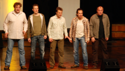
Mergan classical music includes works by some of the world's most well-known composers like Leonhard Buck, Karl Strass and Johann Sing. Others like tbd, tbd and tbd are important composers of the 20th and early 21st centuries.
In the past 50 years, Mergan music includes the movements of pop, heavy metal/rock, punk, pop rock, indie, folk music, and hip hop. Mergan DJs and artists of the techno and house music scene gained global influence, with tbd pioneering in this genre. With the Five Guys (Fünf Kerle), Mergan a capella music have become well known in the whole world.
Film and television
tbd ...
tbd ...
The Mergan public, state-owned broadcaster Mergan Vision] provides radio and television broadcasts in 25 languages across the globe. Its purpose is to inform people in all countries mainly about news and politics in Mergania. Mergan Vision's work is regulated by the Mergan Broadcast Act to ensure that content is independent of government influence.
Sports
Almost 8 million people in Mergania are registered in one of the 55000 sports clubs in the country. About two-thirds of the population between 14 and 70 participate in sports weekly. Field hockey is the most popular team sport in Mergania for men and women, closely followed by football. Also handball and volleyball are popular team sports. Cycling, tennis, gymnastics and golf are the most widely engaged in individual sports. In addition, Mergania is one of the leading motor sports countries in the world. Constructors like tbd and tbd are prominent manufacturers in motor sport.
Organisation of sports began at the end of the 19th century and the beginning of the 20th century. Federations for sports were established, rules were unified and sports clubs came into existence. A Mergan National Geolympic Committee was established in 1918. Historically, Mergan athletes have also been successful contenders in the Geolympiad.
Field hockey
Football
Football is the second most popular sport in Mergania, with many registered players and most clubs among all sports in Mergania.
Other Sports
- Cycling
- Handball
- Tennis
- Motorsport ... Ostring
comin soon...
International contributions
Due to its cultural heritage and economic power, Mergania hosted a number of recognizable international events, such as the Expomondial 2012, tbd and tbd.
Further reading
References
- ↑ "Temperatures in Mergania 2011". Statistisches Amt der Konföderation. Freistat, 2012. Retrieved 28 February 2013.
- ↑ "Religionsausübung in Merganien". Statistisches Amt der Konföderation. Freistat, 2013. Retrieved 1 August 2014.
- ↑ Glockenbacher, H; "Kirchen und ihre Arbeit in Merganien". Journal of International Religions 33(1), 122-135, 2013.
- ↑ Wegerhoff, K.B.; Steiner, S; Maier, P; "Tetzel und seine Geschichte". Zeitschrift für Glaubensfragen 13(2),34-55, 2001.
- ↑ "Languages in Mergania". Statistisches Amt der Konföderation. Freistat, 2018. Retrieved 3 January 2019.
See also
External links
Galleries
Images to be incorporate into the article (some of them have to be modified).
History

Abandoned mine shaft in Stefalen
Geography
Politics

Mergan parliament building in Freistat

Mergan parliament building at night

Parliament hall

Mergan embassy in Ravalin

Mergan embassy in Ravalin

Mergan embassy in Canan-Yar in Al-Kaza

Mergan embassy in Huntington, Federal States

Embassy of Kojo in Freistat
Military
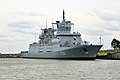
Mergan Naval Forces frigate class F200

Mergan Naval Forces submarine class U300 built at Hohwerdt-Werke shipyard
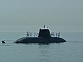
Mergan Naval Forces submarine class U300
Economy

Building of the Mergan Handelsbörse, the Mergan stock exchange
Economy - primary sector

Oil platform in the Darcodian Sea
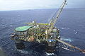
Oil platform in the Darcodian Sea
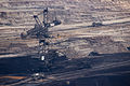
Open coal pit in north Mergania
Economy - secondary sector

SAF chemical plant in Mergania

SAF chemical plant abroad

Pharmovid pharmaceutical production

Civil plane production at the Mergan Aerotheon plant

Experts monitor plane production at the Watanabe Aerospace plant in Mergania

Traditional Wagenunion plant
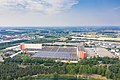
Modern Wagenunion plant

Wheel loader produced by Liebscher, one of the world's leading heavy equipment manufacturers

Halsken Superconducting Magnetic Levitation train (HSML)
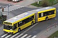
Planeo articulated bus
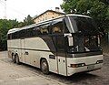
Planeo coach

Planeo airport bus

Construction site of the Mergan company Bautag
Submarine class U300 built at Hohwerdt-Werke shipyard
Economy - tertiary sector
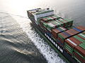
Container ship of Mergaveer Corporation, one of the largest global freight shipping company

Mergaveer Corporation container ship "King George" of the MERG-E-class (about 4250 PPE)

Traditional Gobeletplain coffee roasters
Science and technology
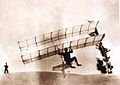
First flight attempts of Georg Lilienthal with a biplane hang glider in 1890

X-ray apparatus build by the Mergan physicist Carl Ernst Röntgen in 1893
Kaplan turbine, developed and patented by the Mergan engineer Hannsjörg Kaplan in 1907

Wankel engine designed by the Mergan engineer Conrad Wankel in 1931

Nuclear research facility
Infrastructure

The container harbor in Brugham is the largest one in Mergania and one of the largest in East Uletha

Halsken Superconducting Magnetic Levitation train (HSML) in operation

HSML in operation
HSML in operation
Demographics
Christian main cathedral in Freistat
Culture

Hockey is one of the most popular sports in Mergania