...rdinate on the Capital District's development. The current coordinators of Huntington are [[User:histor]] and [[User:Ernestpcosby]].
''Moved to [[Collab:Federal States/Government]].''
507 bytes (64 words) - 21:36, 6 September 2021
...ile:Flag_of_the_FSA.svg|28px|border]] Political divisions of the [[Federal States]]</center>
<!-- States marked with italics are labeled on the map but are not active. -->
2 KB (227 words) - 13:45, 24 April 2024
..." colspan="2" | <center>[[File:Flag_of_the_FSA.svg|28px|border]] [[Federal States]] Project Pages</center>
! style="background: #f2f2f2; width:130px; text-align:left" | <small>Collaborative Projects</small>
3 KB (392 words) - 19:00, 25 December 2023
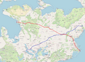 | File:FS-1-2 Plan.png ...t, southeast of Huntington) and FS-2 (proposed). [[Category:Federal States collaborative documentation]]
(1,611 × 1,181 (1.51 MB)) - 16:57, 5 March 2023 |
...ore in-depth and detailed information can be found on the [[Collab:Federal States|FSA project page]].
...approximately 60 states and territories. Additionally, several states are collaborative endeavours that provide newer mappers with an opportunity to participate in
4 KB (630 words) - 19:30, 19 December 2022
| {{way|16693768|Huntington-CD ''(embassy)''}}
| [https://opengeofiction.net/#map=18/-37.55386/157.89122 Huntington-CD ''(embassy)'']
15 KB (1,672 words) - 13:05, 9 April 2024
...been added?'' Feel free to add any NGO from your state, [[Arecales]] or [[Huntington]], in addition to its location on the map.
=== Federal States Astronomic Association (FSAA) ===
4 KB (520 words) - 02:40, 11 May 2023
The government of the Federal States consists of three co-equal branches: a legislature (passes laws), an execut
:* Congress of the Federal States
5 KB (668 words) - 00:39, 24 October 2022
...ral States|Federal States]] → {{PAGENAME}}'''</div>[[Category:Federal States forum posts]]
...a continuation and proposal based on older discussions in [[Collab:Federal States/History]].
4 KB (676 words) - 02:05, 3 January 2022
...es information for the mapping of '''military facilities''' in the Federal States.
...guidelines that have been put in place in an effort to prevent individual states or regions from monopolizing the military. It is important to emphasize tha
6 KB (958 words) - 21:58, 23 October 2022
...jority of the population in the center of the state and in the area around Huntington. The mountains will be sparsely populated, however small towns will appear
...th a population of approximately 250,000 to 500,000. It is just outside of Huntington. This town exists right now as mapping from a previous owner, so I will eit
8 KB (1,234 words) - 23:19, 22 August 2023
...is coordinated by {{User|Alessa}} and inspired in large part by Midwestern states like Indiana, Iowa, Kansas, Missouri, and Ohio. Its climate is similar, how
==Collaborative Framework==
9 KB (1,057 words) - 05:21, 30 January 2024
...city, specifically designed to house the central government of the Federal States. At a minimum, the capital should include the following:
* A high court, where the highest court in the Federal States meets to hear cases
10 KB (1,530 words) - 13:14, 14 September 2021
...dingly by the country flag. Please consider the regulations of the broader collaborative project when mapping.''
...rder|link=Collab:Federal States]] '''[[Collab:Federal States/Collaborative States/Michisaukee|Michisaukee]]'''
21 KB (2,799 words) - 17:32, 3 April 2024
:* Vote to make decisions on discussions in [[Collab:Federal States/Government]] has concluded. The results are as follows:
::* A1. Federal Legislative Body: Congress of the Federal States (54.5% preference)
21 KB (3,239 words) - 21:45, 23 October 2022
* Louis Huntington (First Revolution), General
:''For the chief executive, please see [[Collab:Federal States/Government]].''
4 KB (585 words) - 21:54, 23 October 2022
...to be freely mapped throughout the Federal States, visit [[Collab:Federal States/Franchises]].
...tive space to create multi-state '''industries'''. Unlike [[Collab:Federal States/Franchises|franchise business listings]] that are open to some or all mappe
12 KB (1,543 words) - 04:03, 1 April 2024
=Joining Collaborative Projects=
Currently, my territories in collaborative projects are:
43 KB (5,930 words) - 14:20, 12 April 2024
...corporations. Due to the central location between Stanton, Orterrado, and Huntington, and being near the center of the east coast, this attracted many companies
...of guidelines to a keep regional and even national integration between the states. As said, not a mandatory thing, I am just asking about it. Best regards! [
9 KB (1,393 words) - 20:18, 30 January 2024
...l. Designated coordinators are responsible for overseeing the project, and states are expected to confirm with pre-existing plans and national initiatives.</
...standing leadership structure to guide the project. Mappers are extremely collaborative and continuously work together to move the project forward.''</small></cent
37 KB (5,214 words) - 15:00, 23 January 2024
