Category:Federal States collaborative documentation
Category of Federal States collaborative documentation, as related to states, regions, territories, and the capital district.
For formatting guidelines regarding state pages, see Collab:Federal States/Wiki standards
Pages in category "Federal States collaborative documentation"
The following 28 pages are in this category, out of 28 total.
F
- Collab:Federal States
- Collab:Federal States/Archive
- Collab:Federal States/Collaborative States/Alormen
- Collab:Federal States/Collaborative States/Alormen/San Pascual
- Collab:Federal States/Collaborative States/Cosperica
- Collab:Federal States/Collaborative States/Cosperica/Notable people
- Collab:Federal States/Collaborative States/Eustacia
- Collab:Federal States/Collaborative States/Huntington
- Collab:Federal States/Collaborative States/Huntington/Archive
- Collab:Federal States/Collaborative States/Michisaukee
- Collab:Federal States/Collaborative States/New Carnaby
- Collab:Federal States/Collaborative States/West Massodeya
- Collab:Federal States/Franchises
- Collab:Federal States/Government
- Collab:Federal States/History
- Collab:Federal States/Important persons
- Collab:Federal States/Industries
- Collab:Federal States/International relations
- Collab:Federal States/Military
- Collab:Federal States/National Parks
- Collab:Federal States/Natural features
- Collab:Federal States/Newcomers Guide
- Collab:Federal States/NGOs
- Collab:Federal States/Overseas Territories/Arecales
- Collab:Federal States/Sports
- Collab:Federal States/Transportation
- Collab:Federal States/Wiki standards
Media in category "Federal States collaborative documentation"
The following 21 files are in this category, out of 21 total.
-
 20240707 Freight Rail Proposal v2.png 1,940 × 937; 1.23 MB
-
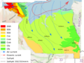 Alormen Climate.png 1,277 × 962; 665 KB
-
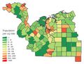 Alormen counties - rough population estimate.jpg 768 × 586; 276 KB
-
 Alormen Motorway Plan 20231229.png 1,120 × 861; 499 KB
-
 FS-1-2 Plan.png 1,611 × 1,181; 1.51 MB
-
 FSA Core Motorway Network.png 1,313 × 865; 1.34 MB
-
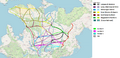
 FSA Draft Passenger Rail Plan.png 800 × 1,290; 360 KB
-
 FSA FreightRailDraft.png 1,940 × 936; 1.47 MB
-
 FSA Grid Motorway Network.png 1,329 × 870; 1.32 MB
-
 Hemming Key Neighborhoods.png 832 × 1,639; 303 KB
-
 Hydrocarbons in Alormen.png 767 × 586; 137 KB
-
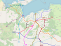
 Iroquesia Current Rail Map.png 2,481 × 3,508; 342 KB
-
 New Carnaby Counties.png 1,534 × 684; 93 KB
-
 New carnaby roads.png 1,497 × 667; 57 KB
-
 Northeastern FSA motorways 2.png 594 × 622; 327 KB
-
 Northeastern FSA motorways 4.png 1,207 × 811; 755 KB
-
 Northeastern FSA motorways.png 565 × 616; 308 KB
-
 Revised FS Business Route Shields.png 630 × 271; 36 KB
-
 Southeastern 18th century proposed map.png 739 × 745; 557 KB
-
 Stanton downtown plan.png 1,573 × 736; 1.25 MB
-
 Stanton wards.png 1,405 × 1,683; 1.87 MB


