Category:Flags and Collab:Federal States/Collaborative States/Alormen: Difference between pages
(Created page with "Category:Images") |
mNo edit summary |
||
| Line 1: | Line 1: | ||
[[Category: | {{FS Infobox state | ||
|coords_zoom = <!-- The zoom coords /#map=THIS/xx.xx/xx.xx?layers=x --> | |||
|coords_y = <!-- The y coords /#map=x/THIS/xx.xx?layers=x --> | |||
|coords_x = <!-- The x coords /#map=x/xx.xx/THIS?layers=x --> | |||
|coords_layer = <!-- The zoom coords /#map=c/xx.xx/xx.xx?layers=THIS (This parameter is entirely optional) --> | |||
|common_name = Alormen | |||
|native_name = <!-- The native name of the country (e.g Éxempelterre) --> | |||
|conventional_long_name = State of Alormen | |||
|image_flag = Proposal_astrasia1.jpg | |||
|alt_flag = <!-- The alt text to go with the flag (e.g Official Flag of Exampleland) --> | |||
|image_coat = <!-- The country's coat of arms (e.g Exampleland_Coatofarms.png) --> | |||
|alt_coat = <!-- The alt text to go with the flag (e.g Official Coat of arms of Exampleland) --> | |||
|national_motto = <!-- The motto of the country (e.g Draco Dormiens Nunquam Titillandus) --> | |||
|english_motto = <!-- The English translation of the motto, if necessary (e.g In Union and Liberty) --> | |||
|national_anthem = <!-- The national anthem of the country (e.g Song of the Examplese) --> | |||
|image_map = <!-- Image of a map showing the location of the country (e.g Exampleland_Location_Map.png) --> | |||
|alt_map = <!-- The alt text to go with the map (e.g Location of Exampleland shown in Examplia) --> | |||
|map_caption = <!-- The caption shown below the map (e.g Location of Exampleland (blue) shown in Examplia (green)) --> | |||
|capital = Alamar | |||
|largest_city = Andreapolis | |||
|official_languages = <!-- The official languages of the country (e.g Examplese, English) --> | |||
|national_languages = <!-- Nation-wide recognised languages (e.g Catalan, Afrikaans) --> | |||
|regional_languages = <!-- Regional languages in the country (e.g Navajo, Welsh) --> | |||
|ethnic_groups = <!-- The ethnic groups within the country (e.g Green Examplese (53%), Purple Examplian (23%), etc) --> | |||
|ethnic_groups_year = <!-- The year the data of the ethnic_groups is from (e.g 2013) --> | |||
|nationalities = <!-- The nationalities within the country (e.g Examplese (78%), Examplian (12%), Other (2%), etc) --> | |||
|demonym = <!-- Term(s) used to refer to those associated with the country (e.g Examplese) --> | |||
|independence = <!-- year of independence --> | |||
|government_type = <!-- The type of government (e.g Federal Parliamentary Constitutional Diarchy) --> | |||
|leader_title1 = <!-- For the country, usually the head of state's title (e.g Monarch) --> | |||
|leader_name1 = | |||
|leader_title2 = <!-- Could be prime minister, vice president, etc (e.g Vice President) --> | |||
|leader_name2 = | |||
<!-- ...... --> | |||
|leader_title6 = <!-- Up to six distinct leaders may be specified --> | |||
|leader_name6 = | |||
|legislature = <!-- The name of the country's governing body (e.g Parliament) --> | |||
|upper_house = <!-- Name of the governing body's upper house (e.g House of Lords) --> | |||
|lower_house = <!-- Name of the governing body's lower house (e.g House of Commons) --> | |||
|area_km2 = <!-- The area of the country in km2 (e.g 32,773) --> | |||
|area_sq_mi = <!-- The area of the country in square miles (e.g 12,654) --> | |||
|percent_water = <!-- The percentage of the total area that is made up of water (e.g 2.7) --> | |||
|population_census = <!-- The population according to a census (e.g 2,356,753) --> | |||
|population_census_year = <!-- The year of the census (e.g 2011) --> | |||
|population_estimate = 17,500,000 | |||
|population_estimate_year = <!-- The year the estimation was made (e.g 2013) --> | |||
|population_density_km2 = <!-- The population density in people per km2 (e.g 844) --> | |||
|population_density_sq_mi = <!-- The population density in people per square mile (e.g 2,186) --> | |||
|GDP_PPP = <!-- The gross domestic product (PPP) of the country in total (e.g $3.197 trillion) --> | |||
|GDP_PPP_per_capita = <!-- The gross domestic product (PPP) of the country per capita (e.g $39,028) --> | |||
|GDP_nominal = <!-- The nominal gross domestic product of the country in total (e.g $3.401 trillion) --> | |||
|GDP_nominal_per_capita = <!-- The nominal gross domestic product of the country per capita (e.g $41,513) --> | |||
|HDI = <!-- The rating between 0 and 1 on the human development index of the country (e.g 0.784) --> | |||
|HDI_year = <!-- The year the HDI rating applies to (e.g 2014) --> | |||
|HDI_change = <!-- "increase", "decrease" or "stable" - Whether the HDI has changed since the previous year (e.g stable) --> | |||
|timezone = <!-- The country's timezone --> | |||
|currency = <!-- The currency used in the country (e.g Exampleland Shillings) --> | |||
|currency_code = <!-- A code, usually three letters long, to distinguish the currency (e.g ELS) --> | |||
|cctld = <!-- The standard country code top level domain(s) for the country (e.g .exl) --> | |||
}} | |||
==Introduction== | |||
'''{{relation|962|Alormen}}''' (AR120-91) is the largest state in the [[Federal States]], with an area roughly 2/3 the size of Texas or the whole state of California. It is a [https://wiki.opengeofiction.net/wiki/index.php/OGF:Federal_States/Dashboard guided collaborative] inspired by Texas and Louisiana. | |||
==Coordination== | |||
The project is being overseen by [https://opengeofiction.net/user/newflanders newflanders] and [https://opengeofiction.net/user/ruadh ruadh]. | |||
==Contributors== | |||
{|class="wikitable" | |||
! Name | |||
! County | |||
! Notes | |||
|- | |||
| [https://opengeofiction.net/user/Luziyca Luziyca] | |||
| [https://opengeofiction.net/relation/135945 Inkana County] | |||
| An area with longstanding Franquese heritage. | |||
|- | |||
| [https://opengeofiction.net/user/Luziyca Luziyca] | |||
| [https://opengeofiction.net/relation/135944 Cayooga County] | |||
| | |||
|- | |||
| [https://opengeofiction.net/user/Portopolis Portopolis] | |||
| [https://opengeofiction.net/relation/135471 Villasana County] | |||
| Urban planning in and around [[San Pascual]]. | |||
|- | |||
| [https://opengeofiction.net/user/BMSOUZA BMSOUZA] | |||
| [https://opengeofiction.net/relation/135939 Gloria County] | |||
| Seaside resorts and tourist attractions. | |||
|- | |||
| [https://opengeofiction.net/user/Y%20Knott Y Knott] | |||
| [https://opengeofiction.net/relation/135762 Clifton County] | |||
| Rural, heavily forested | |||
|- | |||
| [https://opengeofiction.net/user/TBMap TBMap] | |||
| [https://opengeofiction.net/relation/135587 Halifax County] | |||
| | |||
|- | |||
| [https://opengeofiction.net/user/yoyo21 Yoyo21] | |||
| [https://opengeofiction.net/relation/135589#map=9/-32.7662/148.9462 Fleming County] | |||
| | |||
|- | |||
| [https://opengeofiction.net/user/ruadh Ruadh] | |||
| [https://opengeofiction.net/relation/135942 Faures County] | |||
| seaside resorts, rural, wetlands, agriculture, pop 10k approx | |||
|- | |||
| [https://opengeofiction.net/user/ruadh Ruadh] | |||
| [https://opengeofiction.net/relation/135943 Rushe County] | |||
| landlocked, rural, oil and natural gas, agriculture, pop 44k approx | |||
|- | |||
|} | |||
==Background Information on Alormen== | |||
Alormen has a population of around 17.5 million people, the majority of whom live in or around the 10 big cities. | |||
<div style="column-count:3;-moz-column-count:3;-webkit-column-count:3"> | |||
*[https://opengeofiction.net/#map=10/-28.2415/143.1409 Puerto Eloisa] | |||
*[https://opengeofiction.net/#map=12/-28.0905/145.2097 San Pascual] | |||
*[https://opengeofiction.net/#map=11/-30.0465/145.5627 Alamar] | |||
*[https://opengeofiction.net/#map=12/-31.0962/148.5726 Mahpe] | |||
*[https://opengeofiction.net/#map=10/-31.2938/146.8336 Fort Sinclair] | |||
*[https://opengeofiction.net/#map=11/-33.6575/148.7700 Longstone] | |||
*[https://opengeofiction.net/#map=11/-34.1624/152.4758 Shawcross] | |||
*[https://opengeofiction.net/#map=12/-31.0773/148.8012 Andreapolis] | |||
*[https://opengeofiction.net/#map=12/-30.8106/150.5422 Dewar] | |||
*[https://opengeofiction.net/#map=12/-29.7432/148.4359 Port Massehanee] | |||
</div> | |||
The capital city is [https://opengeofiction.net/#map=11/-30.0465/145.5627 Alamar] but the largest urban area is [https://opengeofiction.net/#map=12/-31.0773/148.8012 Andreapolis/Mahpe]. The states busiest seaport is [https://opengeofiction.net/#map=12/-29.7432/148.4359 Port Massehanee]. | |||
The state is large and subdivided into 129 counties, the majority of which are landlocked, sparsely populated and rural in character. Those within easy commuting distance of large cities will have greater population and wider variety of amenities. | |||
[[File:ALORMEN_descriptive_maps.jpg|650px|thumb|right|Maps of Alormen showing major conurbations, road and rail connections, county layout and general land uses.]] | |||
*'''West''' - Alamar and some of the oldest settlements lie in the west of the state which was the first area to come under colonial control. Castellanese influence can still be felt in the urban planning and place names of the region. Some typical industries here include mining, forestry and agriculture. | |||
*'''Central''' - The central and coastal parts of the state were historically under native control and then became nominally Ingerish for an extended period before the current Alormen state was formed. Native settlements and their place names are more evident here. The Passawanah Valley and the Anawuhak Valley run north/south across the region. Along the coast are a variety of wetlands, swamps, bayous and tidal estuaries, many of which are habitats of international importance. Energy companies own oil and gas extraction operations across the region. | |||
*'''East''' - The land that lies east of the 'big river' was annexed to Alormen shortly after the formation of the state and saw a great deal of conflict between native populations, Ingerish settlers/militias and groups associated with Randalia. Unlike the other regions, the counties in the east are very regular squares, having been surveyed and established in more recent times. The eastern landscape is dominated by coastal plains that give way to rolling plains and hill country further south. Important industries include agriculture such as orchards, tourism and ranching. | |||
==History== | |||
This is an outline of the history of the territory that can be modified and refined over time to fit with wider FSA history. | |||
===Pre-History=== | |||
Pre-contact Alormen was home to more than a dozen large native population groups and dozens more smaller tribes. They are classified by geographical region, each with shared cultural traits and language families. They created the first 'pathways' across the territory and left behind many place names seen on the map today. Some were nomadic and others were settled. | |||
There were three main ethnolinguistic groups, the first inhabited the mountains and valleys west of the 'big river', the second major grouping occupied the eastern plains between the 'big river' and the border with Randalia while the third lived along the coastal region. | |||
===Post-Contact Era 1550-1740=== | |||
[[File:Alormen_colonisation.jpg|650px|thumb|right|Map of Alormen during the period when the Ingerish begin to arrive, showing direction of travel for Castellan, Ingerland and Randalia. Red - the Castellan territory of Santa Annestas, Green - the maximum extent of Randalia occupation, Brown & Blue - territory under native control.]] | |||
1550 - 1680 | |||
The Castellanese were the first non-natives to arrive at what is now Puerto Eloisa in the 1550s. In the following decades they moved gradually east, exploring, conquering local tribes, establishing alliances, fortified settlements and churches from which to spread Castellanese influence. It was not a planned colonisation and activity fluctuated depending on the political landscape of the Castellanese royal court and behaviour of the native population. Often they would retain local elites and tribal boundaries, eventually gaining control of the western portion of the modern day state, from Puerto Eloisa to the Nakohe River. The territory was named Santa Annestas after a recently beatified member of the Castellanese royal family. | |||
1680 - 1740 | |||
The Ingerish arrived on the northern coast in the 1670s and 80s where they established a small number of successful colonies at various locations including Port Massehanee. Several colonies failed due to a mixture of native resistance, Castellanese interference, poor harvests, disease and lack of support from Ingerland. Like the Castellanese the Ingerish speaking arrivals began exploring inland, moving south along the 'big river' into the interior of the state. The Ingerish colonisation effort was largely undertaken as private enterprise. Through a combination of trade, military actions and politics they established nominal control over portions of the northern coastline and a few strategic locations southwards along the navigable rivers. | |||
During this era the powers in Randalia were moving west and occupying land held by the eastern plains tribes. This left only natives in the land west of the 'big river' in firm control of their historic tribal lands. Many refugees from other tribes were absorbed into this group. | |||
Franquese explorers and colonists also navigated the big river during this period. Many settlers arrived from the older southern colonies and several communities still exist that trace their roots back to these pioneers. | |||
===Consolidation 1740-1800=== | |||
The Castellanese and Ingerish colonies in the region grew in confidence and capability. The Castellese territories, with easy access to the Asperic Ocean, grew more rapidly and became more developed than the colonial efforts in the east of the state. | |||
1800 - 1820 | |||
Due to wars overseas and falling revenues from the mines of Santa Annestas, the Castellanese were forced to cede/sell control of their territory to the Ingerish. Due to the mountainous geography and resistance from Castellanese settlers and natives alike the new lands proved expensive to garrison and less profitable than hoped. In an attempt to subdue the remaining native tribes and unite their disparate holdings the Ingerish prosecuted a series of low level 'wars' but after decades of conflict they failed to break native resistance. The conflicts left much of the countryside too ravaged and depopulated to be support agriculture. Randalia controlled nearly all the land east of the 'big river'. | |||
===Modern History=== | |||
1820 - 1840 The Alormen Republic | |||
1840 - 1850 Joined the Union | |||
1850 - 1860 Annexed East Alormen from Randalia. | |||
==Counties Map== | |||
{{#multimaps: | |||
| service = OGF | |||
| center = -31.4345,147.7167 | |||
| width = 980px | |||
| height = 850px | |||
| zoom = 7 | |||
| maxzoom = 19 | |||
| layers = +Standard,TopoMap,Histor | |||
| overlays = +Alormen,+Western Counties,+Central Counties,+Eastern Counties, | |||
| overlaydef = { | |||
"Alormen": {"function": "publicTransport", "param": [962]}, | |||
"Western Counties": {"function": "publicTransport", "param": [182462]}, | |||
"Central Counties": {"function": "publicTransport", "param": [182463]}, | |||
"Eastern Counties": {"function": "publicTransport", "param": [182464]} | |||
} | |||
}} | |||
==State parks, nature reserves and wildlife sanctuaries== | |||
Use a relation to map out state parks, nature reserves and other types of wildlife sanctuary, refuge or management area. Always include the following tags; boundary=protected_area and leisure=nature_reserve. It is also helpful to designate a suitable "protection_title" and "protect_class" . | |||
{{MER-autoTable_rfrsh | |||
| type = relation | |||
| topic = Alormen State Parks/Nature Reserves | |||
| width = 800 | |||
| area = Alormen | |||
| search1 = boundary/protected_area | |||
| search2 = leisure/nature_reserve | |||
| search3 = | |||
| search4 = | |||
| column1name = Name | |||
| column1tag = name | |||
| column2name = Protection Type | |||
| column2tag = protection_title | |||
| column3name = Protection Class | |||
| column3tag = protect_class | |||
}} | |||
==Electricity Generation== | |||
Total State production: 286 TWh approx | |||
Sources | |||
*Coal (19.0%) | |||
*Natural Gas (53.5%) | |||
*Hydroelectric (0.3%) | |||
*Wind (17.3%) | |||
*Nuclear (8.6%) | |||
*Biomass (0.3%) | |||
*Solar (0.9%) | |||
*Other (0.1%) | |||
Types of generation | |||
*1 nuclear 2100mw | |||
*10 coal/lignite 500-1500mw each | |||
*32 natural gas 500-2000mw each | |||
*4 biomass 20-100mw | |||
*8 hydroelectric 20-150mw | |||
*100+ wind large/medium scale 150-500mw | |||
*100+ small scale10-500mw | |||
==Economy== | |||
===Hotels=== | |||
{{MER-autoTable_rfrsh | |||
| type = node | |||
| topic = Hotels in Alormen | |||
| width = 800 | |||
| area = Alormen | |||
| search1 = tourism/hotel | |||
| search2 = | |||
| search3 = | |||
| search4 = | |||
| column1name = Name | |||
| column1tag = name | |||
| column2name = | |||
| column2tag = | |||
| column3name = | |||
| column3tag = | |||
}} | |||
===Private Companies=== | |||
{{MER-autoTable_rfrsh | |||
| type = node | |||
| topic = Private Companies in Alormen | |||
| width = 800 | |||
| area = Alormen | |||
| search1 = office/company | |||
| search2 = | |||
| search3 = | |||
| search4 = | |||
| column1name = Name | |||
| column1tag = name | |||
| column2name = | |||
| column2tag = | |||
| column3name = | |||
| column3tag = | |||
}} | |||
===Convenience Stores=== | |||
{{MER-autoTable_rfrsh | |||
| type = node | |||
| topic = Convenience Stores in Alormen | |||
| width = 800 | |||
| area = Alormen | |||
| search1 = shop/convenience | |||
| search2 = name | |||
| search3 = | |||
| search4 = | |||
| column1name = Name | |||
| column1tag = name | |||
| column2name = | |||
| column2tag = | |||
| column3name = | |||
| column3tag = | |||
}} | |||
===Restaurants=== | |||
{{MER-autoTable_rfrsh | |||
| type = node | |||
| topic = Restaurants in Alormen | |||
| width = 800 | |||
| area = Alormen | |||
| search1 = amenity/restaurant | |||
| search2 = name | |||
| search3 = | |||
| search4 = | |||
| column1name = Name | |||
| column1tag = name | |||
| column2name = | |||
| column2tag = | |||
| column3name = | |||
| column3tag = | |||
}} | |||
===Fast Food=== | |||
{{MER-autoTable_rfrsh | |||
| type = node | |||
| topic = Banks in Alormen | |||
| width = 800 | |||
| area = Alormen | |||
| search1 = amenity/fast_food | |||
| search2 = name | |||
| search3 = | |||
| search4 = | |||
| column1name = Name | |||
| column1tag = name | |||
| column2name = | |||
| column2tag = | |||
| column3name = | |||
| column3tag = | |||
}} | |||
===Banking=== | |||
{{MER-autoTable_rfrsh | |||
| type = node | |||
| topic = Banks in Alormen | |||
| width = 800 | |||
| area = Alormen | |||
| search1 = amenity/bank | |||
| search2 = name | |||
| search3 = | |||
| search4 = | |||
| column1name = Name | |||
| column1tag = name | |||
| column2name = | |||
| column2tag = | |||
| column3name = | |||
| column3tag = | |||
}} | |||
==Relations== | |||
Streets | |||
*{{MER-coordinates|name=FS-55|relation=220978}} | |||
*{{MER-coordinates|name=FS-61|relation=220905}} | |||
*{{MER-coordinates|name=AL 11|relation=220920}} | |||
*{{MER-coordinates|name=AL 12|relation=220919}} | |||
*{{MER-coordinates|name=AL 54|relation=220979}} | |||
*{{MER-coordinates|name=AL 56|relation=220980}} | |||
==Get Involved== | |||
If you want to get involved please message either of us directly, [https://opengeofiction.net/user/ruadh ruadh] or [https://opengeofiction.net/user/newflanders newflanders]. There are many projects available that would suit a variety of interests, skill levels and time commitments. These range from large scale natural feature detailing, intermediate county/city level urban and rural planning through to small scale key infrastructure mapping. | |||
The geography, hydrology, population centres and transport network of the state have been roughly mapped out but Alormen is huge and there is a great deal to do! We hope this framework will inspire you and help you to map something unique, set within a fairly coherent bigger picture. | |||
#Most rural counties are now available to individual mappers, on request. The counties allow you free rein, within some general population and natural features guidelines. Counties operate like small states with a local government structure, services provision, police and fire, industry and commerce, even their own seals and symbols. They have all the benefits of a full size country but are small enough to be achievable projects in the shorter term. | |||
#Broader projects such as road and rail development, hydrology and other natural features. There are mappers out there in the community with a great deal of knowledge about these big infrastructure pieces and we'd love to hear from you! | |||
===San Pascual=== | |||
San Pascual is a collaborative city in northern Alormen - | |||
[[OGF:Federal_States/Collaborative_States/Alormen/San_Pascual]] You can find more information and register your interest on the city wiki page. | |||
{{Federal States Coordination}} | |||
[[Category:Federal States collaborative documentation]] | |||
Revision as of 13:58, 18 September 2021
| State of Alormen Alormen | |||
|---|---|---|---|
| |||
| Constituent state of | |||
| Capital | Alamar | ||
| Largest city | Andreapolis | ||
| Population | |||
| • Estimate | 17,500,000 | ||
Introduction
Alormen∈⊾ (AR120-91) is the largest state in the Federal States, with an area roughly 2/3 the size of Texas or the whole state of California. It is a guided collaborative inspired by Texas and Louisiana.
Coordination
The project is being overseen by newflanders and ruadh.
Contributors
| Name | County | Notes |
|---|---|---|
| Luziyca | Inkana County | An area with longstanding Franquese heritage. |
| Luziyca | Cayooga County | |
| Portopolis | Villasana County | Urban planning in and around San Pascual. |
| BMSOUZA | Gloria County | Seaside resorts and tourist attractions. |
| Y Knott | Clifton County | Rural, heavily forested |
| TBMap | Halifax County | |
| Yoyo21 | Fleming County | |
| Ruadh | Faures County | seaside resorts, rural, wetlands, agriculture, pop 10k approx |
| Ruadh | Rushe County | landlocked, rural, oil and natural gas, agriculture, pop 44k approx |
Background Information on Alormen
Alormen has a population of around 17.5 million people, the majority of whom live in or around the 10 big cities.
The capital city is Alamar but the largest urban area is Andreapolis/Mahpe. The states busiest seaport is Port Massehanee.
The state is large and subdivided into 129 counties, the majority of which are landlocked, sparsely populated and rural in character. Those within easy commuting distance of large cities will have greater population and wider variety of amenities.

- West - Alamar and some of the oldest settlements lie in the west of the state which was the first area to come under colonial control. Castellanese influence can still be felt in the urban planning and place names of the region. Some typical industries here include mining, forestry and agriculture.
- Central - The central and coastal parts of the state were historically under native control and then became nominally Ingerish for an extended period before the current Alormen state was formed. Native settlements and their place names are more evident here. The Passawanah Valley and the Anawuhak Valley run north/south across the region. Along the coast are a variety of wetlands, swamps, bayous and tidal estuaries, many of which are habitats of international importance. Energy companies own oil and gas extraction operations across the region.
- East - The land that lies east of the 'big river' was annexed to Alormen shortly after the formation of the state and saw a great deal of conflict between native populations, Ingerish settlers/militias and groups associated with Randalia. Unlike the other regions, the counties in the east are very regular squares, having been surveyed and established in more recent times. The eastern landscape is dominated by coastal plains that give way to rolling plains and hill country further south. Important industries include agriculture such as orchards, tourism and ranching.
History
This is an outline of the history of the territory that can be modified and refined over time to fit with wider FSA history.
Pre-History
Pre-contact Alormen was home to more than a dozen large native population groups and dozens more smaller tribes. They are classified by geographical region, each with shared cultural traits and language families. They created the first 'pathways' across the territory and left behind many place names seen on the map today. Some were nomadic and others were settled.
There were three main ethnolinguistic groups, the first inhabited the mountains and valleys west of the 'big river', the second major grouping occupied the eastern plains between the 'big river' and the border with Randalia while the third lived along the coastal region.
Post-Contact Era 1550-1740

1550 - 1680
The Castellanese were the first non-natives to arrive at what is now Puerto Eloisa in the 1550s. In the following decades they moved gradually east, exploring, conquering local tribes, establishing alliances, fortified settlements and churches from which to spread Castellanese influence. It was not a planned colonisation and activity fluctuated depending on the political landscape of the Castellanese royal court and behaviour of the native population. Often they would retain local elites and tribal boundaries, eventually gaining control of the western portion of the modern day state, from Puerto Eloisa to the Nakohe River. The territory was named Santa Annestas after a recently beatified member of the Castellanese royal family.
1680 - 1740
The Ingerish arrived on the northern coast in the 1670s and 80s where they established a small number of successful colonies at various locations including Port Massehanee. Several colonies failed due to a mixture of native resistance, Castellanese interference, poor harvests, disease and lack of support from Ingerland. Like the Castellanese the Ingerish speaking arrivals began exploring inland, moving south along the 'big river' into the interior of the state. The Ingerish colonisation effort was largely undertaken as private enterprise. Through a combination of trade, military actions and politics they established nominal control over portions of the northern coastline and a few strategic locations southwards along the navigable rivers.
During this era the powers in Randalia were moving west and occupying land held by the eastern plains tribes. This left only natives in the land west of the 'big river' in firm control of their historic tribal lands. Many refugees from other tribes were absorbed into this group.
Franquese explorers and colonists also navigated the big river during this period. Many settlers arrived from the older southern colonies and several communities still exist that trace their roots back to these pioneers.
Consolidation 1740-1800
The Castellanese and Ingerish colonies in the region grew in confidence and capability. The Castellese territories, with easy access to the Asperic Ocean, grew more rapidly and became more developed than the colonial efforts in the east of the state.
1800 - 1820
Due to wars overseas and falling revenues from the mines of Santa Annestas, the Castellanese were forced to cede/sell control of their territory to the Ingerish. Due to the mountainous geography and resistance from Castellanese settlers and natives alike the new lands proved expensive to garrison and less profitable than hoped. In an attempt to subdue the remaining native tribes and unite their disparate holdings the Ingerish prosecuted a series of low level 'wars' but after decades of conflict they failed to break native resistance. The conflicts left much of the countryside too ravaged and depopulated to be support agriculture. Randalia controlled nearly all the land east of the 'big river'.
Modern History
1820 - 1840 The Alormen Republic
1840 - 1850 Joined the Union
1850 - 1860 Annexed East Alormen from Randalia.
Counties Map
Loading map...
State parks, nature reserves and wildlife sanctuaries
Use a relation to map out state parks, nature reserves and other types of wildlife sanctuary, refuge or management area. Always include the following tags; boundary=protected_area and leisure=nature_reserve. It is also helpful to designate a suitable "protection_title" and "protect_class" .
Electricity Generation
Total State production: 286 TWh approx
Sources
- Coal (19.0%)
- Natural Gas (53.5%)
- Hydroelectric (0.3%)
- Wind (17.3%)
- Nuclear (8.6%)
- Biomass (0.3%)
- Solar (0.9%)
- Other (0.1%)
Types of generation
- 1 nuclear 2100mw
- 10 coal/lignite 500-1500mw each
- 32 natural gas 500-2000mw each
- 4 biomass 20-100mw
- 8 hydroelectric 20-150mw
- 100+ wind large/medium scale 150-500mw
- 100+ small scale10-500mw
Economy
Hotels
Private Companies
Convenience Stores
Restaurants
Fast Food
Banking
Relations
Streets
- Template:MER-coordinates
- Template:MER-coordinates
- Template:MER-coordinates
- Template:MER-coordinates
- Template:MER-coordinates
- Template:MER-coordinates
Get Involved
If you want to get involved please message either of us directly, ruadh or newflanders. There are many projects available that would suit a variety of interests, skill levels and time commitments. These range from large scale natural feature detailing, intermediate county/city level urban and rural planning through to small scale key infrastructure mapping.
The geography, hydrology, population centres and transport network of the state have been roughly mapped out but Alormen is huge and there is a great deal to do! We hope this framework will inspire you and help you to map something unique, set within a fairly coherent bigger picture.
- Most rural counties are now available to individual mappers, on request. The counties allow you free rein, within some general population and natural features guidelines. Counties operate like small states with a local government structure, services provision, police and fire, industry and commerce, even their own seals and symbols. They have all the benefits of a full size country but are small enough to be achievable projects in the shorter term.
- Broader projects such as road and rail development, hydrology and other natural features. There are mappers out there in the community with a great deal of knowledge about these big infrastructure pieces and we'd love to hear from you!
San Pascual
San Pascual is a collaborative city in northern Alormen - OGF:Federal_States/Collaborative_States/Alormen/San_Pascual You can find more information and register your interest on the city wiki page.
| Collaborative Projects | States: Territories: Protectorates: |
|---|---|
| Natural Environment | National Parks • Natural features |
| Commerce | Franchises • Industries |
| Infrastructure | Government • Military • Transportation |
| Worldbuilding | History • Important persons • International relations • Non-governmental organizations • Sports • State profiles |
| Project Communication | Main project page • Discord (request access) • Federal States Forum (archive) • Newcomers Guide • Archives |
Subcategories
This category has the following 3 subcategories, out of 3 total.
H
- Historic flags (15 F)
Q
- Qennesan flags and coats of arms (66 F)
Media in category "Flags"
The following 200 files are in this category, out of 447 total.
(previous page) (next page) Flag of Táriao.svg 844 × 562; 104 KB
 Flag of Uloa.svg 844 × 562; 45 KB
 Flag of Uran.svg 900 × 600; 22 KB
 Flag of Vyzdland.png 800 × 574; 24 KB
 Flag of Weldoslendo.png 1,600 × 800; 7 KB
 Flag of Wyster.png 621 × 400; 7 KB
 Flag of Yavi.png 1,280 × 853; 16 KB
 Flag of Ítama.svg 844 × 562; 9 KB
 Flag Ostau.png 3,000 × 2,000; 619 KB
 Flag TCC.svg 1,000 × 500; 47 KB
 Flag-le.png 3,489 × 1,988; 67 KB
 Flag-se.png 804 × 473; 9 KB
 FlagKastichetshan.png 1,333 × 727; 70 KB
 FlagKofuku.jpg 2,048 × 1,351; 86 KB
 Flagnorrick.png 766 × 512; 70 KB
 Flagofanrovia.png 1,920 × 960; 23 KB
 FlagOfHalison.png 1,562 × 943; 299 KB
 FlagofMarize.png 2,550 × 1,700; 328 KB
 FlagQennes.png 3,220 × 2,132; 480 KB
 FlagSteilerberg.png 1,037 × 691; 33 KB
 FlagSápvuodmá.png 1,728 × 1,069; 62 KB
 FlagTennewa.png 1,241 × 882; 73 KB
 FlagZalivnia.png 500 × 262; 7 KB
 FLC Flag.png 1,573 × 938; 134 KB
 FlyingFlagArdencia.jpg 318 × 375; 20 KB
 FreedemianFlag.png 2,606 × 1,626; 53 KB
 Frießen flag.png 1,024 × 614; 54 KB
 Gadruönaqniflag.png 1,440 × 882; 66 KB
 Galésie.jpg 465 × 274; 28 KB
 Gatruz.jpg 1,358 × 761; 50 KB
 Gilongad Flag.png 800 × 494; 2 KB
 GRC Flag.png 1,551 × 919; 473 KB
 Gt-flag.png 800 × 500; 193 KB
 Habsach flag.png 1,024 × 614; 27 KB
 Haute Ambroisie.jpg 465 × 274; 27 KB
 Havania Flag.png 939 × 563; 20 KB
 Holswig flag.png 1,024 × 614; 18 KB
 IA ProvinceFlag.png 2,000 × 1,000; 203 KB
 Iaria flag.png 958 × 639; 88 KB
 Illuvia Flag V2.svg 512 × 307; 6 KB
 Ingerish bromlavian colonies.png 916 × 576; 81 KB
 Ingerland proposal5.png 500 × 300; 2 KB
 Ingerland-flag-proposal1.png 500 × 300; 15 KB
 Ingerland-flag-proposal2.png 500 × 300; 17 KB
 Ingerland-flag-proposal3.png 500 × 300; 10 KB
 Ingerland-flag-proposal4.png 500 × 300; 22 KB
 Ingerland-flag-rectified.svg 177 × 106; 3 KB
 Ingerland-flag.png 800 × 480; 28 KB
 Iscu.png 800 × 480; 26 KB
 Itakiri flag.svg 600 × 360; 534 bytes
 IvermoriaFlag.png 805 × 537; 3 KB
 IWB-Flag.png 3,195 × 1,978; 216 KB
 Izaland flag.png 300 × 200; 4 KB
 Izara.jpg 1,280 × 742; 45 KB
 Johksvardsbak Flag.png 1,440 × 864; 30 KB
 KabyeaFlag.png 502 × 360; 10 KB
 Kalm flag.svg 499 × 314; 5 KB
 KaoshaFlag.png 752 × 508; 3 KB
 Karaflagrevised.png 2,500 × 1,666; 99 KB
 Karolia national flag.png 1,308 × 755; 6 KB
 Kasaki flag.svg 600 × 400; 516 bytes
 Kelawa Flag.png 1,000 × 600; 138 KB
 Kinglavia flag.svg 300 × 200; 93 KB
 Kojo flag ddtuga.png 1,040 × 694; 8 KB
 Koredzymuflag.png 580 × 386; 67 KB
 Kuhukli Paka Flag.jpg 2,000 × 1,333; 53 KB
 KõstsõrmKahtiákflag.png 1,440 × 864; 145 KB
 Lake City flag.png 800 × 494; 31 KB
 Lasarne Flag.png 800 × 494; 101 KB
 Latflag.png 500 × 300; 1 KB
 Lauritia Flag.png 1,000 × 600; 37 KB
 Lavaransy Flag.png 800 × 494; 10 KB
 LayrFlag.svg 621 × 373; 4 KB
 Lentian flag.svg 390 × 260; 3 KB
 Lorantian Flag.png 1,200 × 700; 102 KB
 Luciano Flag Makaska 01.png 500 × 300; 15 KB
 Luoððipäkflag.png 1,440 × 864; 78 KB
 LUT LemaigreFlag.png 1,440 × 882; 84 KB
 Luthesia flag.png 960 × 640; 4 KB
 Luña.png 817 × 453; 12 KB
 Lymvyvakmuflag.png 1,440 × 882; 63 KB
 Lévionnay flag.png 1,000 × 611; 23 KB
 Madische Union flag.png 300 × 200; 716 bytes
 Makkenoke.svg 600 × 400; 475 bytes
 Malacosflag.png 1,440 × 882; 191 KB
 Mallyorianflag.png 750 × 500; 81 KB
 Malësoria flag - Timboh01.svg 512 × 308; 7 KB
 MassaeyaFlag.png 502 × 360; 17 KB
 MauretiaFlag-new.svg 1,000 × 600; 15 KB
 Mazan Flag.png 2,048 × 1,169; 153 KB
 MCC Flag.png 1,562 × 938; 15 KB
 Me Flag Atdhe.png 671 × 820; 87 KB
 Me Flag Bicajze.png 1,000 × 700; 105 KB
 Me Flag Errez Kambunar.png 800 × 604; 90 KB
 Me Flag Hijekufit.png 998 × 700; 96 KB
 Me Flag Kallmet.png 984 × 700; 38 KB
 Me Flag Pyjerret.png 1,000 × 700; 121 KB
 Me Flag Somer.png 800 × 604; 54 KB
 Me Flag Telrasan.png 1,000 × 700; 118 KB
 Me Flag Teredes.png 800 × 604; 7 KB
 Me Flag Topoje.png 1,000 × 700; 54 KB
 Me Flag Vojenenpet.png 600 × 420; 83 KB
 Medrano flag.png 958 × 639; 43 KB
 Mennowa Flag revised.svg 300 × 200; 103 KB
 Mergania flag.png 2,000 × 1,200; 92 KB
 Milgan Flag.png 800 × 494; 53 KB
 Military symbols.png 2,392 × 702; 135 KB
 Minara-Flag.png 577 × 288; 8 KB
 Minnonigan Flag.png 800 × 500; 30 KB
 Mitrasflag.png 360 × 240; 1,004 bytes
 Mopaso State Flag.png 1,000 × 600; 10 KB
 MTC Flag.png 1,525 × 904; 838 KB
 Myrcianflag.png 796 × 536; 20 KB
 Mähringen flag.png 1,024 × 614; 39 KB
 Namburi.png 600 × 300; 1 KB
 Nankai.svg 512 × 307; 21 KB
 Nasany-Targarat Flag.png 800 × 494; 45 KB
 NawaganFlag.jpg 1,920 × 960; 128 KB
 Nayina flag.png 598 × 398; 9 KB
 Neberlian Flag.png 900 × 600; 5 KB
 New Austland Flag.png 2,000 × 1,333; 32 KB
 New Riopoderos flag.png 800 × 480; 41 KB
 New-flag-opelika.png 1,083 × 677; 36 KB
 Nieski Islands flag.PNG 600 × 400; 4 KB
 Nikorenatsuki flag.svg 600 × 400; 478 bytes
 Nolexo Flag.png 1,000 × 600; 71 KB
 NuevaVicheria.jpg 1,200 × 600; 15 KB
 NUflag.png 800 × 533; 3 KB
 Ogdalenflag.png 1,500 × 981; 126 KB
 Ohemian Imperial Flag Large.png 1,000 × 600; 122 KB
 Ohemian Royal Flag.png 800 × 494; 2 KB
 Old-flag-opelika.png 1,083 × 677; 14 KB
 OnnutuFlag.png 800 × 468; 27 KB
 ORflag.png 1,105 × 657; 117 KB
 OuanatchkanFlag.svg 7,087 × 3,543; 5 KB
 OXC Flag.png 1,562 × 937; 169 KB
 ParoyFlag.png 800 × 450; 16 KB
 Passamaqueets flag.png 1,500 × 1,000; 147 KB
 Pehalasippi Flag.png 1,000 × 600; 40 KB
 Penquisset Flag.jpg 1,179 × 788; 88 KB
 Peralia Flag.png 1,200 × 600; 66 KB
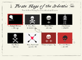 Pirate flags Ardentic.png 1,988 × 1,436; 225 KB
 PiscipulaFlag.png 500 × 300; 17 KB
 Podoliaflag.png 1,200 × 800; 7 KB
 Province d'ambroisine.jpg 465 × 274; 39 KB
 Province d'Hamiscie.jpg 464 × 273; 58 KB
 Province de galésie.jpg 465 × 274; 29 KB
 Province de haute galesie.jpg 464 × 273; 33 KB
 Province de Landerose.jpg 465 × 274; 35 KB
 Province de Transgalésie.jpg 465 × 274; 40 KB
 Province du Daragon.jpg 385 × 242; 35 KB
 Province du Kerohan.jpg 465 × 274; 31 KB
 Province Galesie orientale.jpg 447 × 263; 37 KB
 Puazsâ̄jjvé flag.png 1,088 × 666; 617 KB
 QAI Flag.png 1,024 × 512; 50 KB
 QFC Flag.png 1,344 × 797; 220 KB
 QolnaMauretanaFlag.png 502 × 360; 6 KB
 Quendarú.jpg 550 × 400; 12 KB
 Quenexia Flag.png 1,000 × 600; 103 KB
 Reeland flag.svg 1,600 × 1,000; 1.24 MB
 Republic of Cinasia.png 1,920 × 960; 47 KB
 Riederland Flag.png 1,500 × 1,000; 33 KB
 RifaleyaFlag.png 502 × 360; 33 KB
 Riyatoma flag.svg 600 × 400; 1 KB
 Rüthingen flag.png 1,024 × 614; 42 KB
 Saintmargaret flag.png 3,000 × 1,800; 238 KB
 Sainzaul flag.png 1,080 × 720; 17 KB
 San Juan Flag.png 800 × 532; 78 KB
 Sangria flag.svg 325 × 216; 1.2 MB
 Sastuant Flag.png 1,000 × 600; 103 KB
 Schersen flag.png 1,024 × 614; 10 KB
 Schnelldorf Flag.png 812 × 477; 13 KB
 Selonia and Flamain flag.PNG 1,138 × 815; 9 KB
 Shinsun.svg 512 × 341; 7 KB
 Shōlyon flag.svg 600 × 400; 822 bytes
 Silland country flag.png 583 × 369; 16 KB
 SinegradFlag.svg 805 × 537; 2 KB
 Sirvan flag.png 812 × 533; 42 KB
 Staporning-Vandagad Coat of Arms.png 465 × 552; 34 KB
 Staporning-Vandagad Flag.png 800 × 494; 16 KB
 Stefalen flag.png 1,024 × 614; 30 KB
 SuvumaFlag.png 640 × 384; 18 KB
 Syraénčdâflag.png 637 × 392; 33 KB
 Takora Flag.svg 360 × 240; 467 bytes
 Takorado flag.png 338 × 225; 15 KB
 Tamor flag.jpg 1,125 × 675; 19 KB
 TangereyaFlag.png 502 × 360; 7 KB
 Tassauny Flag.png 800 × 494; 27 KB
 Tatany Flag.png 800 × 494; 2 KB
 Teguteca flag.png 959 × 639; 23 KB
 Telkarnatha flag.png 2,000 × 1,333; 66 KB
 Tempache flag.png 1,360 × 750; 6 KB
 Tempeira Flag.png 711 × 474; 14 KB
 Tenata Flag.png 1,000 × 600; 24 KB
 Teotiyolcan-flag.png 1,440 × 882; 192 KB
 Thasporia Coat of Arms.png 465 × 552; 80 KB
 Thasporia Flag.png 800 × 494; 39 KB
 The Flag of Ateria.png 2,700 × 1,800; 47 KB
 Tircambry-ct-arthenion-flag.png 1,000 × 600; 25 KB
 Tircambry-ct-caerarthen-flag.png 1,000 × 600; 25 KB


