Clamash

|
State of Clamash Capital: Clifford
Population: 2,081,745 (2022) Motto: Your Next Adventure |
Loading map... |
Clamash, officially the State of Clamash, is a state of the Federal States. The state is situated along the coast of the Asperic Ocean, with an international border with the Deodeca (Provinces of Peralia, Nawagan, and Riverina) to the west, the state of Tauhon to the north, the state of Sierra to the northeast, state of Riopoderos to the east, Wychelle to the southeast, and state of Illuvia to the south. Clamash is well known for the Cordilleras. Other important geographical features in the state include the Henrietta River Valley and Limestone Hills. Due to its location and topography, Clamash is one of the rainiest states.
The state's name derives from the Clamash River, which's name is derived from the Castellanese "clamar" in reference to the former Blanco Rapids. Clamash has just over 2 million residents.
The largest city in Clamash is Wahanta, with approximately 62.22% of the state's population in the metropolitan area (Trentonson, Meade, & San Ramon Counties). Wahanta is an important industrial and economic hub, developed as a port and rail hub for commodities of the West Lakes region. While transportation remains the principal sector of the city's business base, Wahanta has become a major center of the FSA insurance industry.
The state capital, Clifford, is part of the Wahanta-Clifford Metropolitan Area. Clifford is an older city than Wahanta and was originally a Castellanese mission. The city is home to the unicameral state government, which is the chief sector of the local economy. Clifford is home to Spiritus Apparitio University which is located at the site of the original mission.
Other important cities include:
-Gantiac, which is located at the crossroads of FS-50 and FS-91 and is home to the flagship state land-grant university, University of Clamash-Gantiac.
-Cook Springs, which is located in the Cordilleras. Cook Springs was named for the Cook Hot Springs, which are now a resort. The city is a popular year-round destination for locals, second-home buyers, and tourists. The 1996 Pax Nova Winter Games were held in Cook Springs.
-Saunebago, which is located in southern Clamash at the crossroads of FS-40 and FS-91. Saunebago is the economic hub of the southern half of the state.
Area
Area = 101,741.90 square kilometers
Area = 39,282.77 square miles
History
Before Ulethan settlement, Native Archantan tribes including the Pahareek, Burrakoo, Nantee, Lumquah, Saunebago, and Gahaha.
The northern Clamashegian coast was settled by the Castellanese in the early 1700s. Despite the fertility of the Henrietta River valley, the Castellanese only founded a few coastal settlements including San Ramon. After a few skirmishes with Ingrean colonists from Deodeca, Castelan ceded all territory claims in present day Clamash. After Deodeca's independence from Ingrea, Clamash became a province in the nation of Deodeca. It was not until the 1842 when Clamash became territory of FSA through the Clamash Purchase. In 1866, the State of Clamash was admitted to the union.
Geography
Clamash is notable for its diverse geography, which include ocean coast with barrier islands, plains, highlands, and mountains.
Asperic Ocean Coast
Six of Clamash's forty-four (44) counties are located along the Asperic Ocean Coast (Briggs, Meade, McLeod, Purchase, San Ramon, and Trentoson). The coast of Clamash is protected by numerous sandy barrier islands. The coastal plain historically was a mixed forest consisting of both broadleaf deciduous trees and needle-leaved coniferous trees. In present day, the coastal plain serves as productive farmland, while the more highland terrain remains wooded. Coastal Clamash is home to the majority of the population of Clamash including the Wahanta-Clifford metropolitan area.
Plains
The plains region stretches from the northern border to the southern border between the Limestone Hills and the Cordilleras. Thirty (30) of Clamash's forty-four (44) counties are partially or wholly located in the plains. The Clamash plains are mostly rolling hills of mixed grass prairie, but also include wetlands and forested bluffs. Presently, the plains are mainly farmland and rangeland along with small farming villages and towns. Corn, soybeans, oats, and alfalfa are typically crops. Irrigation water is available from both surface and subterranean sources. Surface water sources include the Henrietta River watershed and Union River watershed. Subterranean sources, such as the Central Aquifier, are is generally accessed through artesian wells
Highlands - Limestone Hills
The highlands region of Clamash primarily consists of the isolated mountain range known as the Limestone Hills. Nine (9) of Clamash's forty-four (44) counties are located in the highlands region. The Limestone Hills are located in Clamash and the Deodecan province of Peralia. The Limestone Hills are primarily coniferous forest. It encompasses the Limestone Hills State Forest and McFranklin State Forest. The hills are so called because of the prevalance of exposed limestone.
Mountains - The Cordilleras
Along the eastern border of Clamash rises the western slope of the Cordilleras. Thirteen (13) of Clamash's forty-four (44) counties are located in the mountain region, either wholly or partially. The tallest peaks of Clamash are found in the Cordilleras with notable peaks including Meades Peak and Grallois Peak. This area drains primarily to the west via the Henrietta River watershed and Yellow Frog River watershed. The Cordilleras of Clamash includes several terrains from apline mountains to basins to canyons. It is the least populous area of Clamash with only one community over 30,000 (Cook Springs).
Natural Landforms
The tallest peaks of Clamash are listed in the table below. All peaks are located in the Cordilleras mountain range.
| Rank | Name | County | Height |
|---|---|---|---|
| 1 | Meades Peak | Verde County | 4418 meters |
| 2 | Mount Yallis | Verde County | 3891 meters |
| 3 | Wisner Peak | Verde County | 3487 meters |
| 4 | Grallois Peak | Verde County, CL & Floyd County, RS | 3429 meters |
| 5 | Hideout Mountain | Verde County | 3150 meters |
| 6 | Crobels Folly | Verde County | 2963 meters |
| 7 | Teekwole Peak | Verde County | 2915 meters |
| 8 | Wintereon Peak | Verde County | 2866 meters |
| 9 | Golgate Mountain | Verde County | 2709 meters |
| 10 | Mount St. Grewald | Verde County | 2702 meters |
| 11 | Parker Peak | Verde County | 2602 meters |
| 12 | Mount Stocksmith | Verde County | 2601 meters |
| 13 | Scout Mountain | Verde County | 2583 meters |
| 14 | Marmot Peak | Verde County | 2573 meters |
| 15 | Short's Mountain | Verde County | 2513 meters |
Rivers
The State of Clamash takes its from the Clamash River, a navigable river forming the majority of the Clamash-Tauhon Border.
The longest and largest river in Clamash is the Henrietta River and nearly 80% of the state is located in its watershed. The Henrietta River is 427.42 miles long. The Henrietta River takes it name from Henrietta Prinkletter, the daughter of the Clamash Province Governor George Prinkletter. Major tributaries of the Henrietta River include the Udlith River, Big Verde River, Gahaha River, War Creek, Indigo River, Brome River, and Big Keskee River.
The Union River is the largest river in southern Clamash and drains into Lake Amanecer. Major tributaries of the Union River include the Ingram River and Yellow Frog River.
The Grenoke River is the largest river in the Clamashegian portion of the Limestone Hills and drains the interior of the hills.
The headwaters of the Jersey and McDougall Rivers are also located in the Limestone Hills.
| Rank | Name | Mouth | Total Length | Length in Clamash (mi) | Source | States, Provinces, and Clamash Counties |
|---|---|---|---|---|---|---|
| 1 | Henrietta River | Asperic Ocean (Meade County) | 427.42 | Boshokie County, CL | Clamash (Boshokie, Henrietta, Woodbine, Blaney, Grover, Merryman, Nash, Pahareek, Grelling, Strawes, Kennard, Plummer, Valley, Nepoee, Trentonson, San Ramon, and Meade Counties) | |
| 2 | Jersey River | Asperic Ocean (Peralia) | 200.83 | 11.82 | Darracott County, CL | Clamash (Darracott County), Peralia |
| 3 | McDougall River | Mullumbidgee River (Peralia) | 161.81 | 15.14 | Lindley County, CL | Clamash (Lindley County), Peralia |
| 4 | Gahaha River | Henrietta River (Plummer County) | 154.85 | 154.11 | Peralia, Deodeca | Peralia, Clamash (Mannon, Lindley, Huntington, Darracott, Grelling, Plummer Counties) |
| 5 | Union River | Wahauja River (Confluence County) | 142.31 | 33.90 | Boshokie County, CL | Clamash (Boshokie and Ralley Counties), Illuvia |
| 6 | Big Verde River | Henrietta River (Valley County) | 133.05 | 127.31 | Floyd County, RS | Riopoderos, Clamash (Verde, Sidney, Hillman, and Valley Counties |
| 7 | Grenoke River | Henrietta River (Meade County) | 124.94 | Darracott County, CL | Clamash (Darracott, Lowell, Purchase, Cortizas, and Meade Counties) | |
| 8 | Indigo River | Henrietta River (Nash County) | 120.27 | 117.95 | Prahlow County WY | Wychelle (Prahlow County), Clamash (Sanawappan, Grover, Merryman, & Nash Counties) |
| 9 | Clamash River | Asperic Ocean (Briggs County) | 116.70 | 64.82 | Tauhon | Tauhon, Clamash (Gardiwapeka and Briggs Counties) |
| 10 | Yellow Frog River | Union River (Ingram County) | 89.81 | 41.05 | Wychelle | Wychelle, Clamash (Yellow Frog County), Illuvia |
| 11 | Udlith River | Henrietta River (Trentonson County) | 87.54 | McGeorge County, CL | Clamash (McGeorge & Trentonson Counties) | |
| 12 | Little Verde River | Big Verde River (Hillman County) | 85.26 | 63.39 | Tauhon | Tauhon, Sierra, Clamash (Sidney, McGeorge and Hillman Counties) |
| 13 | West Gahaha River | Gahaha River (Darracott River) | 79.10 | Darracott County, CL | Clamash (Darracott and Chester Counties) | |
| 14 | Brome River | Henrietta River (Blaney County) | 77.77 | Chalmers County, CL | Clamash (Chalmers, Rudeen, and Blaney Counties) | |
| 15 | Big Keskee River | Henrietta River (Merryman County) | 77.28 | Swanson County, CL | Clamash (Swanson, Henrietta, Clayton, & Merryman Counties) | |
| 16 | Moosehorn River | Big Verde River (Verde County | 67.93 | Verde County, CL | Clamash (Verde County) | |
| 17 | War Creek | Henrietta River (Nash County) | 64.47 | Wamboldt County, CL | Clamash (Wamboldt, Foster, and Nash Counties) | |
| 18 | Eckawapanee River | Henrietta River (Nash County) | 64.16 | Butte County, CL | Clamash (Nash & Butte Counties) | |
| 19 | Denada River | Henrietta River (Grelling County) | 61.40 | Strawes County, CL | Clamash (Strawes and Grelling Counties) | |
| 20 | Ogatakan River | Henrietta River (Pahareek County) | 60.83 | Foster County, CL | Clamash (Foster, Nash, & Pahareek Counties) | |
| 21 | Ingram River | Union River (Ingram County, Illuvia) | 58.66 | 52.49 | Chalmers County, CL | Clamash (Chalmers & Ralley Counties), Illuvia |
| 22 | Trout River | Brome River (Albin County) | 57.21 | Albin County, CL | Clamash (Albin County) | |
| 23 | Limestone River | Henrietta River (Meade County) | 55.81 | Lowell County, CL | Clamash (Lowell, Nepoee, and Meade Counties) | |
| 24 | Cannover Creek | Henrietta River (Pahareek County) | 54.94 | Foster County, CL | Clamash (Foster, Onslow, and Pahareek Counties) | |
| 25 | Simskagi River | Henrietta River (Pahareek County) | 54.45 | Puma County, CL | Clamash (Puma and Pahareek Counties) | |
| 26 | Wolf Creek | Henrietta River (Merryman County) | 54.21 | Wamboldt County, CL | Clamash (Wamboldt and Merryman Counties) | |
| 27 | Rock River (incomplete) | TBD | TBD | 51.29 | Chalmers County, CL | Clamash (Chalmers & Yellow Frog Counties), Illuvia |
| 28 | Saunebago River | Henrietta River (Woodbine County) | 50.57 | Ralley County, CL | Clamash (Ralley & Woodbine Counties) | |
| 29 | McLeod River | Asperic Ocean (Peralia) | 49.92 | 13.73 | Purchase County, CL | Clamash (Purchase County), Peralia |
| 30 | Boppson Creek | Gahaha River (Darracott County) | 49.32 | Chester County, CL | Clamash (Chester, Huntington, and Darracott Counties) | |
| 31 | Cooper Creek | Henrietta River (Nepoee County) | 49.25 | Lowell County, CL | Clamash (Lowell, Plummer and Nepoee Counties) | |
| 32 | Southern Pike Creek | Henrietta River (Merryman County) | 49.21 | Albin County, CL | Clamash (Albin, Grover, and Merryman Counties) | |
| 33 | Raging Fork River | Brome River (Rudeen County) | 46.47 | Rudeen County, CL | Clamash (Rudeen County) | |
| 34 | Middle Gahaha River | Gahaha River (Huntington County) | 45.47 | Chester County, CL | Clamash (Chester and Huntington Counties) | |
| 35 | Moseby River | Henrietta River (Grover County) | 44.69 | Woodbine County, CL | Clamash (Woodbine, Clayton, Blaney and Grover Counties) | |
| 36 | Fawn Creek | Henrietta River (Valley County | 43.92 | Sidney County, CL | Clamash (Sidney, Hillman, Kennard, and Valley Counties) | |
| 37 | Oketa River | Henrietta River (Kennard County) | 40.82 | Sidney County, CL | Clamash (Sidney and Kennard Counties) | |
Lakes
Most lakes in Clamash are either manmade or oxbow lakes. The largest lake in Clamash is Lake Spalding, while the largest natural lake is Floyd Lake located in the northeastern part of the state.
| Rank | Name | Clamash Counties | Area | Type |
|---|---|---|---|---|
| 1 | Lake Spalding | Grelling & Darracott Counties | 12.188 square miles | Man-made |
| 2 | Lake Louisa | Rudeen County | 8.204 square miles | Man-made |
| 3 | Rubicue Lake | Trentonson County | 3.399 square miles | Man-made |
| 4 | Fawn Creek Reservoir | Kennard County | 3.808 square miles | Man-made |
| 5 | Floyd Lake | Sidney County | 2.715 square miles | Natural |
| 6 | Arborland Reservoir | Merryman & Swanon Counties | 1.745 square miles | Man-made |
| 7 | Rowley Lake | Valley County | 1.041 square miles | Man-made |
| 8 | Lake Triloka | Puma County | 511.347 acres | Natural |
| 9 | Grebe Lake | Ralley County | 473.146 acres | Man-made |
| 10 | Covered Wagon Lake | Nash County | 304.582 acres | Man-made |
| 11 | Marvin Oaks Lake | Meade County | 244.791 acres | Man-made |
| 12 | Yalensky Lake | Trentonson & Gardiwapeka Counties | 239.309 acres | Man-made |
| 13 | Unnamed Lake | Onslow County | 230.678 acres | Natural |
| 14 | Chalmers Reservoir | Huntington County | 159.019 acres | Man-made |
| 15 | Lake Winterby | San Ramond County | 149.017 | Man-made |
| 16 | Marsh Lake | Pahareek County | 97.282 acres | Oxbow |
| Islands
There are several islands located in the State of Clamash. Most islands are either located along the coast or in the Henrietta River delta.
| Rank | Name | Clamash Counties | Area | Type |
|---|---|---|---|---|
| 1 | Folkerts Island | McLeod County | Peralia, Deodeca | 2.91 sq mi | Barrier |
| 2 | Ranatope Island | Meade County | 2.789 sq mi | Barrier |
| 3 | Maystead Island | San Ramon County | 2.409 sq mi | Barrier |
| 4 | Featherton Island | Meade County & Purchase County | 2.313 sq mi | Barrier |
| 5 | Canetuck Island | San Ramon County & Trentonson County | 1.710 sq mi | Barrier |
| 6 | Deodeca Island | San Ramon County | 1.691 sq mi | River |
| 7 | Headsail Island | Trentonson County | 1.532 sq mi | Barrier |
| 8 | Toffey Island | Briggs County & San Ramon County | 1.525 sq mi | Barrier |
| 9 | King's Sliver | Meade Couty & Trentonson County | 1.401 sq mi | Barrier |
| 10 | Unnamed Island | Meade County | 625.571 acres | River |
| 11 | Stedman Banks | McLeod County | 552.650 acres | Barrier |
| 12 | Unnamed Island | Meade County | 406.377 acres | River |
| 13 | Woopeek Island | Purchase County | 401.707 acres | Barrier |
| 14 | Strawberry Island | McLeod County & Purchase County | 363.118 acres | Barrier |
| 15 | Bokesboro Banks | Briggs County | 348.675 acres | Barrier |
| 16 | Fisher Island | Purchase County | 341.985 acres | Barrier |
| 17 | Dog Island | McLeod County | 330.565 acres | Barrier |
| 18 | Big Shoal | San Ramon County | 282.525 acres | Shoal |
| 19 | Neville Island | Meade County | 276.259 acres | River |
| 20 | Sheep Island | Meade County | 265.491 acres | Barrier |
| 21 | Wilbert Island | Meade County | 246.451 acres | River |
| 22 | Bosselman Island | Trentonson & Meade Counties | 199.406 acres | River |
| 23 | Oyster Island | Meade County | 195.351 acres | Shoal |
Government
State Government
Unlike most state legislatures, Clamash has a unicameral legislature.
Administrative Divisions
Clamash is divided into 44 counties.
List of Counties
| Name | County Seat | Largest City | Area in km² | Area in sq mi | Population | Population per sq mi |
|---|---|---|---|---|---|---|
| Albin County | Richland | Stakesville | 2,707.10 | 1,049.08 | 4,193 | 4.00 |
| Blaney County | Brookford | Brookford | 1,489.64 | 575.16 | 3,115 | 5.42 |
| Boshokie County | Boshokie Center | Boshokie Center | 1,515.17 | 585.01 | 7,248 | 12.39 |
| Briggs County | Port Union | Port Union | 1,475.74 | 569.78 | 62,381 | 109. |
| Butte County | Gray Rock | Gray Rock | 2,900.34 | 1,119.83 | 5,279 | 4.71 |
| Chalmers County | Brome | Brome | 1,845.33 | 712.49 | 4,422 | 6.21 |
| Chester County | Theoville | Theoville | 1,685.78 | 650.88 | 1,696 | 2.61 |
| Clayton County | Lawfield | Lawfield | 1,821.62 | 703.33 | 2,565 | 3.65 |
| Darracott County | West Gahaha | West Gahaha | 2,326.85 | 898.40 | 3,506 | 3.90 |
| Foster County | Herbert | Brantgomery | 2,017.11 | 778.81 | 1,804 | 2.32 |
| Gardiwapeka County | Tauhon City | Tauhon City | 2,515.69 | 971.31 | 15,089 | 15.53 |
| Grelling County | Grawton | Grawton | 2,399.67 | 926.52 | 12,663 | 13.67 |
| Grover County | Jessamine | Appahappa | 1,999.38 | 771.96 | 3,844 | 4.98 |
| Henrietta County | Ardentic | Ardentic | 2,269.77 | 876.36 | 9,731 | 11.10 |
| Hillman County | Vanito | Trowell | 1,557.16 | 601.22 | 2,436 | 40.5 |
| Huntington County | Quitman | Quitman | 2,335.73 | 901.83 | 6,187 | 6.86 |
| Kennard County | Normsfield | Normsfield | 1,796.87 | 693.78 | 3,438 | 4.96 |
| Lindley County | Arrowhead | Bovina | 2,582.90 | 997.26 | 6,564 | 6.58 |
| Lowell County | Federal Camp | Federal Camp | 2,102.32 | 811.71 | 3,587 | 4.42.42 |
| Mannon County | Tekbota | Tekbota | 1,869.00 | 721.62 | 2,875 | 3.98 |
| McGeorge County | Willoch | Red Owl | 3,596.39 | 1,388.58 | 1,392 | 1.00 |
| McLeod County | Port McLeod | Port McLeod | 2,221.49 | 857.72 | 15,415 | 17.97 |
| Meade County | Clifford | Clifford | 1,560.44 | 602.49 | 518,855 | 861.18 |
| Merryman County | Andersen | Andersen | 1,489.64 | 575.16 | 8,438 | 14.67 |
| Nash County | Supurb | Rexville | 2,196.00 | 847.88 | 7,487 | 8.83 |
| Nepoee County | Chambersville | Chambersville | 1,954.23 | 754.53 | 7,072 | 9.37 |
| Onslow County | Stevensport | Stevensport | 1,933.84 | 746.66 | 5,443 | 7.29 |
| Pahareek County | Dunlap | Dunlap | 2,691.46 | 1,039.18 | 35,870 | 34.52 |
| Plummer County | Fort Bellis | Fort Bellis | 2,042.54 | 788.63 | 22,993 | 29.16 |
| Puma County | Thorbecke | Thorbecke | 2,938.39 | 1,134.52 | 4,940 | 4.35 |
| Purchase County | New Watson | New Watson | 1,918.98 | 740.92 | 7,956 | 10.73 |
| Ralley County | Green Point | Bannetoon | 1,954.90 | 754.79 | 24,455 | 32.40 |
| Rudeen County | Louisa | Louisa | 2,762.15 | 1,066.47 | 2,246 | 2.11 |
| San Ramon County | San Ramon | Robertsville | 1,486.90 | 574.09 | 39,193 | 68.27 |
| Sanawappan County | Indigo Rapids | Indigo Rapids | 2,182.42 | 842.64 | 3,551 | 4.21 |
| Sidney County | Marcher | Marcher | 4,675.47 | 1,805.21 | 7,041 | 3.90 |
| Strawes County | Verving | Verving | 5,117.63 | 1,975.93 | 2,110 | 1.07 |
| Swanson County | Antelope | Franzer | 1,851.57 | 714.89 | 5,752 | 8.05 |
| Trentonson County | Wahanta | Wahanta | 1,934.65 | 746.97 | 726,120 | 972.09 |
| Valley County | Gantiac | Gantiac | 1,606.06 | 620.10 | 67,695 | 109.17 |
| Verde County | Cook Springs | Cook Springs | 4,424.19 | 1,708.19 | 43,197 | 25.29 |
| Wamboldt County | Lyonburg | Plains Grove | 2,061.30 | 795.87 | 4,608 | 5.79 |
| Woodbine County | Saunebago | Saunebago | 2,024.45 | 781.64 | 57,426 | 73.47 |
| Yellow Frog County | Kokodoji | Hayson | 2,937.78 | 1,134.28 | 8,198 | 7.23 |
Municipalities
Incorporated communites in Nebraska are legally classified as cities or villages, depending on their population. Cities are further subdivided into three categories: Metropolitan (200,000 or more) , First-Class (20,000-199,999), Second-Class (4,000-19,999), and Third-Class (1,000-3,999). Of Clamash's 244 municipalities, 75 are cities and 169 are villages.
| Rank | Name | Classification | 2023 Estimate | County | Metropolitan/Micropolitan Area | MSA Population |
|---|---|---|---|---|---|---|
| 1 | Wahanta | Metropolitan | 554,955 | Trentonson | Wahanta-Clifford Metropolitan Area | 1,369,195 |
| 2 | Clifford | Metropolitan | 269,277 | Meade | Wahanta-Clifford Metropolitan Area | |
| 3 | Sprucewood | First-Class | 59,221 | Meade | Wahanta-Clifford Metropolitan Area | |
| 4 | Gantiac | First-Class | 57,664 | Valley | Wahanta-Clifford Metropolitan Area | |
| 5 | Port Union | First-Class | 49,124 | Briggs | Port Union Micropolitan Area | 62,381 |
| 6 | Land Park | First-Class | 45,321 | Meade | Wahanta-Clifford Metropolitan Area | |
| 7 | Saunebago | First-Class | 41,893 | Woodbine | Saunebago Micropolitan Area | 65,820 |
| 8 | Cook Springs | First-Class | 34,719 | Verde | Cook Springs Micropolitan Area | 50,795 |
| 9 | Huntington Heights | First-Class | 24,952 | Meade | Wahanta-Clifford Metropolitan Area | |
| 10 | Dunlap | First-Class | 23,897 | Pahareek | Dunlap Micropolitan Area | 35,870 |
| 11 | Robertsville | First-Class | 21,918 | San Ramon | Wahanta-Clifford Metropolitan Area | |
| 12 | Wardsville | Second-Class | 17,520 | Trentonson | Wahanta-Clifford Metropolitan Area | |
| 13 | Morningside Hills | Second-Class | 16,882 | Meade | Wahanta-Clifford Metropolitan Area | |
| 14 | Vista Orchard | Second-Class | 15,893 | Trentonson | Wahanta-Clifford Metropolitan Area | |
| 15 | Lakefield | Second-Class | 14,070 | Trentonson | Wahanta-Clifford Metropolitan Area | |
| 16 | Fort Bellis | Second-Class | 11,526 | Plummer | ||
| 17 | Valley Grove | Second-Class | 9,162 | Trentonson | Wahanta-Clifford Metropolitan Area | |
| 18 | San Ramon | Second-Class | 8,473 | San Ramon | Wahanta-Clifford Metropolitan Area | |
| 19 | Port McLeod | Second-Class | 7,495 | McLeod | ||
| 20 | Tauhon City | Second-Class | 6,715 | Gardiwapeka | ||
| 21 | Waterbury Heights | Second-Class | 6,480 | Trentonson | Wahanta-Clifford Metropolitan Area | |
| 22 | Ardentic | Second-Class | 6,117 | Henrietta | ||
| 23 | Grawton | Second-Class | 5,774 | Grelling | ||
| 24 | Budlee | Second-Class | 5,226 | Trentonson | Wahanta-Clifford Metropolitan Area | |
| 25 | Bannetoon | Second-Class | 5,005 | Ralley | Fort Braxton MSA* | TBD |
| 26 | Alvinale | Second-Class | 4,220 | Meade | Wahanta-Clifford Metropolitan Area | |
| 27 | Lake Kanawa | Third-Class | 3,972 | Woodbine | Saunebago Micropolitan Area | |
| 28 | Merryman | Third-Class | 3,882 | Plummer | ||
| 29 | Andersen | Third-Class | 3,681 | Merryman | ||
| 30 | Thorbecke | Third-Class | 3,118 | Puma | ||
| 31 | Rockfall | Third-Class | 2,918 | Verde | Cook Springs Micropolitan Area | |
| 32 | Indigo Rapids | Third-Class | 2,916 | Sanawappan | ||
| 33 | Dorothy | Third-Class | 2,899 | Pahareek | Dunlap Micropolitan Area | |
| 34 | Pocksville | Third-Class | 2,855 | Trentonson | Wahanta-Clifford Metropolitan Area | |
| 35 | Youngsville | Third-Class | 2,787 | Trentonson | Wahanta-Clifford Metropolitan Area | |
| 36 | Boshokie Center | Third-Class | 2,714 | Boshokie | ||
| 37 | Chambersville | Third-Class | 2,693 | Nepoee | ||
| 38 | Headsail Island | Third-Class | 2,688 | Trentonson | Wahanta-Clifford Metropolitan Area | |
| 39 | Rushton | Third-Class | 2,665 | Valley | Wahanta-Clifford Metropolitan Area | |
| 40 | Gray Rock | Third-Class | 2,662 | Butte | ||
| 41 | Riverview | Third-Class | 2,380 | Meade | Wahanta-Clifford Metropolitan Area | |
| 42 | Marcher | Third-Class | 2,065 | Sidney |
Economy
The largest sectors in Clamash's economy are agricultural, forestry, tourism, healthcare, manufacturing, transportation, and financial/insurance. The Wahanta-Clifford metropolitan area is the economic center of the state.
| Name | Headquarters | Economic Sector/Industry | Brands | Notes |
|---|---|---|---|---|
| Mutual of Wahanta | Wahanta | Insurance | Mutual of Wahanta owns the second tallest building in Clamash and the naming rights to the major league baseball stadium in Wahanta | |
| Prudent Choice Investments | Wahanta | Financial Services | Prudent Choice Investments owns the naming rights to the major league gridiron stadium in the Wahanta metropolitan area. | |
| Second National Bank (of Clamash) | Wahanta | Banking | Largest privately-owned bank in Clamash | |
| ConcordaHealth | Wahanta | Healthcare | ConcordaHealth owns the naming rights to the major league soccer stadium in Wahanta | |
| Bassett-Leyton Hotel Brands | Wahanta | Lodging | The Bassett, Consulate Suites, Leyton Hotel, Restfield Inn, Bassett Botanica Inn, Patio by Bassett, ArchantInn, Morningsky Inn, | |
| Huckelberry's | Land Park | Fast Food Restaurants | Huckelberry's, Barzona Chicken Company | International fast-food restaurant company |
| Cordilleras Southern Railroad | Wahanta | Railroad Transportation | Cordilleras Southern owns the tallest building in Clamash. | |
| Greeley Mart | Land Park | Retail Supercenters | ||
| WLT Advisors | Wahanta | Financial Services | ||
| TaxFSA | Wahanta | Tax Preparation | TaxFSA owns the naming rights to the basketball/hockey arena in Wahanta. | |
| S&S Foods | Wahanta | Supermarkets | Swift Saver, GUDBY | |
| Breeze | Clifford | Vehicle Rentals | Breeze, Cheep Rent-a-Car | |
| PLICO | Gantiac | Insurance | ||
| LunarBeam | Telecommunications | |||
| Bank of the Cordilleras | Banking | |||
| Briggs-Lionheart Financial | Wahanta | Financial Services | ||
| MontanaWeston | Alcoholic Beverages | Otto Weston | The original Otto Weston brewery is located in the City of Wahanta. | |
| Granlar | Wahanta | Agricultural Commodities | ||
| Graxton's | Huntington Heights | Retail - Pharmacy | ||
| Bradfords | Land Park | Supermarkets | ||
| Fossill-7M | Port Massehanee, Alormen | Petroleum | Fossill, SevenMiles, Raceday, Rudd Bros. | The headquarters of Fossill was originally in Clifford, but moved to Alormen after consolidation with SevenMiles. |
| Rook & Knight Financial | Clifford | Financial Services | ||
| Kerbys Farm & Ranch Supply | Saunebago | Retail - Farm and Ranch Supplies | ||
| Fieldlander | Agricultural Equipment Manufacturer | |||
| Fitzpatrick Auto Parts | Retail - Auto Parts | |||
| Thriftwell | Retail - Thrift Store | |||
| Price Pointe | Retail - Variety Store | |||
| Ames Executive Entertainment | Wahanta | Casino & Lodging | VICE President Casino, Amulet Casino, Hotel Zzz | |
| Top Archantan | Port Union | Food Processing |
Culture
Arts
| Name | Location | Type |
|---|---|---|
| Name | Location | Type |
|---|---|---|
Sports
| Team | Home | Sport | League |
|---|---|---|---|
| Wahanta Scouts | Wahanta - Mutual of Wahanta Stadium | Baseball | |
| Wahanta Whirlpool | Wahanta - TaxFSA Center Arena | Basketball | |
| Sporting Wahanta | Wahanta - ConcordaHealth Field | Soccer | |
| Wahanta Mammoths | Wahanta - TaxFSA Center Arena | Ice Hockey | |
| Wahanta Warthogs | Lakefield - Prudent Choice Stadium | ||
| Clifford Cruisers | Clifford - Chopwitz Arena | Ice Hockey | |
| Sprucewood - Clamash Speedway | Racing |
| Team | School | City | Division | Football | Basketball (M/W) | Baseball | Softball | Ice Hockey (M/W) | Soccer (M/W) | Wrestling | Cross Country | Track & Field | Tennis |
|---|---|---|---|---|---|---|---|---|---|---|---|---|---|
| University of Clamash - Gantiac | Gantiac | I | |||||||||||
| University of Clamash - Wahanta | Wahanta | I | |||||||||||
| University of Clamash - Port Union | Port Union | II | |||||||||||
| University of Clamash - Saunebago | Saunebago | II | |||||||||||
| McKnight University | Wahanta | I | |||||||||||
| Rancaster University | Cook Springs | II | |||||||||||
| Clamash Bartholomewan University | Wahanta | II | |||||||||||
| Spiritus Apparitio University | Clifford | II | |||||||||||
| Clifford University | Clifford | I | |||||||||||
| Grawton College | Grawton | III | |||||||||||
| Glenwood College | Wahanta | III | |||||||||||
| Evergreen College | Wahanta | III |
Education
The State of Clamash has one univeristy system, one state college system, and one community college system. Each system is overseen by a Board of Regents.
University of Clamash System
- University of Clamash - Gantiac (flagship campus)
- University of Clamash - Wahanta
- University of Clamash - Port Union
- University of Clamash - Saunebago
Clamash State College System
- Brampton State College - Brampton
- Cook Springs State College - Cook Springs
- Muehling State College - Muehling
- Dunlap State College - Dunlap
- Clamash Mountain State College - Stakesville
- Confluence State College - Confluence
Community College Systems
- Northern Clamash Community College - Clamash Valley (Tauhon City), San Ramon, Lakefield, City Center (Wahanta), Jane Valley (Huntington Heights), and Clifford
- Eastern Clamash Community College - Marcher and Cook Springs,
- Mid-Clamash Community College - South Coast (Brubecks), Fort Bellis, and Gantiac
- Clamash Valley Community College - Quitman, Clamash Tribal (Bovina), Dunlap, and Thorbecke
- Southern Clamash Community College - Andersen, Ardentic, Saunebago, and Bannetoon
Private Colleges/Universities
- Wildwood College - Robertsville
- Udlith Valley University - Wardsville
- McKnight University - Wahanta
- Evergreen College - Wahanta
- Glenwood College - Wahanta
- Clamash College of Technology - Wahanta
- Lyman College - Wahanta
- Clamash Bartholomewan University - Wahanta
- Mount Mirgo Seminary - Wahanta
- Clifford University - Clifford
- Spiritus Apparitio University - Clifford
- Grawton College - Grawton
- Rancaster University - Cook Springs
- Verde View University - Gantiac
- Grace College - Supurb
Transportation
The three primary motorways in Clamash are FS-40, FS-5, and FS-8. Other motorways can be found in the Wahanta-Clifford Metropolitan Area including FS-305, FS- 608, and CL 78.
In 2009, the Clamash Department of Transportation started the Statewide Expressway Project in which significant routes would be upgraded to four-lane divided expressways. Due to a lack of funding, the majority of the project is still incomplete as of 2025. Completed expressways are CL 85 in Trentonson County and CL 43 in Meade County. In April 2025, construction completed on the Central Meade Beltway (CL 22) and Southern Meade Beltway (CL 54) in Meade County. Construction is underway and portions are completed of CL 47, which will connect Port Union with Tauhon City, CL 77, which will connect Clifford to Muehling and Deodeca, and CL 94 which will connect Finns Rapids to Lakewood. Other highways designated for upgrades are CL 31 from Gantiac to Tauhon City, CL 17 from Dunlap (FS 91) to Wychelle, and CL 15 from Waterbury Heights to San Ramon.
-
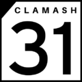 Clamash State Highway Shield for State Highway 31, the longest state route in Clamash.

The Sunsetter is a passenger rail service in west FSA. The main stations in Clamash are located in Wahanta, Cook Springs, Dunlap, Saunebago, and Gantiac. Freight rail lines cross the state connecting the Lakes Region with the Port of Wahanta and the port in Jundah, Tauhon.
There are four commercial airports in Clamash: Wahanta-Clifford International Airport, Cook Springs Regional Airport, Saunebago Regional Airport and Dunlap Regional Airport.
Protected Areas
| Name | Location | Acreage | Information |
|---|---|---|---|
| Fort Walprove National Historic Site | Wahanta | 53.54 acres | |
| Hurricane Caverns National Park | Sundan | ||
| Clamash Purchase National Monument | Clifford | 16.93 acres |
| Name | Location | Acreage | Information |
|---|---|---|---|
| Basin State Park | Basin | ||
| Clamash Bluffs State Park | Tauhon City | 1,895.04 acres | |
| Confuence State Park | Confluence | ||
| Fern Creek Falls State Park | Darsons | ||
| Floyd Lake State Park | Marcher | ||
| Headlands State Park | Pocksville | 12,089.60 acres | |
| Henry Sturholdt State Park | Wahanta | 7,036.16 acres | |
| Indigo Canyon State Park | Indigo Rapids | ||
| Lake Spalding State Park | West Gahaha | ||
| Old Limey State Park | Humor Springs | 1,718.4 acres | |
| Painted Caves State Park | Limestone | ||
| Poison Ivy Falls State Park | Granite | ||
| River Cave State Park | Humor Springs | ||
| Sundan State Park | Sundan | ||
| Tall Pine State Park | Thorbecke |
| Name | Location | Acreage | Information |
|---|---|---|---|
| Arborland Reservoir State Recreation Area | Elmland | ||
| Chadman State Recreation Area | Chadman | ||
| Chalmers Reservoir State Recreation Area | Quitman | ||
| Covered Wagon Lake State Recreation Area | Campbell | ||
| Crab Beach State Recreation Area | Dayport | 155.65 acres | |
| Fawn Creek Reservoir State Recration Area | Normsfield | ||
| Grebe Lake State Recreation Area | Vesper | ||
| Hausel Lake State Recreation Area | Hancaburg | 609.87 acres | |
| Henrietta River State Recreation Area | Rushram | 4,993.28 acres | |
| Lake Louisa State Recreation Area | Louisa | ||
| Lake Winterby State Recreation Area | Robertsville | 672.73 acres | |
| Pioneer State Recreation Area | Clifford | 1,569.28 acres | |
| Rubicue Lake State Recreation Area | Taylin | 5,751.68 acres | |
| Strawes Reservoir State Recreation Area | Mimrose | ||
| Tekbota State Recreation Area | Tekbota | ||
| Tenn Butte State Recreation Area | Tenn Butte | ||
| Yalensky Lake State Recreation Area | Wardsville | 1,534.72 |
| Name | Location | Acreage | Information |
|---|---|---|---|
| War Creek State Grassland | Herbert |
| Name | Location | Acreage | Information |
|---|---|---|---|
| Dalsey State Forest | Albin, Butte, Grover, Rudeen, and Sanawappan Counties | Heaquarters located in Indigo Rapids | |
| Gilbert State Forest | Bute, Pahareek, Puma, Sidney, Strawes, and Verde Counties | 2,354,076 acres | Headquarters located in Cook Springs |
| Limestone Hills State Forest | Darracott, Lowell, Meade, McLeod, Nepoee, Purchase, and Plummer Counties | Headquarters located in Galton Springs | |
| McFranklin State Forest | Chester, Huntington, and Lindley Counties | 197,712 acres | Headquarters located in Quitman |
| Meekewalop State Forest | Chalmers, Rudeen, and Yellow Frog Counties | Headquarters located in Granite | |
| San Ramon State Forest | Briggs, San Ramon, and Trentonson Counties | 89,859 acres | Headquarters located in Hancaburg |
| Verde Rivers State Forest | Gardiwapeka, Hillman, McGeorge, Sidney, Valley, and Verde Counties | 1,924,744 acres | Headquarters located in Cook Springs |
| Name | Location | Acreage | Information |
|---|---|---|---|
| Black Feather Hill State Historical Park | Kotzbauer | ||
| Castillo de San Ramon State Historical Park | San Ramon | 39.843 | |
| Debock Farm Fossil Beds State Historical Park | Franzer | ||
| Fort Brunell State Historical Park | Federal Camp | ||
| Fort Hunderstatt State Historical Park | Fort Hunderstatt | ||
| Kilby Mine State Historical Park | Stakesville | ||
| Raspberry Ridge Battlefield State Historical Park | Antler | ||
| Toleka Point State Historical Park | Toleka |
| Name | Location | Acreage | Information |
|---|---|---|---|
| Albert Zanuck State Wildlife Refuge | Federal Camp | ||
| Arborland Reservoir State Wildlife Refuge | Elmland | ||
| Blue Heron State Wildlife Refuge | Huntington Heights | 1,269.76 acres | |
| Brewster River Wildlife Refuge | Dayport | 7,842 acres | |
| Cottage Shore State Wildlife Refuge | Cottage Shore | 1,082.88 acres | |
| Deadwood State Wildlife Refuge | Grawton | ||
| Deodeca Island State Wildlife Refuge | Cottage Shore | 1,233.92 acres | |
| Hidden Gulch State Wildlife Refuge | Federal Camp | ||
| Johnson Bend State Wildlife Refuge | Kesterson | 1,164.16 acres | |
| Lumquah State Wildlife Refuge | Sullivan | ||
| Luna Lake State Wildlife Refuge | Ocelling | 357.09 acres | |
| Nedland Peak State Wildlife Refuge | Evelyn | ||
| Relko Creek State Wildlife Refuge | Lone Captain | 6,200.96 acres | |
| Sheep Island State Wildlife Refuge | Pocksville | 907.52 acres | |
| Slowpoke Creek State Wildlife Refuge | Humor Springs | ||
| Snyder Lake State Wildlife Refuge | Muehling | ||
| Sumner Marshes State Wildlife Refuge | Swann | ||
| West Muehling State Wildlife Refuge | Muehling | 17,472 acres |
| States |
Alcortez • |
|---|---|
| Capital District | Huntington(c) |
| Overseas Territories | |