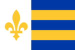
Des Plaines

|
State of Des Plaines Húraahkatuusu (Skiree) Capital: Steeletown
Population: 2,607,104 (2020) Motto: "L'agriculture est ce qui nous unit" ("Agriculture is what unites us") |
Loading map... |
Des Plaines, officially the State of Des Plaines, is a state located in the Federal States of Archanta, located in the Heartland region, it borders AR120-41 to the north, West Massodeya to the east, Mennowa and Tennewa to the south, and Riopoderos and Apawiland to the west. The topography of Des Plaines is mainly a giant plain, however in the east lies some valleys, and in the west comes buttes that stick out of the flat lands of the state. The state has a few notable cities, including Steeletown, Thinis, Ascopolis, Riviereburg, Skiree City, Wheatville, Fillmore, and Imperial Bluffs.
Etymology
Before Ulethan exploration, what is now Des Plaines was called "Húraahkatuusu", by the Skiree tribe, the word roughly translates to "Flat Land" in Ingerish. The name "Des Plaines" can be traced back to Valonian origins, as when Valorian explorers were exploring the region, they gave it the name "Les Aéchantans Indigènes des Plaines", which in Ingerish translates to "The Native Archantans of the Plains". This was due to the fact there was reportedly a decent amount of Native Archantans in the area. Later the name got shorten to just "Des Plaines" when the Des Plaines Territory got established.
History
Geography
Demographics
Economy
Government
Infrastructure
Culture
Administrative Divisions
List of Counties
Des Plaines is divided into a total of 32 counties, with the largest being Askuparus County and the smallest being Alormen County, with Whittle County being the most populated county. Each county has a code starting from 01 for Mennowee County to 32 for Askuparus County, going from south to north and east to west.
| County Name | County Code | County Seat | Largest City | Population | Area in mi2 (km2) | Map |
|---|---|---|---|---|---|---|
| Alormen County | 08 | Thinis | TBA | TBA | Map | |
| Askuparus County | 32 | Ascopolis | TBA | TBA | Map | |
| Bownd County | 20 | TBA | TBA | Map | ||
| Burrow County | 07 | TBA | TBA | Map | ||
| Confederacy County | 19 | TBA | TBA | Map | ||
| Crying Buffalo County | 18 | TBA | TBA | Map | ||
| DeWit County | 25 | Wheatville | TBA | TBA | Map | |
| Eveleigh County | 12 | TBA | TBA | Map | ||
| Great Northern County | 28 | Westmark | TBA | TBA | Map | |
| Huntington County | 29 | TBA | TBA | Map | ||
| Ingrea County | 04 | TBA | TBA | Map | ||
| Kalmischendorf County | 09 | Atchison | Imperial Bluffs | TBA | TBA | Map |
| Kinnowa County | 03 | Quail | TBA | TBA | Map | |
| Kurahus County | 06 | TBA | TBA | Map | ||
| Lee County | 15 | TBA | TBA | Map | ||
| Little Truchas County | 24 | Harveysburg | TBA | TBA | Map | |
| Love County | 26 | TBA | TBA | Map | ||
| Lynch County | 30 | TBA | TBA | Map | ||
| Maskonee County | 14 | TBA | TBA | Map | ||
| McPherson County | 16 | TBA | TBA | Map | ||
| Meadowlark County | 22 | TBA | TBA | Map | ||
| Mennowee County | 01 | TBA | TBA | Map | ||
| Nikwaan County | 23 | Nikwaan City | TBA | TBA | Map | |
| Reservation County | 31 | TBA | TBA | Map | ||
| Riviere County | 13 | Riviereburg | TBA | TBA | Map | |
| Skiree County | 10 | Skiree City | TBA | TBA | Map | |
| Tallgrass County | 21 | TBA | TBA | Map | ||
| Tukitskita County | 27 | Fillmore | TBA | TBA | Map | |
| Union County | 05 | TBA | TBA | Map | ||
| Valley County | 17 | TBA | TBA | Map | ||
| Whittle County | 11 | Tarrance | Steeletown | TBA | TBA | Map |
| Williams County | 02 | TBA | TBA | Map | ||
Work in Progress
| States |
Alcortez • |
|---|---|
| Capital District | Huntington(c) |
| Overseas Territories | |