File:AN146-Physical-2.png and Assembly of Nations/Membership: Difference between pages
(Difference between pages)
(Overview of Central Antarephia geography: high-level features only. Own work (2018-Dec 2020) with large inputs from other users incL Ruadh, Taka, Egen and Eklas. Category:Administrative images) |
(changing Belgravia to Novakia) |
||
| Line 1: | Line 1: | ||
* {{Adaria}} | |||
* {{Airannia}} | |||
* {{Allendea}} | |||
* {{Alora}} | |||
* {{Ambrosia}} | |||
* {{Antharia}} | |||
* {{Ardencia}} | |||
{{ | * {{Azure Coast}} | ||
* {{Bai Empire}} | |||
* {{Barzona}} | |||
* {{Bromley}} | |||
* {{Cabelia}} | |||
* {{Cariocas}} | |||
* {{Cinasia}} | |||
* {{Demirhan Empire}} | |||
* {{Dregovine}} | |||
* {{Eelanti}} | |||
* {{Federal States}} | |||
* {{Freedemia}} | |||
* {{Gobrassanya}} | |||
* {{Grisean-Thirranic Commonwealth}} | |||
* {{Guai}} | |||
* {{Iscu}}<ref>Sends a non-voting representative due to its status as an AN Territory.</ref> | |||
* {{Izaland}} | |||
* {{Kara}} | |||
* {{Khaiwoon}} | |||
* {{Kofuku}} | |||
* {{Kojo}} | |||
* {{Kuehong}} | |||
* {{Layr}} | |||
* {{Lentia}} | |||
* {{Leresso}} | |||
* {{Lorantis}} | |||
* {{Luslandia}} | |||
* {{Lutécie}} | |||
* {{Maka'he}} | |||
* {{Mallyore}} | |||
* {{Mauretia}} | |||
* {{Mitras}} | |||
* {{Navenna}} | |||
* {{Norrick}} | |||
* {{Novakia}} | |||
* {{Ohemia}} | |||
* {{Paroy}} | |||
* {{Plevia}} | |||
* {{Qennes}} | |||
* {{Semanya}} | |||
* {{Suvuma}} | |||
* {{Tigeria}} | |||
**{{Inxigne}} | |||
**{{Kotel}} | |||
**{{Meilan}} | |||
* {{Vodeo}} | |||
* {{Xochimalta}} | |||
* {{Zalivnia}} | |||
Revision as of 14:10, 18 June 2022
- Template:Adaria
 Airannia
 Allendea
 Alora
Alora Ambrosia
 Antharia
 Ardencia
 Azure Coast
 Bai Empire
 Barzona
 Bromley
 Cabelia
 Cariocas
 Cinasia
 Demirhanlı Devleti
 Dregovine
 Eelanti
 Federal States
 Freedemia
 Gobrassanya
 Grisean-Thirranic Commonwealth
 Guai
Guai Iscu[1]
 Izaland
 Kara
Kara Khaiwoon
 Kofuku
 Kojo
Kojo Kuehong
 Layr
Layr Lentia
 Leresso
- Template:Lorantis
 Luslandia
- Template:Lutécie
- Template:Maka'he
 Mallyore
 Mauretia
 Mitras
 Navenna
 Norrick
 Novakia
 Ohemia
 Paroy
Paroy Plevia
 Qennes
 Semanya
 Suvuma
 Tigeria
 Vodeo
Vodeo- Template:Xochimalta
 Zalivnia
- ↑ Sends a non-voting representative due to its status as an AN Territory.
File history
Click on a date/time to view the file as it appeared at that time.
| Date/Time | Thumbnail | Dimensions | User | Comment | |
|---|---|---|---|---|---|
| current | 20:51, 15 June 2022 | 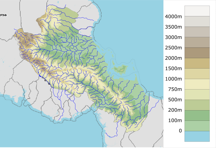 | 728 × 501 (197 KB) | Aiki (talk | contribs) | Overview of Central Antarephia geography: high-level features only. Own work (2018-Dec 2020) with large inputs from other users incL Ruadh, Taka, Egen and Eklas. Category:Administrative images |
You cannot overwrite this file.
File usage
The following page uses this file: